
NE8 Bus Route Map
View the NE8 route map and see all NE8 stops along the route. The map of NE8 shows where the bus travels and the location of each stop, making it easy to understand the entire route at a glance.
Explore St. Werke Krefeld routes on the map and see where St. Werke Krefeld bus services operate. Use the NE8 map to find bus stops and see how the NE8 connects different areas along its trip.
All NE8 stops on the map are displayed in route order, helping you follow the NE8 bus from the first stop to the last.
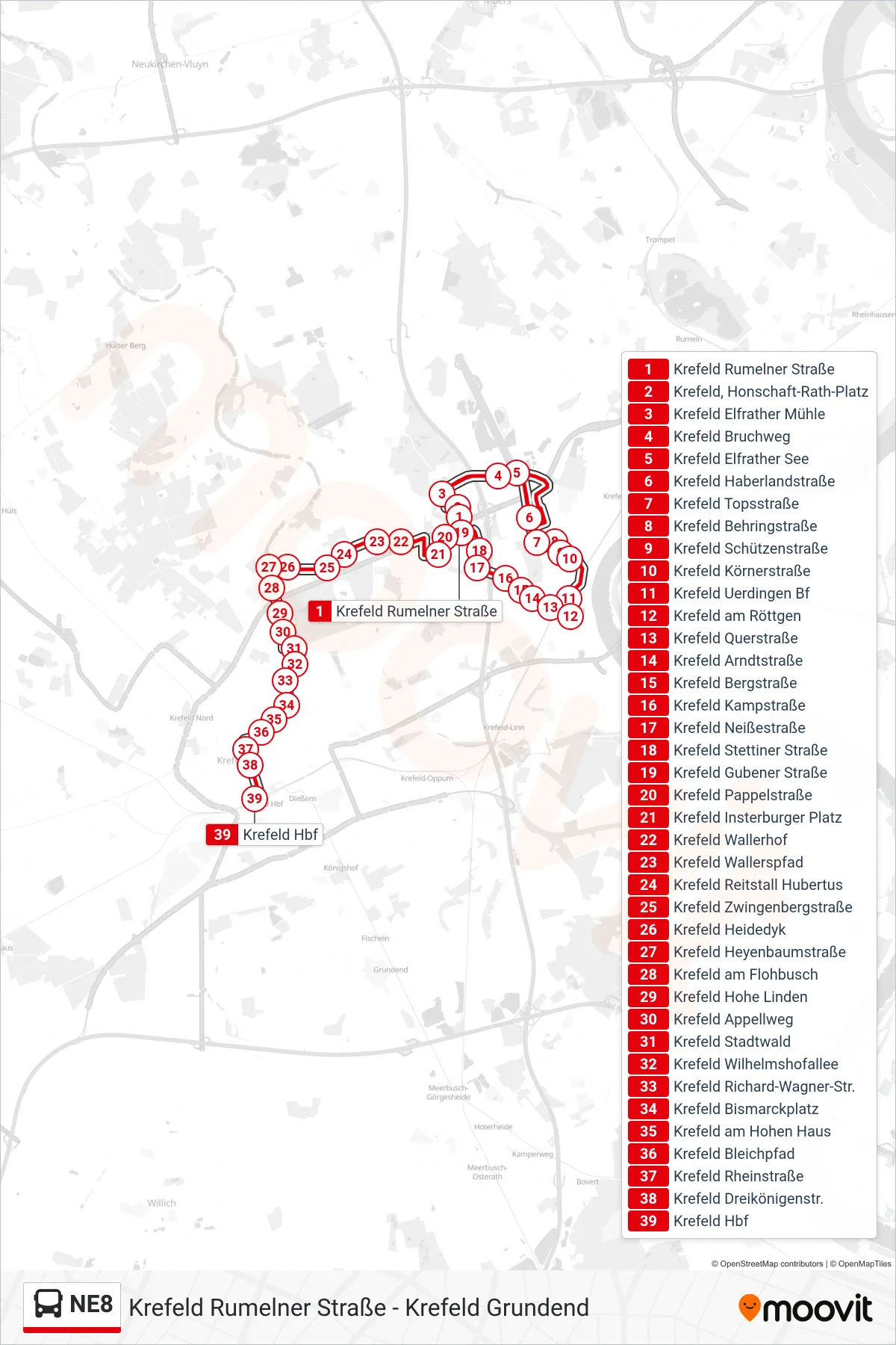
Stops list (NE8 - Krefeld Hbf)
- Krefeld Rumelner Straße
- Krefeld, Honschaft-Rath-Platz
- Krefeld Elfrather Mühle
- Krefeld Bruchweg
- Krefeld Elfrather See
- Krefeld Haberlandstraße
- Krefeld Topsstraße
- Krefeld Behringstraße
- Krefeld Schützenstraße
- Krefeld Körnerstraße
- Krefeld Uerdingen Bf
- Krefeld am Röttgen
- Krefeld Querstraße
- Krefeld Arndtstraße
- Krefeld Bergstraße
- Krefeld Kampstraße
- Krefeld Neißestraße
- Krefeld Stettiner Straße
- Krefeld Gubener Straße
- Krefeld Pappelstraße
- Krefeld Insterburger Platz
- Krefeld Wallerhof
- Krefeld Wallerspfad
- Krefeld Reitstall Hubertus
- Krefeld Zwingenbergstraße
- Krefeld Heidedyk
- Krefeld Heyenbaumstraße
- Krefeld am Flohbusch
- Krefeld Hohe Linden
- Krefeld Appellweg
- Krefeld Stadtwald
- Krefeld Wilhelmshofallee
- Krefeld Richard-Wagner-Str.
- Krefeld Bismarckplatz
- Krefeld am Hohen Haus
- Krefeld Bleichpfad
- Krefeld Rheinstraße
- Krefeld Dreikönigenstr.
- Krefeld Hbf