
P20 Bus Route Map
View the P20 route map and see all P20 stops along the route. The map of P20 shows where the bus travels and the location of each stop, making it easy to understand the entire route at a glance.
Explore Pioneer Valley Transit Authority routes on the map and see where Pioneer Valley Transit Authority bus services operate. Use the P20 map to find bus stops and see how the P20 connects different areas along its trip.
All P20 stops on the map are displayed in route order, helping you follow the P20 bus from the first stop to the last.
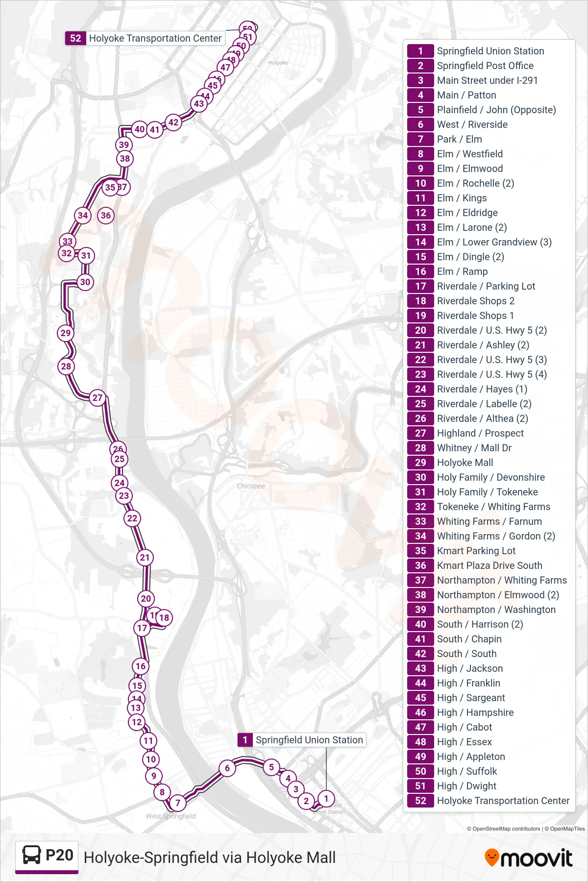
Stops list (P20 - Holyoke Trans. Ctr. Via Holyoke Mall)
- Springfield Union Station
- Springfield Post Office
- Main Street under I-291
- Main / Patton
- Plainfield / John (Opposite)
- West / Riverside
- Park / Elm
- Elm / Westfield
- Elm / Elmwood
- Elm / Rochelle (2)
- Elm / Kings
- Elm / Eldridge
- Elm / Larone (2)
- Elm / Lower Grandview (3)
- Elm / Dingle (2)
- Elm / Ramp
- Riverdale / Parking Lot
- Riverdale Shops 2
- Riverdale Shops 1
- Riverdale / U.S. Hwy 5 (2)
- Riverdale / Ashley (2)
- Riverdale / U.S. Hwy 5 (3)
- Riverdale / U.S. Hwy 5 (4)
- Riverdale / Hayes (1)
- Riverdale / Labelle (2)
- Riverdale / Althea (2)
- Highland / Prospect
- Whitney / Mall Dr
- Holyoke Mall
- Holy Family / Devonshire
- Holy Family / Tokeneke
- Tokeneke / Whiting Farms
- Whiting Farms / Farnum
- Whiting Farms / Gordon (2)
- Kmart Parking Lot
- Kmart Plaza Drive South
- Northampton / Whiting Farms
- Northampton / Elmwood (2)
- Northampton / Washington
- South / Harrison (2)
- South / Chapin
- South / South
- High / Jackson
- High / Franklin
- High / Sargeant
- High / Hampshire
- High / Cabot
- High / Essex
- High / Appleton
- High / Suffolk
- High / Dwight
- Holyoke Transportation Center