
S44 Bus Route Map
View the S44 route map and see all S44 stops along the route. The map of S44 shows where the bus travels and the location of each stop, making it easy to understand the entire route at a glance.
Explore MTA Bus routes on the map and see where MTA Bus bus services operate. Use the S44 map to find bus stops and see how the S44 connects different areas along its trip.
All S44 stops on the map are displayed in route order, helping you follow the S44 bus from the first stop to the last.
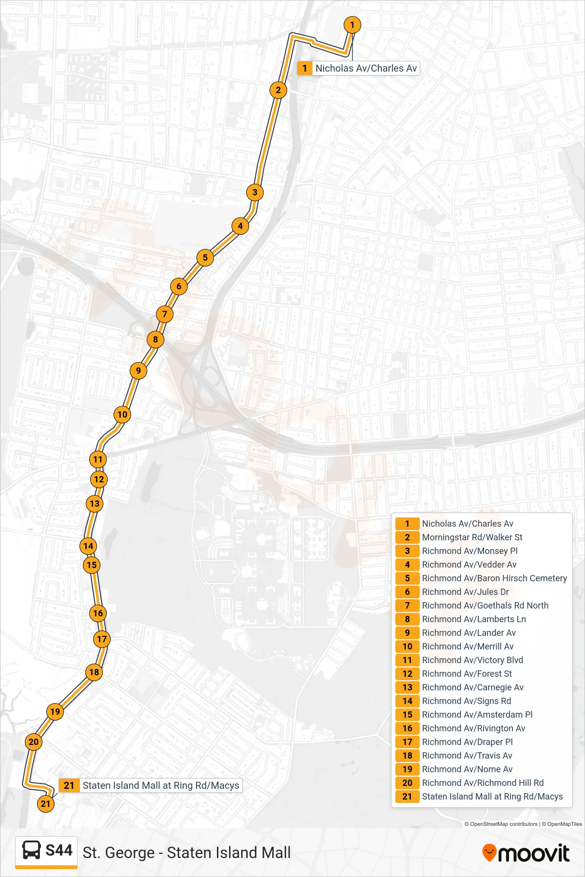
Stops list (S44 - Marsh Av Ring Rd)
- Nicholas Av/Charles Av
- Morningstar Rd/Walker St
- Richmond Av/Monsey Pl
- Richmond Av/Vedder Av
- Richmond Av/Baron Hirsch Cemetery
- Richmond Av/Jules Dr
- Richmond Av/Goethals Rd North
- Richmond Av/Lamberts Ln
- Richmond Av/Lander Av
- Richmond Av/Merrill Av
- Richmond Av/Victory Blvd
- Richmond Av/Forest St
- Richmond Av/Carnegie Av
- Richmond Av/Signs Rd
- Richmond Av/Amsterdam Pl
- Richmond Av/Rivington Av
- Richmond Av/Draper Pl
- Richmond Av/Travis Av
- Richmond Av/Nome Av
- Richmond Av/Richmond Hill Rd
- Staten Island Mall at Ring Rd/Macys