
S44 Bus Route Map
View the S44 route map and see all S44 stops along the route. The map of S44 shows where the bus travels and the location of each stop, making it easy to understand the entire route at a glance.
Explore MTA Bus routes on the map and see where MTA Bus bus services operate. Use the S44 map to find bus stops and see how the S44 connects different areas along its trip.
All S44 stops on the map are displayed in route order, helping you follow the S44 bus from the first stop to the last.
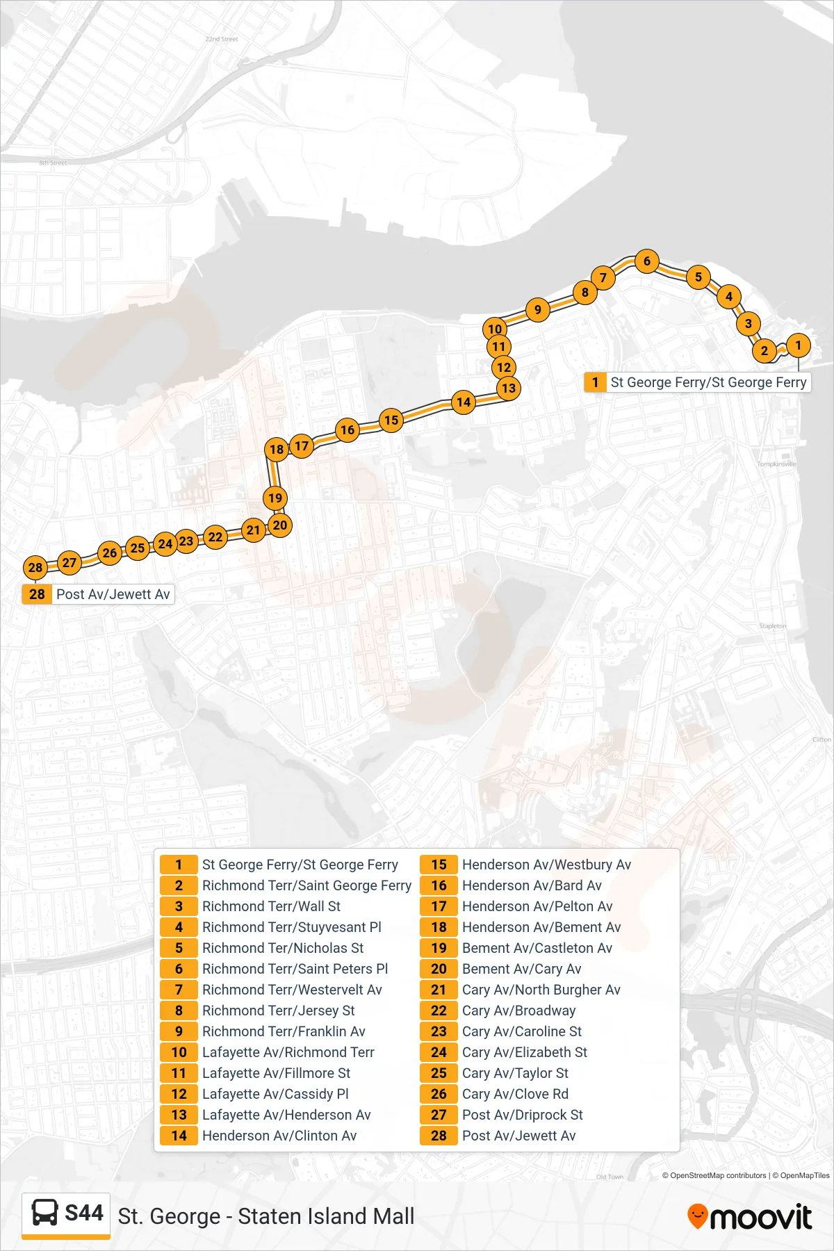
Stops list (S44 - Post Av Jewett Av)
- St George Ferry/St George Ferry
- Richmond Terr/Saint George Ferry
- Richmond Terr/Wall St
- Richmond Terr/Stuyvesant Pl
- Richmond Ter/Nicholas St
- Richmond Terr/Saint Peters Pl
- Richmond Terr/Westervelt Av
- Richmond Terr/Jersey St
- Richmond Terr/Franklin Av
- Lafayette Av/Richmond Terr
- Lafayette Av/Fillmore St
- Lafayette Av/Cassidy Pl
- Lafayette Av/Henderson Av
- Henderson Av/Clinton Av
- Henderson Av/Westbury Av
- Henderson Av/Bard Av
- Henderson Av/Pelton Av
- Henderson Av/Bement Av
- Bement Av/Castleton Av
- Bement Av/Cary Av
- Cary Av/North Burgher Av
- Cary Av/Broadway
- Cary Av/Caroline St
- Cary Av/Elizabeth St
- Cary Av/Taylor St
- Cary Av/Clove Rd
- Post Av/Driprock St
- Post Av/Jewett Av