
T3 Bus Route Map
View the T3 route map and see all T3 stops along the route. The map of T3 shows where the bus travels and the location of each stop, making it easy to understand the entire route at a glance.
Explore IZILO routes on the map and see where IZILO bus services operate. Use the T3 map to find bus stops and see how the T3 connects different areas along its trip.
All T3 stops on the map are displayed in route order, helping you follow the T3 bus from the first stop to the last.
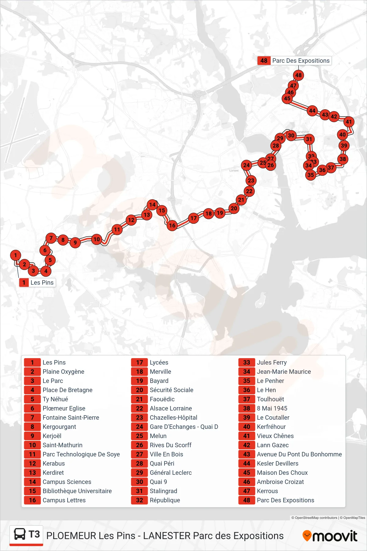
Stops list (T3 - Les Pins→Parc Des Expositions)
- Les Pins
- Plaine Oxygène
- Le Parc
- Place De Bretagne
- Ty Néhué
- Plœmeur Eglise
- Fontaine Saint-Pierre
- Kergourgant
- Kerjoël
- Saint-Mathurin
- Parc Technologique De Soye
- Kerabus
- Kerdiret
- Campus Sciences
- Bibliothèque Universitaire
- Campus Lettres
- Lycées
- Merville
- Bayard
- Sécurité Sociale
- Faouëdic
- Alsace Lorraine
- Chazelles-Hôpital
- Gare D'Echanges - Quai D
- Melun
- Rives Du Scorff
- Ville En Bois
- Quai Péri
- Général Leclerc
- Quai 9
- Stalingrad
- République
- Jules Ferry
- Jean-Marie Maurice
- Le Penher
- Le Hen
- Toulhouët
- 8 Mai 1945
- Le Coutaller
- Kerfréhour
- Vieux Chênes
- Lann Gazec
- Avenue Du Pont Du Bonhomme
- Kesler Devillers
- Maison Des Choux
- Ambroise Croizat
- Kerrous
- Parc Des Expositions