
T4 Bus Route Map
View the T4 route map and see all T4 stops along the route. The map of T4 shows where the bus travels and the location of each stop, making it easy to understand the entire route at a glance.
Explore IZILO routes on the map and see where IZILO bus services operate. Use the T4 map to find bus stops and see how the T4 connects different areas along its trip.
All T4 stops on the map are displayed in route order, helping you follow the T4 bus from the first stop to the last.
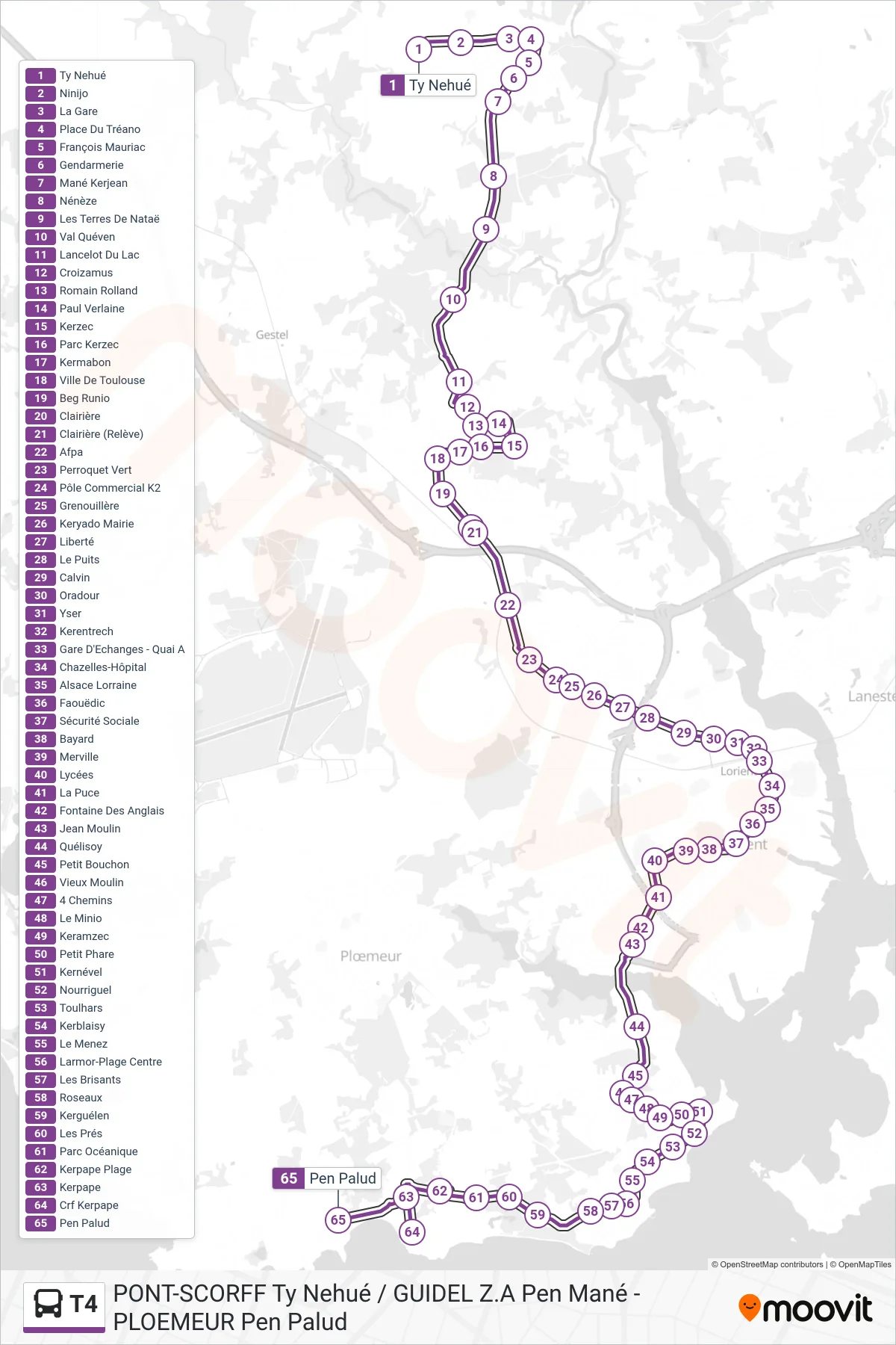
Stops list (T4 - Ty Nehué→Pen Palud)
- Ty Nehué
- Ninijo
- La Gare
- Place Du Tréano
- François Mauriac
- Gendarmerie
- Mané Kerjean
- Nénèze
- Les Terres De Nataë
- Val Quéven
- Lancelot Du Lac
- Croizamus
- Romain Rolland
- Paul Verlaine
- Kerzec
- Parc Kerzec
- Kermabon
- Ville De Toulouse
- Beg Runio
- Clairière
- Clairière (Relève)
- Afpa
- Perroquet Vert
- Pôle Commercial K2
- Grenouillère
- Keryado Mairie
- Liberté
- Le Puits
- Calvin
- Oradour
- Yser
- Kerentrech
- Gare D'Echanges - Quai A
- Chazelles-Hôpital
- Alsace Lorraine
- Faouëdic
- Sécurité Sociale
- Bayard
- Merville
- Lycées
- La Puce
- Fontaine Des Anglais
- Jean Moulin
- Quélisoy
- Petit Bouchon
- Vieux Moulin
- 4 Chemins
- Le Minio
- Keramzec
- Petit Phare
- Kernével
- Nourriguel
- Toulhars
- Kerblaisy
- Le Menez
- Larmor-Plage Centre
- Les Brisants
- Roseaux
- Kerguélen
- Les Prés
- Parc Océanique
- Kerpape Plage
- Kerpape
- Crf Kerpape
- Pen Palud