How to get to smart Fit by bus?
Click on the bus route to see step by step directions with maps, line arrival times and updated time schedules.
From Tambdi Jogeshwari Mandir, Pune & Velhe
43 minFrom Balgandharva Rangmandir, Pune & Velhe
43 minFrom Jangli Maharaj Mandir, Pune & Velhe
39 minFrom Salisbury Park, Pune & Velhe
65 minFrom Bird Valley, Pune & Velhe
68 minFrom Mulshi Dam, Paud
46 minFrom Cognizant Deccan Campus (CDC), Paud
51 minFrom Lal Mahal, Pune & Velhe
43 minFrom D. Y. Patil International University, Pune & Velhe
53 minFrom ABC, Pune & Velhe
43 min
Bus stops near smart Fit in Pune & Velhe
Bus lines to smart Fit in Pune & Velhe
What are the closest stations to smart Fit?
The closest stations to smart Fit are:
- Laxmi Mata Mandir Balewadi is 53 meters away, 1 min walk.
- Petrol Pump Pimple Nilakh is 3202 meters away, 41 min walk.
Which bus lines stop near smart Fit?
These bus lines stop near smart Fit: 256, 360.
What’s the nearest bus station to smart Fit in Pune & Velhe?
The nearest bus station to smart Fit in Pune & Velhe is Laxmi Mata Mandir Balewadi. It’s a 1 min walk away.
What time is the first bus to smart Fit in Pune & Velhe?
The 256 is the first bus that goes to smart Fit in Pune & Velhe. It stops nearby at 5:05 AM.
What time is the last bus to smart Fit in Pune & Velhe?
The 256 is the last bus that goes to smart Fit in Pune & Velhe. It stops nearby at 11:50 PM.
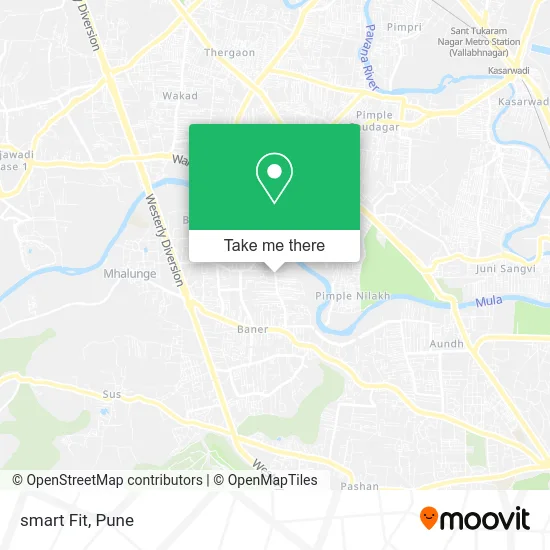
See smart Fit, Pune & Velhe, on the map
Public Transit to smart Fit in Pune & Velhe
Wondering how to get to smart Fit in Pune & Velhe? Moovit helps you find the best way to get to smart Fit with step-by-step directions from the nearest public transit station.
Moovit provides free maps and live directions to help you navigate through your city. View schedules, routes, timetables, and find out how long does it take to get to smart Fit in real time.
Looking for the nearest stop or station to smart Fit? Check out this list of stops closest to your destination: Laxmi Mata Mandir Balewadi; Petrol Pump Pimple Nilakh.
Bus: 256, 360, 35B, 93, 333, 344, 344A, 344B.
Want to see if there’s another route that gets you there at an earlier time? Moovit helps you find alternative routes or times. Get directions from and directions to smart Fit easily from the Moovit App or Website.
We make riding to smart Fit easy, which is why over 1.5 million users, including users in Pune & Velhe, trust Moovit as the best app for public transit. You don’t need to download an individual bus app or train app, Moovit is your all-in-one transit app that helps you find the best bus time or train time available.
For information on prices of bus, costs and ride fares to smart Fit, please check the Moovit app.
Use the app to navigate to popular places including to the airport, hospital, stadium, grocery store, mall, coffee shop, school, college, and university.
smart Fit Address: पुणे 411045 MH street in Pune & Velhe
- Shri Residency Gate 1,
- Puna Trading Wholesale Kirana,
- Dipvrund Engineering Energy Consultants,
- Cafe Durga,
- sonali dudh dairy,
- Royal Enfield,
- La Vida Sales Office,
- Gokul Caterers,
- Bloomynest,
- RSM Astute Consulting,
- Kotalinga Prasanna Auto Garage,
- Hair Lounge Unisex Hair Salon,
- Vehicle Artzone Car Accessories Store,
- New Public Mart,
- Excella - Coworking Space,
- Studio11 Salon & Spa Balewadi,
- Nyati S Academy,
- Happy Health,
- Shanbhag Engineering Company,
- Physio Zone
Places Near smart Fit (Pune & Velhe)
- Tulshibaug, Pune & Velhe,
- Dagdusheth Halwai Ganpati Mandir, Pune & Velhe,
- Dagadusheth Halwai Ganapati Temple, Pune & Velhe,
- Laxmi Road, Pune & Velhe,
- Cognizant Deccan Campus (CDC), Paud,
- Chaturshringi Temple, Pune & Velhe,
- Pune Okayama Friendship Garden, Pune & Velhe,
- Symbiosis Lavale Bus Stop, Pune & Velhe,
- Senapati Bapat Road, Pune & Velhe,
- Pvr Icon - Pavilion Mall, Pune & Velhe,
- ISKCON Pune, Pune & Velhe,
- BAPS Shri Swaminarayan Mandir, Pune & Velhe,
- ISKCON Nvcc Temple, Pune & Velhe,
- Fc Road, Pune & Velhe,
- Swaminarayan Mandir, Pune & Velhe,
- M G Road, Pune & Velhe,
- Ion Digital Zone, Pune & Velhe,
- Sarasbaug, Pune & Velhe,
- Westend Mall, Pune & Velhe,
- Vishwakarma Institute Of Technology (Vit), Pune & Velhe
How to get to popular places in Pune with public transit
Get around Pune & Velhe by public transit!
Traveling around Pune & Velhe has never been so easy. See step by step directions as you travel to any attraction, street or major public transit station. View bus and train schedules, arrival times, service alerts and detailed routes on a map, so you know exactly how to get to anywhere in Pune & Velhe.
When traveling to any destination around Pune & Velhe use Moovit's Live Directions with Get Off Notifications to know exactly where and how far to walk, how long to wait for your line, and how many stops are left. Moovit will alert you when it's time to get off — no need to constantly re-check whether yours is the next stop.
Wondering how to use public transit in Pune & Velhe or how to pay for public transit in Pune & Velhe? Moovit public transit app can help you navigate your way with public transit easily, and at minimum cost. It includes public transit fees, ticket prices, and costs. Looking for a map of Pune & Velhe public transit lines? Moovit public transit app shows all public transit maps in Pune & Velhe with all Bus, Train and Metro routes and stops on an interactive map.
Pune has 3 transit type(s), including: Bus, Train and Metro, operated by several transit agencies, including Pune Metro (Maha Metro), PMPML, PMPML Night Bus Service (Ratrani) and Central Railways (Indian Railways)