How to get to via link by bus?
Click on the bus route to see step by step directions with maps, line arrival times and updated time schedules.
From Rodovia Washington Luís, Duque De Caxias
50 minFrom Xerém, Duque De Caxias
49 minFrom Refinaria Duque de Caxias (REDUC), Duque De Caxias
34 minFrom Campos Elíseos, Duque De Caxias
40 minFrom Avenida Governador Leonel de Moura Brizola, Duque De Caxias
48 minFrom Sítio H20, Duque De Caxias
73 minFrom Morro do Garibaldi, Duque De Caxias
57 minFrom Feirão De Malhas, Duque De Caxias
32 minFrom Caxias x Magé, Duque De Caxias
32 minFrom Bairro Amapá, Duque de Caxias, Duque De Caxias
76 min
Bus stops near via link in Duque De Caxias
Bus lines to via link in Duque De Caxias
- TZ08, Jardim Anhangá ↔ Santa Cruz da Serra,VIEW
- TZ19, Santa Cruz da Serra - Taquara,VIEW
- 022, Santa Cruz da Serra - Piabetá (Via Parada Angélica),VIEW
- 46, Caxias - Ilha,VIEW
- 510, Caxias - Raiz da Serra (Via Lote XV / Taquara),VIEW
- 511, Caxias - Parque Paulista (Via Lote Xv),VIEW
- 513, Caxias - Nova Campinas (Via Lote Xv),VIEW
- 571C, Nova Campinas - Central (Via Parque Paulista / Santa Cruz da Serra),VIEW
- 765I, Piabetá - Xerém (Via Nova Campinas / Imbariê),VIEW
- 031, Vila Maria Helena,VIEW
- 70, Parque Paulista,VIEW
- 413, Nova Campinas,VIEW
What are the closest stations to via link?
The closest stations to via link are:
- Avenida Automóvel Clube, 936-984 is 145 meters away, 3 min walk.
- Estrada Da Várzea, 492 is 676 meters away, 9 min walk.
- Avenida Automóvel Clube, 151 is 684 meters away, 9 min walk.
Which bus lines stop near via link?
These bus lines stop near via link: 46, 469C, 510, 513, 765I.
What’s the nearest bus station to via link in Duque De Caxias?
The nearest bus station to via link in Duque De Caxias is Avenida Automóvel Clube, 936-984. It’s a 3 min walk away.
What time is the first bus to via link in Duque De Caxias?
The 469C is the first bus that goes to via link in Duque De Caxias. It stops nearby at 4:01 AM.
What time is the last bus to via link in Duque De Caxias?
The 510 is the last bus that goes to via link in Duque De Caxias. It stops nearby at 12:58 AM.
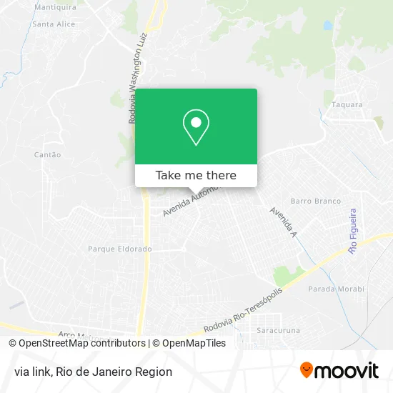
See via link, Duque De Caxias, on the map
Public Transit to via link in Duque De Caxias
Wondering how to get to via link in Duque De Caxias? Moovit helps you find the best way to get to via link with step-by-step directions from the nearest public transit station.
Moovit provides free maps and live directions to help you navigate through your city. View schedules, routes, timetables, and find out how long does it take to get to via link in real time.
Looking for the nearest stop or station to via link? Check out this list of stops closest to your destination: Avenida Automóvel Clube; Estrada Da Várzea; Avenida Automóvel Clube.
Bus: 46, 469C, 510, 513, 765I, TZ08, TZ19, 022, 031, 70, 413.
Want to see if there’s another route that gets you there at an earlier time? Moovit helps you find alternative routes or times. Get directions from and directions to via link easily from the Moovit App or Website.
We make riding to via link easy, which is why over 1.5 million users, including users in Duque De Caxias, trust Moovit as the best app for public transit. You don’t need to download an individual bus app or train app, Moovit is your all-in-one transit app that helps you find the best bus time or train time available.
For information on prices of bus, costs and ride fares to via link, please check the Moovit app.
Use the app to navigate to popular places including to the airport, hospital, stadium, grocery store, mall, coffee shop, school, college, and university.
Location: Duque De Caxias, Rio de Janeiro Region
- Via Link Telecomunicações,
- CEME - Centro Médico Empresarial,
- Restaurante Dom Pietro,
- Dr Credito Rio Correspondente Bancário,
- Drogarias Pacheco,
- Castelão Loteria Esportiva,
- Supermercados Feira Nova,
- Pet do Sarapui Comercio de Rações Ltda,
- Vaidosa Fashion,
- Assistência Técnica Aquaplás,
- Clinica Ceme,
- Em Professor Carmen Lúcia Resende Alvim da Silva,
- West box Auto Center,
- E M. Professora Carmem Lucia,
- Silva e Servicos de Instalacao, Manutencao e Reparacao de Máquinas de Escritorio e de Informatica,
- Lamarcel Indústria e Comercio,
- Sítio Seu Sonho,
- Rua Maria da Silva,
- Jig Jig Pesca,
- Tapioca du'Norte
Places Near via link (Duque De Caxias)
- Norte Shopping, Cachambi,
- Hospital Federal Cardoso Fontes, Jacarepaguá,
- Hospital Federal Do Andaraí, Andaraí,
- Museu Do Amanhã, Centro,
- Rua Ulysses Guimarães 16, Cidade Nova,
- Praia do Arpoador, Ipanema,
- Shopping Downtown, Barra Da Tijuca,
- Feira Livre da Gloria, Glória,
- Avenida Rio Branco, Centro,
- Shopping RioSul, Botafogo,
- Shopping Rio Sul, Botafogo,
- Shopping Nova América, Del Castilho,
- Rua Licínio Cardoso, São Francisco Xavier,
- Niterói, Niterói,
- Rio De Janeiro,
- Feirão De Malhas, Duque De Caxias,
- Hospital Municipal Ronaldo Gazolla, Acari,
- Rodoviária Novo Rio (Rodoviária do Rio de Janeiro), Santo Cristo,
- Hospital Pedro Ernesto, Vila Isabel,
- Avenida Venezuela 134, Saúde
How to get to popular places in Rio de Janeiro Region with public transit
Get around Duque De Caxias by public transit!
Traveling around Duque De Caxias has never been so easy. See step by step directions as you travel to any attraction, street or major public transit station. View bus and train schedules, arrival times, service alerts and detailed routes on a map, so you know exactly how to get to anywhere in Duque De Caxias.
When traveling to any destination around Duque De Caxias use Moovit's Live Directions with Get Off Notifications to know exactly where and how far to walk, how long to wait for your line, and how many stops are left. Moovit will alert you when it's time to get off — no need to constantly re-check whether yours is the next stop.
Wondering how to use public transit in Duque De Caxias or how to pay for public transit in Duque De Caxias? Moovit public transit app can help you navigate your way with public transit easily, and at minimum cost. It includes public transit fees, ticket prices, and costs. Looking for a map of Duque De Caxias public transit lines? Moovit public transit app shows all public transit maps in Duque De Caxias with all Bus, Train, Metro, Light Rail, Ferry, Cable Car, Gondola and Funicular routes and stops on an interactive map.
Rio de Janeiro Region has 8 transit type(s), including: Bus, Train, Metro, Light Rail, Ferry, Cable Car, Gondola and Funicular, operated by several transit agencies, including TrensRJ, Metrô Rio, VLT Carioca, Barcas Rio, BRT MOBI-Rio, Auto Viação Alpha, Auto Viação Tijuca, Gire Transportes, Transurb, Viação Nossa Senhora das Graças, Consórcio INTERSUL, Braso Lisboa (Municipal), Caprichosa Auto Ônibus, Auto Viação Três Amigos and Rodoviária Âncora Matias