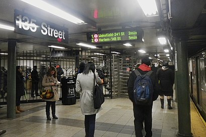
Ver 135th Street Station IRT Lenox Avenue Line, Manhattan, en el mapa
Direcciones a 135th Street Station IRT Lenox Avenue Line (Manhattan) en transporte público
Las siguientes líneas de transporte tienen rutas que pasan cerca de 135th Street Station IRT Lenox Avenue Line
 Autobús:
 - Tren:
- Metro:
¿Cómo llegar a 135th Street Station IRT Lenox Avenue Line en autobús?
Pulsa en la ruta de autobús para ver indicaciones paso a paso con mapas, tiempos de llegada de línea y horarios actualizados.
¿Cómo llegar a 135th Street Station IRT Lenox Avenue Line en tren?
Pulsa en la ruta de tren para ver indicaciones paso a paso con mapas, tiempos de llegada de línea y horarios actualizados.
¿Cómo llegar a 135th Street Station IRT Lenox Avenue Line en metro?
Pulsa en la ruta de metro para ver indicaciones paso a paso con mapas, tiempos de llegada de línea y horarios actualizados.
Estaciones de autobús cercanas a 135th Street Station IRT Lenox Avenue Line en Manhattan
- Lenox Ave & W 135th St,1 min a pie,
- Lenox Av/W 135 St,1 min a pie,
- W 135 St/Malcolm X Bl,1 min a pie,
- Adam C Powell Bl/W 135 St,4 min a pie,
Estaciones de metro cercanas a 135th Street Station IRT Lenox Avenue Line en Manhattan
- 135 St,1 min a pie,
- 138 St-Grand Concourse,10 min a pie,
Líneas de autobús a 135th Street Station IRT Lenox Avenue Line en Manhattan
- SHORTLINE HUDSON,Montgomery,
- M7,14 St Via Columbus Via 7 Av,
- M102,Lex Av-96 St Via Lenox Av,
- BX33,Port Morris 132 St,
- M2,Washington Hts Bway-168 St Via Madison,
¿Cuáles son las paradas más cercanas a 135th Street Station IRT Lenox Avenue Line?
Las paradas más cercanas a 135th Street Station IRT Lenox Avenue Line son:
- Lenox Ave & W 135th St está a 5 yardas de distancia, 1 minutos caminando.
- Lenox Av/W 135 St está a 17 yardas de distancia, 1 minutos caminando.
- 135 St está a 34 yardas de distancia, 1 minutos caminando.
- W 135 St/Malcolm X Bl está a 60 yardas de distancia, 1 minutos caminando.
- Adam C Powell Bl/W 135 St está a 331 yardas de distancia, 4 minutos caminando.
- 138 St-Grand Concourse está a 831 yardas de distancia, 10 minutos caminando.
¿Qué líneas de autobús se detienen cerca de 135th Street Station IRT Lenox Avenue Line?
Estas líneas de autobús se detienen cerca de 135th Street Station IRT Lenox Avenue Line: M102, M7.
¿Qué líneas de tren se detienen cerca de 135th Street Station IRT Lenox Avenue Line?
Estas líneas de tren se detienen cerca de 135th Street Station IRT Lenox Avenue Line: HUDSON, NEW HAVEN.
¿Qué líneas de metro se detienen cerca de 135th Street Station IRT Lenox Avenue Line?
Estas líneas de metro se detienen cerca de 135th Street Station IRT Lenox Avenue Line: 2, 3.
¿Cuál es la estación de metro más cercana a 135th Street Station IRT Lenox Avenue Line en Manhattan?
La estación más cercana de metro a 135th Street Station IRT Lenox Avenue Line en Manhattan es 135 St. Está a 1 min a pie.
¿Cuál es la parada de autobús más cercana a 135th Street Station IRT Lenox Avenue Line en Manhattan?
La paradas más cercanas de autobús a 135th Street Station IRT Lenox Avenue Line en Manhattan son Lenox Ave & W 135th St, Lenox Av/W 135 St y W 135 St/Malcolm X Bl. La más cercana está a 1 min a pie.
¿A qué hora sale el primer metro a 135th Street Station IRT Lenox Avenue Line en Manhattan?
El 3 es el primer metro que para cerca de 135th Street Station IRT Lenox Avenue Line en Manhattan a las 3:01.
¿A qué hora sale el último metro a 135th Street Station IRT Lenox Avenue Line en Manhattan?
El A es el último metro que para cerca de 135th Street Station IRT Lenox Avenue Line en Manhattan a las 4:10.
¿A qué hora sale el primer autobús a 135th Street Station IRT Lenox Avenue Line en Manhattan?
El M102 es el primer autobús que para cerca de 135th Street Station IRT Lenox Avenue Line en Manhattan a las 3:09.
¿A qué hora sale el último autobús a 135th Street Station IRT Lenox Avenue Line en Manhattan?
El M7 es el último autobús que para cerca de 135th Street Station IRT Lenox Avenue Line en Manhattan a las 3:13.
¿Cuánto cuesta viajar en metro hasta 135th Street Station IRT Lenox Avenue Line?
La tarifa del viaje en metro hasta 135th Street Station IRT Lenox Avenue Line cuesta aproximadamente $2.90.
¿Cuánto cuesta viajar en autobús hasta 135th Street Station IRT Lenox Avenue Line?
La tarifa del viaje en autobús hasta 135th Street Station IRT Lenox Avenue Line cuesta aproximadamente $2.90.
Ver 135th Street Station IRT Lenox Avenue Line, Manhattan, en el mapa
Transporte Público a 135th Street Station IRT Lenox Avenue Line en Manhattan
¿Te preguntas cómo llegar a 135th Street Station IRT Lenox Avenue Line en Manhattan, Estados Unidos? Moovit te ayuda a encontrar la mejor manera de llegar a 135th Street Station IRT Lenox Avenue Line con indicaciones paso a paso desde la estación de transporte público más cercana.
Moovit proporciona mapas gratuitos y direcciones en vivo para ayudarte a navegar por tu ciudad. Mira los horarios, las rutas, los servicios y descubre cuánto tiempo lleva llegar a 135th Street Station IRT Lenox Avenue Line en tiempo real.
¿Buscas la estación o parada más cercana a 135th Street Station IRT Lenox Avenue Line? Mira esta lista de paradas más cercanas a tu destino: Lenox Ave & W 135th St; Lenox Av/W 135 St; 135 St; W 135 St/Malcolm X Bl; Adam C Powell Bl/W 135 St; 138 St-Grand Concourse.
Autobús:Tren:Metro:
¿Quieres ver si hay otra ruta que te lleve allí antes? Moovit te ayuda a encontrar rutas y horarios alternativos. Obtén fácilmente instrucciones y direcciones desde 135th Street Station IRT Lenox Avenue Line con la aplicación Moovit o desde el sitio web.
Hacemos que viajar a 135th Street Station IRT Lenox Avenue Line sea fácil, por eso más de 1.5 millones de usuarios, incluidos los usuarios de Manhattan, confían en Moovit como la mejor aplicación de transporte público. No necesitas descargar una aplicación de autobús individual o una aplicación de tren, Moovit es tu aplicación de transporte todo en uno, que te ayuda a encontrar el mejor horario de autobús o de tren disponible.
Para información de precios de metro, autobús y tren, costos y tarifas de viaje a 135th Street Station IRT Lenox Avenue Line, por favor, revisa la aplicación Moovit.
Usa la aplicación para navegar a lugares populares, como el aeropuerto, hospital, estadio, tienda de alimentos, centro comercial, cafetería, escuela, facultad y universidad.
Ubicación: Manhattan, New York - New Jersey
Atracciones cercanas a 135th Street Station IRT Lenox Avenue Line
135th Street,135th Street and Lenox Ave,Wesley Williams Pl W 135 St,135th St Malcolm X Blvd,Lenox Ave (135th street and lenox),135 St,Malcolm X Blvd (135th street and Malcolm X Blvd),Lenox Ave / W 135th St,MTA Subway - 135th St (2/3),Schomburg Center For Research In Black Culture,Malcolm X Blvd,New York Public Library - Schomburg Center for Research in Black Culture,Harlem Hospital Center,NYC Health Hospitals Harlem-ER,Friends of Harlem,Harlem Hospital,Harlem Sneaker Train,Schomburg Center for Research In Black Culture,The Schomburg Center Teen Curators,Nypl Astor Lenox TildeCómo llegar a los destinos más populares de Manhattan en transporte público
MTA Subway - Coney Island / Stillwell Ave (D / F/N / Q),MTA Subway - Broadway (N/W), Queens,Central Park SummerStage, Manhattan,Ulysses Folk House, Manhattan,I-80 (Interstate 80), Paterson, Nj,Stamford, CT, Stamford, Ct,Beauty & Essex, Manhattan,Virgin America Ticket Counter, Elizabeth, Nj,J.G. Melon, Manhattan,LIRR - Huntington Station, Huntington Station, Ny,Burger Joint, Manhattan,Barrage, Manhattan,Long Island, NY, Huntington Station, Ny,Shake Shack, Manhattan,The Dutch, Manhattan,Rubirosa Ristorante, Manhattan,Eataly, Manhattan,Sheep Meadow, Manhattan,Hill Country Chicken, Manhattan,High Line, Manhattan¡Viaja por Manhattan en transporte público!
Viajar por Manhattan nunca ha sido tan fácil. Obtén indicaciones paso a paso mientras viajas a cualquier destino, calle o parada. Mira los horarios de trenes y autobuses, alertas de servicio y detalles de las rutas en el mapa, para que sepas exactamente cómo llegar a cualquier parte de Manhattan.
Cuando viajas a cualquier destino de Manhattan usa la herramienta ¡Vamos! con alertas para saber cuando bajar, dónde y cuánto caminar, cuánto tiempo esperar a tu línea y cuántas paradas quedan. Moovit te avisará cuando llegue el momento de bajar - no es necesario fijarse de nuevo si la parada siguiente es la tuya.
¿Te has preguntado cómo utilizar el transporte público en Manhattan o cómo pagar el transporte público en Manhattan? La aplicación de Moovit puede ayudarte a viajar en transporte público fácilmente. Incluye las tarifas de tu viaje completo en transporte público, los precios de los tickets y costos adicionales. ¿Buscas un mapa de las líneas de transporte público de Manhattan? La aplicación de Moovit muestra todos los mapas de transporte público en Manhattan con todas las rutas y paradas de metro, autobús o tren en un mapa interactivo.
Manhattan tiene 3 tipos de transporte, incluyendo: metro, autobús o tren, operado por agencias de transporte público, incluyendo MTA Subway, Metro-North Railroad, LIRR, PATH, Shore Line East, MTA Bus Company, MTA New York City Transit - Express routes, MTA Bus, NJ Transit, NYC Ferry, NICE bus, Bee-Line Bus, NJ Transit Rail, NJ Transit Rail y Norwalk Transit District