La app de movilidad urbana más popular en Plymouth.
Todas las opciones de movilidad local en una aplicación
| Línea | Dirección | Hora |
|---|---|---|
| FREEDOM LINK | Industrial Park | 7:00 AM |
| LIBERTY LINK | Industrial Park | 7:00 AM |
| MAYFLOWER LINK - PLYMOUTH TO MANOMET | Manomet Stop And Shop | 7:00 AM |
| LIBERTY LINK | Plymouth Center | 7:52 AM |
| FREEDOM LINK | Plymouth Center | 7:55 AM |
| FREEDOM LINK | Industrial Park | 8:00 AM |
| LIBERTY LINK | Industrial Park | 8:00 AM |
| MAYFLOWER LINK - PLYMOUTH TO MANOMET | Manomet Stop And Shop | 8:00 AM |
| LIBERTY LINK | Plymouth Center | 8:52 AM |
| MAYFLOWER LINK - PLYMOUTH TO MANOMET | Plymouth Center | 8:52 AM |
| FREEDOM LINK | Plymouth Center | 8:55 AM |
| FREEDOM LINK | Industrial Park | 9:00 AM |
| LIBERTY LINK | Industrial Park | 9:00 AM |
| MAYFLOWER LINK - PLYMOUTH TO MANOMET | Manomet Stop And Shop | 9:00 AM |
| FREEDOM LINK | Plymouth Center | 9:50 AM |
| MAYFLOWER LINK - PLYMOUTH TO MANOMET | Plymouth Center | 9:52 AM |
| LIBERTY LINK | Plymouth Center | 9:57 AM |
| FREEDOM LINK | Industrial Park | 10:00 AM |
| LIBERTY LINK | Industrial Park | 10:00 AM |
| MAYFLOWER LINK - PLYMOUTH TO MANOMET | Manomet Stop And Shop | 10:00 AM |
| LIBERTY LINK | Plymouth Center | 10:52 AM |
| MAYFLOWER LINK - PLYMOUTH TO MANOMET | Plymouth Center | 10:52 AM |
| FREEDOM LINK | Plymouth Center | 10:55 AM |
| FREEDOM LINK | Industrial Park | 11:00 AM |
| LIBERTY LINK | Industrial Park | 11:00 AM |
Las siguientes líneas de transporte tienen rutas que pasan cerca de Plymouth Center
Pulsa en la ruta de autobús para ver indicaciones paso a paso con mapas, tiempos de llegada de línea y horarios actualizados.
Las paradas más cercanas a Plymouth Center son:
Estas líneas de autobús se detienen cerca de Plymouth Center: LIBERTY LINK, MAYFLOWER LINK - PLYMOUTH TO MANOMET.
La parada más cercana de autobús a Plymouth Center es Post Office - Plymouth. Está a 12 min a pie.
El MAYFLOWER LINK - PLYMOUTH TO MANOMET es el primer autobús que para cerca de Plymouth Center a las 7:03.
La línea MAYFLOWER LINK - PLYMOUTH TO MANOMET es el último autobús que viaja a Plymouth Center. Tiene una parada cercana a las 17:49.
La tarifa del viaje en autobús hasta Plymouth Center cuesta aproximadamente $1.50 - $27.00.
La tarifa del viaje en metro hasta Plymouth Center cuesta aproximadamente $2.40.
La tarifa del viaje en tren hasta Plymouth Center cuesta aproximadamente $3.25 - $12.25.
¿Estás buscando direcciones a Plymouth Center en Plymouth, Estados Unidos?
Descarga la aplicación Moovit para encontrar la programación actual y las instrucciones paso a paso para las rutas de Autobús, Tren o Metro que pasan por Plymouth Center.
¿Buscas las paradas más cercanas a Plymouth Center? Consulta esta lista de paradas más cercanas a tu destino: Post Office - Plymouth.
Autobús:
Hacemos que viajar en transporte público a Plymouth Center sea fácil, razón por la cual más de 1.5 millones de usuarios, incluidos los usuarios de Plymouth, confían en Moovit como la mejor aplicación de transporte público.
Usa la aplicación para navegar a lugares populares, como el aeropuerto, hospital, estadio, tienda de alimentos, centro comercial, cafetería, escuela, facultad y universidad.
La primera línea de esta parada es FREEDOM LINK, a las 7:00 AM, y la última línea es LIBERTY LINK a las 5:57 PM.
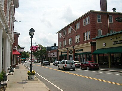
Memorial Drive, Plymouth, MA, USA
Esta parada es utilizada por las líneas de GATRA
Viajar por Plymouth nunca ha sido tan fácil. Obtén indicaciones paso a paso mientras viajas a cualquier destino, calle o parada. Mira los horarios de trenes y autobuses, alertas de servicio y detalles de las rutas en el mapa, para que sepas exactamente cómo llegar a cualquier parte de Plymouth.
Cuando viajas a cualquier destino de Plymouth usa la herramienta ¡Vamos! con alertas para saber cuando bajar, dónde y cuánto caminar, cuánto tiempo esperar a tu línea y cuántas paradas quedan. Moovit te avisará cuando llegue el momento de bajar - no es necesario fijarse de nuevo si la parada siguiente es la tuya.
¿Te has preguntado cómo utilizar el transporte público en Plymouth o cómo pagar el transporte público en Plymouth? La aplicación de Moovit puede ayudarte a viajar en transporte público fácilmente. Incluye las tarifas de tu viaje completo en transporte público, los precios de los tickets y costos adicionales. ¿Buscas un mapa de las líneas de transporte público de Plymouth? La aplicación de Moovit muestra todos los mapas de transporte público en Plymouth con todas las rutas y paradas de autobús, tren o metro en un mapa interactivo.
Plymouth tiene 3 tipos de transporte, incluyendo: autobús, tren o metro, operado por agencias de transporte público, incluyendo MBTA, MBTA, MBTA, Southeastern Regional Transit Authority, MetroWest Regional Transit Authority, Rhode Island Public Transit Authority, WRTA, Lowell Regional Transit Authority, Merrimack Valley Transit, Montachusett Regional Transit Authority, Cape Cod Regional Transit Authority, Brockton Area Transit Authority, Cape Cod Regional Transit Authority, Martha's Vineyard Transit Authority y the WAVE - Nantucket Regional Transit Authority