Directions to Anaheim Convention Center Arena with public transportation
The following transit lines have routes that pass near Anaheim Convention Center Arena
How to get to Anaheim Convention Center Arena by bus?
Click on the bus route to see step by step directions with maps, line arrival times and updated time schedules.
Bus stops near Anaheim Convention Center Arena
- Katella-Convention Center, 2 min walk,
- Convention Center - Katella, 2 min walk,
- Westin Anaheim, 5 min walk,
- Harbor Blvd. SB @ Katella Ave., 6 min walk,
- Katella FS Harbor, 6 min walk,
- Harbor Blvd. NB @ Katella Ave., 7 min walk,
Train stations near Anaheim Convention Center Arena
- Anaheim-Artic Metrolink Station, 60 min walk,
Bus lines to Anaheim Convention Center Arena
- 50, The Village at Orange,
- 09, Four Points Sheraton Anaheim,
- 11, Disneyland Main Transportation Center - 11,
- 09, Ball & Flore,
- 43, Costa Mesa - 18th and Newport,
- 543, Fullerton Transp Center,
- 05, Harbor SB & Katella,
- 83, Laguna Hills Transp Center,
- 200, West to Anaheim/Disneyland Express,
- 03, Disneyland Main Transportation Center - 04,
- 06, Courtyard Anaheim Theme Park,
What are the closest stations to Anaheim Convention Center Arena?
The closest stations to Anaheim Convention Center Arena are:
- Katella-Convention Center is 113 yards away, 2 min walk.
- Convention Center - Katella is 144 yards away, 2 min walk.
- Westin Anaheim is 401 yards away, 5 min walk.
- Harbor Blvd. SB @ Katella Ave. is 459 yards away, 6 min walk.
- Katella FS Harbor is 502 yards away, 6 min walk.
- Harbor Blvd. NB @ Katella Ave. is 505 yards away, 7 min walk.
- Anaheim-Artic Metrolink Station is 5139 yards away, 60 min walk.
Which bus lines stop near Anaheim Convention Center Arena?
These bus lines stop near Anaheim Convention Center Arena: 43, 50, 543, 83.
What’s the nearest bus stop to Anaheim Convention Center Arena?
The nearest bus stops to Anaheim Convention Center Arena are Katella-Convention Center and Convention Center - Katella. The closest one is a 2 min walk away.
What time is the first train to Anaheim Convention Center Arena?
The ORANGE COUNTY LINE is the first train that goes to Anaheim Convention Center Arena. It stops nearby at 4:38 AM.
What time is the last train to Anaheim Convention Center Arena?
The PACIFIC SURFLINER is the last train that goes to Anaheim Convention Center Arena. It stops nearby at 11:10 PM.
What time is the first bus to Anaheim Convention Center Arena?
The 43 is the first bus that goes to Anaheim Convention Center Arena. It stops nearby at 4:11 AM.
What time is the last bus to Anaheim Convention Center Arena?
The 50 is the last bus that goes to Anaheim Convention Center Arena. It stops nearby at 1:34 AM.
See Anaheim Convention Center Arena on the map
Public Transportation to Anaheim Convention Center Arena
Wondering how to get to Anaheim Convention Center Arena, United States? Moovit helps you find the best way to get to Anaheim Convention Center Arena with step-by-step directions from the nearest public transit station.
Moovit provides free maps and live directions to help you navigate through your city. View schedules, routes, timetables, and find out how long does it take to get to Anaheim Convention Center Arena in real time.
Looking for the nearest stop or station to Anaheim Convention Center Arena? Check out this list of stops closest to your destination: Katella-Convention Center; Convention Center - Katella; Westin Anaheim; Harbor Blvd. SB @ Katella Ave.; Katella FS Harbor; Harbor Blvd. NB @ Katella Ave.; Anaheim-Artic Metrolink Station.
Bus: 43, 50, 543, 83, 09, 11, 09, 05, 200.Train: ORANGE COUNTY LINE, PACIFIC SURFLINER.
Want to see if there’s another route that gets you there at an earlier time? Moovit helps you find alternative routes or times. Get directions from and directions to Anaheim Convention Center Arena easily from the Moovit App or Website.
We make riding to Anaheim Convention Center Arena easy, which is why over 1.5 million users, including users in Anaheim, trust Moovit as the best app for public transit. You don’t need to download an individual bus app or train app, Moovit is your all-in-one transit app that helps you find the best bus time or train time available.
For information on prices of bus, costs and ride fares to Anaheim Convention Center Arena, please check the Moovit app.
Use the app to navigate to popular places including to the airport, hospital, stadium, grocery store, mall, coffee shop, school, college, and university.
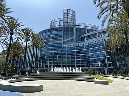
Anaheim Convention Center Arena Address: 800 W Katella Ave street in Anaheim
Attractions near Anaheim Convention Center Arena
NAMM,Official Power Morphicon Convention,California Screamin',Radiator Springs Racers,WESTIN Anaheim Resort,Cars Land,Radiator Springs - Carburetor County,Pixar Pier,Residence Inn by Marriott at Anaheim Resort Convention Center,Anaheim Convention Center,SpringHill Suites by Marriott-Anaheim Maingate (Springhill Suites-Anaheim Resort),MD&M West,Touhoucon,Nshmba Cyber Cafe Sponsored by Unitedhealth Group,Kid's Nite Out Recreation & Resort,J T's Shoeshine,Desert Palms Hotel Suites Anaheim Resort,Paradise Pier,Luigi's Admin Building,800 West Katella AvenueHow to get to popular attractions in Anaheim with public transit
Toppers Pizza Place, Santa Clarita,Pacifica High School, Oxnard,Military Entrance Processing Station (MEPS), El Segundo,Burlington Coat Factory, Inglewood,Stater Bros. Markets, Colton,Crenshaw High School, Hyde Park, La,Sunset Boulevard & Alvarado Street, Echo Park, La,LAX Badge Office, Westchester, La,Washington Preparatory High School, Westmont,The Vitamin Shoppe, Pasadena,Los Angeles Memorial Coliseum, Exposition Park, La,Venice And Fairfax, Mid-City, La,Armand Hammer Museum Of Art, Westwood, La,St John's Pleasant Valley Hospital, Camarillo,Denny's, Downtown, La,Fred Kavli Theatre, Thousand Oaks,Montecito Heights, CA, Highland Park, La,Fontana Superior Court, Fontana,Wilshire/Alvarado Metro Stop, Westlake, La,Playboy Plus, BurbankGet around Los Angeles by public transit!
Traveling around Los Angeles has never been so easy. See step by step directions as you travel to any attraction, street or major public transit station. View bus and train schedules, arrival times, service alerts and detailed routes on a map, so you know exactly how to get to anywhere in Los Angeles.
When traveling to any destination around Los Angeles use Moovit's Live Directions with Get Off Notifications to know exactly where and how far to walk, how long to wait for your line, and how many stops are left. Moovit will alert you when it's time to get off — no need to constantly re-check whether yours is the next stop.
Wondering how to use public transit in Los Angeles or how to pay for public transit in Los Angeles? Moovit public transit app can help you navigate your way with public transit easily, and at minimum cost. It includes public transit fees, ticket prices, and costs. Looking for a map of Los Angeles public transit lines? Moovit public transit app shows all public transit maps in Los Angeles with all Bus, Train, Subway, Light Rail, Ferry and Funicular routes and stops on an interactive map.
Los Angeles has 6 transit type(s), including: Bus, Train, Subway, Light Rail, Ferry and Funicular, operated by several transit agencies, including Metro - Los Angeles, Metrolink Trains, METRO, Long Beach Transit, LADOT, OCTA, Foothill Transit, Big Blue Bus, Riverside Transit Agency, LAX FlyAway, Airporter Shuttle, Playa Vista Shuttle, Amtrak, OMNITRANS, Pasadena Transit