Directions to Prairie Crossing (Chicago) with public transportation
The following transit lines have routes that pass near Prairie Crossing
How to get to Prairie Crossing by bus?
Click on the bus route to see step by step directions with maps, line arrival times and updated time schedules.
How to get to Prairie Crossing by train?
Click on the train route to see step by step directions with maps, line arrival times and updated time schedules.
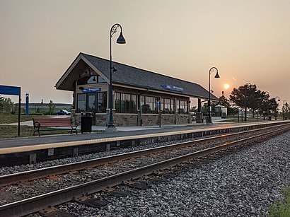
Train stations near Prairie Crossing in Chicago
- Prairie Crossing., 1 min walk,
- Prairie Crossing, 6 min walk,
What are the closest stations to Prairie Crossing?
The closest stations to Prairie Crossing are:
- Prairie Crossing. is 45 yards away, 1 min walk.
- Prairie Crossing is 475 yards away, 6 min walk.
Which bus line stops near Prairie Crossing?
574
Which train lines stop near Prairie Crossing?
These train lines stop near Prairie Crossing: MD-N, NCS.
What’s the nearest train station to Prairie Crossing in Chicago?
The nearest train station to Prairie Crossing in Chicago is Prairie Crossing.. It’s a 1 min walk away.
What time is the first train to Prairie Crossing in Chicago?
The MD-N is the first train that goes to Prairie Crossing in Chicago. It stops nearby at 5:00 AM.
What time is the last train to Prairie Crossing in Chicago?
The MD-N is the last train that goes to Prairie Crossing in Chicago. It stops nearby at 12:17 AM.
How much is the bus fare to Prairie Crossing?
The bus fare to Prairie Crossing costs about $2.00.
How much is the train fare to Prairie Crossing?
The train fare to Prairie Crossing costs about $4.00 - $9.50.
See Prairie Crossing, Chicago, on the map
Public Transit to Prairie Crossing in Chicago
Wondering how to get to Prairie Crossing in Chicago, United States? Moovit helps you find the best way to get to Prairie Crossing with step-by-step directions from the nearest public transit station.
Moovit provides free maps and live directions to help you navigate through your city. View schedules, routes, timetables, and find out how long does it take to get to Prairie Crossing in real time.
Looking for the nearest stop or station to Prairie Crossing? Check out this list of stops closest to your destination: Prairie Crossing.; Prairie Crossing.
Bus: 574.Train: MD-N, NCS.
Want to see if there’s another route that gets you there at an earlier time? Moovit helps you find alternative routes or times. Get directions from and directions to Prairie Crossing easily from the Moovit App or Website.
We make riding to Prairie Crossing easy, which is why over 1.5 million users, including users in Chicago, trust Moovit as the best app for public transit. You don’t need to download an individual bus app or train app, Moovit is your all-in-one transit app that helps you find the best bus time or train time available.
For information on prices of bus and train, costs and ride fares to Prairie Crossing, please check the Moovit app.
Use the app to navigate to popular places including to the airport, hospital, stadium, grocery store, mall, coffee shop, school, college, and university.
Location: Chicago
Attractions near Prairie Crossing
Prairie Crossing,Metra - Prairie Crossing / Libertyville (MD-N),Dalton's Cakes,Keller Williams Realty,Financial Insurance Brokers,Capture the Moment Photography,Prairie Crossing Station Condos,Chicago Vintage Guitar and Drum Show,Chicagoland Grayslake Antique Flea Market,Delicja,Northern Illinois Boat Show,Festival of Little Hills St Charles Mo,Ilsportsshow,U-Pack-It,Austin's Fuel Arena,2s Designs,Lake County Fairgrounds,Apg Exhibits,Doe's Motel (Does Motel),The European GarageHow to get to popular attractions in Chicago with public transit
I-94 Dempster Exit, Morton Grove,Lakefront Trail, Chicago,Macy's, Chicago,Crowne Plaza Chicago West Loop, Chicago,Uscis, Chicago,St Patrick's Day Parade Committee of Chicago, Chicago,400 West Superior Street, Chicago,Chicago Marriott O'Hare, Chicago,Jones College Prep, Chicago,South Loop, Chicago,Michigan Ave & Upper Wacker Dr, Chicago,London House Chicago by Hilton, Chicago,Edison Park, Chicago,111 E Wacker, Chicago,122 South Michigan, Chicago,Indiana Dunes,Fulton Market @ Google, Chicago,Silver Cross Hospital, New Lenox,InterContinental Chicago Magnificent Mile, Chicago,United Airlines Training CenterGet around Chicago by public transit!
Traveling around Chicago has never been so easy. See step by step directions as you travel to any attraction, street or major public transit station. View bus and train schedules, arrival times, service alerts and detailed routes on a map, so you know exactly how to get to anywhere in Chicago.
When traveling to any destination around Chicago use Moovit's Live Directions with Get Off Notifications to know exactly where and how far to walk, how long to wait for your line, and how many stops are left. Moovit will alert you when it's time to get off — no need to constantly re-check whether yours is the next stop.
Wondering how to use public transit in Chicago or how to pay for public transit in Chicago? Moovit public transit app can help you navigate your way with public transit easily, and at minimum cost. It includes public transit fees, ticket prices, and costs. Looking for a map of Chicago public transit lines? Moovit public transit app shows all public transit maps in Chicago with all Bus, Train and Chicago 'L' routes and stops on an interactive map.
Chicago has 3 transit type(s), including: Bus, Train and Chicago 'L', operated by several transit agencies, including CTA 'L', Metra, Northern Indiana Commuter Transportation District, CTA, PACE, Gary Public Transit, Amtrak, River Valley Metro, Valpo Transit, DeKalb Public Transit, FlixBus-us, Greyhound-us, Van Galder (Coach USA), Wisconsin Coach Lines