
How to get to 將軍澳廣場 in 西貢 Sai Kung by Subway or Bus?

See 將軍澳廣場, 西貢 Sai Kung, on the map

Directions to 將軍澳廣場 (西貢 Sai Kung) with public transportation

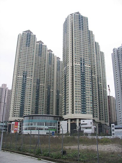
The following transit lines have routes that pass near 將軍澳廣場

  • BusBus:
  • SubwaySubway:

How to get to 將軍澳廣場 by Bus?

Click on the Bus route to see step by step directions with maps, line arrival times and updated time schedules.

How to get to 將軍澳廣場 by Subway?

Click on the Subway route to see step by step directions with maps, line arrival times and updated time schedules.

Subway stations near 將軍澳廣場 in 西貢 Sai Kung

  • 調景嶺 Tiu Keng Leng,2 min walk,

Bus stations near 將軍澳廣場 in 西貢 Sai Kung

  • 佛教志蓮小學 Chi Lin Buddhist Primary School,4 min walk,
  • 寶康路, 富康花園外 Po Hong Road, Outside Bevery Garden,4 min walk,
  • 港鐵將軍澳站小巴總站 Tseung Kwan O Mtr Station Minibus Terminus,4 min walk,
  • 將軍澳站 Tseung Kwan O Station,4 min walk,
  • 富康花園 Beverly Garden,5 min walk,

Bus lines to 將軍澳廣場 in 西貢 Sai Kung

  • 90,將軍澳(彩明) Tseung Kwan O (Choi Ming),
  • N290,荃灣西站 Tsuen Wan West Station,
  • N293,將軍澳(尚德) Tseung Kwan O (Sheung Tak),
  • N691,中環(港澳碼頭) Central (Macau Ferry),
  • 694,小西灣邨 Siu Sai Wan Estate,
  • 694S,小西灣邨 Siu Sai Wan Estate,
  • 793,將軍澳工業邨 Tseung Kwan O Industrial Estate,
  • 795X,清水灣半島 Oscar by the Sea,
  • N796,尖沙咀 / 旺角 (循環線) Tsim Sha Tsui / Mong Kok (Circular),
  • 796X,將軍澳站 Tseung Kwan O Station,
  • 798P,大圍站 Tai Wai Station,
  • 798X,火炭(駿洋邨) Fo Tan (Chun Yeung Estate),
  • 108A,坑口(北)公共運輸交匯處 Hang Hau (North) Public Transport Interchange,
  • 115,寶琳公共運輸交匯處 Po Lam Public Transport Interchange,
  • 114A,港鐵將軍澳站小巴總站 Tseung Kwan O Mtr Station Minibus Terminus,
  • 290,將軍澳(彩明) Tseung Kwan O (Choi Ming),
  • 290A,將軍澳(彩明) Tseung Kwan O (Choi Ming),
  • NR212,火炭 Fo Tan,
Questions & Answers
  • What are the closest stations to 將軍澳廣場?

    The closest stations to 將軍澳廣場 are:

    • 調景嶺 Tiu Keng Leng is 84 meters away, 2 min walk.
    • 佛教志蓮小學 Chi Lin Buddhist Primary School is 228 meters away, 4 min walk.
    • 寶康路, 富康花園外 Po Hong Road, Outside Bevery Garden is 247 meters away, 4 min walk.
    • 港鐵將軍澳站小巴總站 Tseung Kwan O Mtr Station Minibus Terminus is 265 meters away, 4 min walk.
    • 將軍澳站 Tseung Kwan O Station is 275 meters away, 4 min walk.
    • 富康花園 Beverly Garden is 309 meters away, 5 min walk.
  • Which Bus lines stop near 將軍澳廣場?

    These Bus lines stop near 將軍澳廣場: 296D, 795X, 796P, E22A

  • Which Subway lines stop near 將軍澳廣場?

    These Subway lines stop near 將軍澳廣場: 將軍澳綫 TSEUNG KWAN O LINE

  • What’s the nearest subway station to 將軍澳廣場 in 西貢 Sai Kung?

    The nearest subway station to 將軍澳廣場 in 西貢 Sai Kung is 調景嶺 Tiu Keng Leng. It’s a 2 min walk away.

  • What’s the nearest bus stop to 將軍澳廣場 in 西貢 Sai Kung?

    The nearest bus stops to 將軍澳廣場 in 西貢 Sai Kung are 佛教志蓮小學 Chi Lin Buddhist Primary School, 寶康路, 富康花園外 Po Hong Road, Outside Bevery Garden, 港鐵將軍澳站小巴總站 Tseung Kwan O Mtr Station Minibus Terminus and 將軍澳站 Tseung Kwan O Station. The closest one is a 4 min walk away.

  • What time is the first Subway to 將軍澳廣場 in 西貢 Sai Kung?

    The 將軍澳綫 TSEUNG KWAN O LINE is the first Subway that goes to 將軍澳廣場 in 西貢 Sai Kung. It stops nearby at 6:01 AM.

  • What time is the last Subway to 將軍澳廣場 in 西貢 Sai Kung?

    The 觀塘綫 KWUN TONG LINE is the last Subway that goes to 將軍澳廣場 in 西貢 Sai Kung. It stops nearby at 12:27 AM.

  • What time is the first Bus to 將軍澳廣場 in 西貢 Sai Kung?

    The N293 is the first Bus that goes to 將軍澳廣場 in 西貢 Sai Kung. It stops nearby at 3:02 AM.

  • What time is the last Bus to 將軍澳廣場 in 西貢 Sai Kung?

    The 112S is the last Bus that goes to 將軍澳廣場 in 西貢 Sai Kung. It stops nearby at 3:03 AM.

  • How much is the Subway fare to 將軍澳廣場?

    The Subway fare to 將軍澳廣場 costs about $4.80 - $23.60.

  • How much is the Bus fare to 將軍澳廣場?

    The Bus fare to 將軍澳廣場 costs about $4.30 - $12.30.

See 將軍澳廣場, 西貢 Sai Kung, on the map

The Most Popular Urban Mobility App in 西貢 Sai Kung.
All local mobility options in one app

Public Transit to 將軍澳廣場 in 西貢 Sai Kung

Wondering how to get to 將軍澳廣場 in 西貢 Sai Kung, Hong Kong? Moovit helps you find the best way to get to 將軍澳廣場 with step-by-step directions from the nearest public transit station.

Moovit provides free maps and live directions to help you navigate through your city. View schedules, routes, timetables, and find out how long does it take to get to 將軍澳廣場 in real time.

Looking for the nearest stop or station to 將軍澳廣場? Check out this list of stops closest to your destination: 調景嶺 Tiu Keng Leng; 佛教志蓮小學 Chi Lin Buddhist Primary School; 寶康路; 港鐵將軍澳站小巴總站 Tseung Kwan O Mtr Station Minibus Terminus; 將軍澳站 Tseung Kwan O Station; 富康花園 Beverly Garden.

Bus:Subway:

Want to see if there’s another route that gets you there at an earlier time? Moovit helps you find alternative routes or times. Get directions from and directions to 將軍澳廣場 easily from the Moovit App or Website.

We make riding to 將軍澳廣場 easy, which is why over 1.5 million users, including users in 西貢 Sai Kung, trust Moovit as the best app for public transit. You don’t need to download an individual bus app or train app, Moovit is your all-in-one transit app that helps you find the best bus time or train time available.

For information on prices of Subway and Bus, costs and ride fares to 將軍澳廣場, please check the Moovit app.

Use the app to navigate to popular places including to the airport, hospital, stadium, grocery store, mall, coffee shop, school, college, and university.

將軍澳廣場 Address: 1 Tong Tak St street in 西貢 Sai Kung

將軍澳廣場, 西貢 Sai Kung
將軍澳廣場, 西貢 Sai KungTseung Kwan O New Town is one of the nine new towns in Hong Kong, built mainly on reclaimed land in the northern half of Junk Bay (known as Tseung Kwan O in Chinese/Cantonese language) in southeastern New Territories, after which it is named. The town/land area is usually known simply as Tseung Kwan O. Development of the new town was approved in 1982, with the initial population intake occurring in 1988. As of 2016, the town is home to around 396,000 residents. The total development area of Tseung Kwan O, including its industrial estate, is about 17.18 square kilometres (6.63 sq mi), with a planned population of 445,000. Major residential neighbourhoods within the new town include Tsui Lam, Po Lam, Hang Hau, Tseung Kwan O Town Centre, Tiu Keng Leng (also known by its English name Rennie's Mill) and Siu Chik Sha, etc. Administratively, the new town belongs to Sai Kung District in southeastern New Territories, although it is often incorrectly regarded as part of Kowloon / New Kowloon due to its close proximity to the city — the new town is bordered by Kwun Tong District, a high rise built-up area, to Tseung Kwan O's west.
How to get to 將軍澳廣場 with public transit - About the place

Public transit lines with stations closest to 將軍澳廣場 in 西貢 Sai Kung

Subway lines with stations closest to 將軍澳廣場 in 西貢 Sai Kung

Bus lines with stations closest to 將軍澳廣場 in 西貢 Sai Kung

Easier to get to 將軍澳廣場 in…