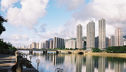
See 沙田, 沙田 Sha Tin, on the map
Directions to 沙田 (沙田 Sha Tin) with public transportation
The following transit lines have routes that pass near 沙田
Bus:
Subway:
How to get to 沙田 by Bus?
Click on the Bus route to see step by step directions with maps, line arrival times and updated time schedules.
How to get to 沙田 by Subway?
Click on the Subway route to see step by step directions with maps, line arrival times and updated time schedules.
Bus stations near 沙田 in 沙田 Sha Tin
- 美松苑 Mei Chung Court,2 min walk,
- 美城苑 May Shing Court,3 min walk,
Bus lines to 沙田 in 沙田 Sha Tin
- 46P,美田 Mei Tin - 葵芳站 Kwai Fong Station,
- 81S,美田 Mei Tin - 彌敦道(眾坊街) Nathan Road (Public Square Street),
- 283,沙田市中心 Sha Tin Central - 美松苑(循環線) Mei Chung Court (Circular),
- 286P,美松苑 Mei Chung Court - 長沙灣 Cheung Sha Wan,
- 798P,將軍澳工業邨 Tseung Kwan O Industrial Estate - 大圍站 Tai Wai Station,
- 985,美田邨 Mei Tin Estate - 銅鑼灣/金鐘 Causeway Bay / Admiralty,
- 985A,美田(美致樓) Mei Tin (Mei Chi House) > 銅鑼灣 Causeway Bay,
- 989,火炭(駿洋邨) Fo Tan (Chun Yeung Estate) - 西灣河 Sai Wan Ho,
- 288C,水泉澳(上) Shui Chuen O (Upper),
What are the closest stations to 沙田?
The closest stations to 沙田 are:
- 美松苑 Mei Chung Court is 137 meters away, 2 min walk.
- 美城苑 May Shing Court is 197 meters away, 3 min walk.
Which Bus lines stop near 沙田?
These Bus lines stop near 沙田: 286X, 481B, 63A, 80
Which Subway lines stop near 沙田?
These Subway lines stop near 沙田: 東鐵綫 EAST RAIL LINE
What’s the nearest bus stop to 沙田 in 沙田 Sha Tin?
The nearest bus stop to 沙田 in 沙田 Sha Tin is 美松苑 Mei Chung Court. It’s a 2 min walk away.
See 沙田, 沙田 Sha Tin, on the map

Public Transit to 沙田 in 沙田 Sha Tin
Wondering how to get to 沙田 in 沙田 Sha Tin, Hong Kong? Moovit helps you find the best way to get to 沙田 with step-by-step directions from the nearest public transit station.
Moovit provides free maps and live directions to help you navigate through your city. View schedules, routes, timetables, and find out how long does it take to get to 沙田 in real time.
Looking for the nearest stop or station to 沙田? Check out this list of stops closest to your destination: 美松苑 Mei Chung Court; 美城苑 May Shing Court.
Bus:Subway:
Want to see if there’s another route that gets you there at an earlier time? Moovit helps you find alternative routes or times. Get directions from and directions to 沙田 easily from the Moovit App or Website.
We make riding to 沙田 easy, which is why over 1.5 million users, including users in 沙田 Sha Tin, trust Moovit as the best app for public transit. You don’t need to download an individual bus app or train app, Moovit is your all-in-one transit app that helps you find the best bus time or train time available.
For information on prices of Bus and Subway, costs and ride fares to 沙田, please check the Moovit app.
Use the app to navigate to popular places including to the airport, hospital, stadium, grocery store, mall, coffee shop, school, college, and university.
沙田 Address: 香港沙田沙田大圍美松苑停車場2樓1號ATM street in 沙田 Sha Tin

Attractions near 沙田
How to get to popular attractions in 沙田 Sha Tin with public transit
- Avenue Of Stars, 油尖旺 Yau Tsim Mong
- 小白鷺餐廳, 大埔 Tai Po
- 浚湖樓
- 宜家家居餐廳, 沙田 Sha Tin
- Saizeriya 薩莉亞, 黃大仙 Wong Tai Sin
- 德福廣場, 觀塘 Kwun Tong
- West Hotel 偉晴軒, 油尖旺 Yau Tsim Mong
- Aji Ichiban 優の良品, 香港島 Islands
- Maxim's Cakes 美心西餅, 沙田 Sha Tin
- Ralph Lauren, 香港島 Islands
- Times Square, 灣仔 Wan Chai
- 海洋公園, 南區 Southern
- Kubrick Café, 油尖旺 Yau Tsim Mong
- 田舍屋, 油尖旺 Yau Tsim Mong
- Kau To Shan 九肚山, 沙田 Sha Tin
- Avon Mall 碧湖商場, 北區 North
- Jadewater 南灣御園, 南區 Southern
- Facesss, 油尖旺 Yau Tsim Mong
- Toys"R"Us 玩具反斗城, 沙田 Sha Tin
- Budaoweng Hotpot Cuisine 不倒翁中日火鍋料理, 油尖旺 Yau Tsim Mong