See 白普理叁養中心, 沙田 Sha Tin, on the map
Directions to 白普理叁養中心 (沙田 Sha Tin) with public transportation
The following transit lines have routes that pass near 白普理叁養中心
- Bus:
How to get to 白普理叁養中心 by Bus?
Click on the Bus route to see step by step directions with maps, line arrival times and updated time schedules.
Bus stations near 白普理叁養中心 in 沙田 Sha Tin
- 亞公角山路, 近沙田慈氏護養院 A Kung Kok Shan Road, Near Cheshire Home Shatin,5 min walk,
- 沙田醫院 Shatin Hospital,9 min walk,
- 亞公角街, 沙田醫院外 A Kung Kok Street, Outside Shatin Hospital,9 min walk,
- 未命名通道, 近沙田醫院賽馬會耆智園 Unnamed Access Road, Near Jockey Club Centre For Positive Ageing, Shatin Hospital,11 min walk,
Bus lines to 白普理叁養中心 in 沙田 Sha Tin
- 67K,亞公角山路, 近鄰舍輔導會怡欣山莊 A Kung Kok Shan Road, Near the Neighbourhood Advice-Action Council Harmony Manor,
- NA40,機場/港珠澳大橋香港口岸 Airport / HZMB Hong Kong Port - 烏溪沙站 Wu Kai Sha Station,
- 40X,烏溪沙站 Wu Kai Sha Station - 葵涌邨 Kwai Chung Estate,
- A41P,烏溪沙站 Wu Kai Sha Station - 機場 Airport,
- N42,馬鞍山(耀安) Ma On Shan (Yiu On) - 東涌站 Tung Chung Station,
- 43X,馬鞍山(耀安) Ma On Shan (Yiu On) - 荃灣西站 Tsuen Wan West Station,
- 81C,耀安 Yiu On - 尖沙咀東(麼地道) Tsim Sha Tsui East (Mody Road),
- 84M,富安花園 Chevalier Garden - 樂富 Lok Fu,
- 85K,恆安 Heng On - 沙田站 Sha Tin Station,
- 85M,錦英苑 Kam Ying Court - 黃大仙(循環線) Wong Tai Sin (Circular),
- 85S,馬鞍山(耀安) Ma On Shan (Yiu On) - 紅磡(紅鸞道) Hung Hom (Hung Luen Road),
- 85X,馬鞍山市中心 Ma On Shan Town Centre - 紅磡(紅鸞道) Hung Hom (Hung Luen Road),
- 86C,馬鞍山(利安) Ma On Shan (Lee On) - 長沙灣 Cheung Sha Wan,
- 86K,錦英苑 Kam Ying Court - 沙田站 Sha Tin Station,
- 86S,錦英苑 Kam Ying Court - 沙田站 Sha Tin Station,
- 87D,錦英苑 Kam Ying Court - 紅磡站 Hung Hom Station,
- 89C,恒安 Heng On - 觀塘(翠屏道) Kwun Tong (Tsui Ping Road),
- 89D,烏溪沙站 Wu Kai Sha Station - 藍田站 Lam Tin Station,
- 89P,馬鞍山市中心 Ma On Shan Town Centre - 藍田站 Lam Tin Station,
- 89S,圓洲角 Yuen Chau Kok - 烏溪沙站(循環線) Wu Kai Sha Station (circular),
What are the closest stations to 白普理叁養中心?
The closest stations to 白普理叁養中心 are:
- 亞公角山路, 近沙田慈氏護養院 A Kung Kok Shan Road, Near Cheshire Home Shatin is 300 meters away, 5 min walk.
- 沙田醫院 Shatin Hospital is 633 meters away, 9 min walk.
- 亞公角街, 沙田醫院外 A Kung Kok Street, Outside Shatin Hospital is 664 meters away, 9 min walk.
- 未命名通道, 近沙田醫院賽馬會耆智園 Unnamed Access Road, Near Jockey Club Centre For Positive Ageing, Shatin Hospital is 808 meters away, 11 min walk.
Which Bus lines stop near 白普理叁養中心?
These Bus lines stop near 白普理叁養中心: 299X, 67K, 85M
What’s the nearest bus stop to 白普理叁養中心 in 沙田 Sha Tin?
The nearest bus stop to 白普理叁養中心 in 沙田 Sha Tin is 亞公角山路, 近沙田慈氏護養院 A Kung Kok Shan Road, Near Cheshire Home Shatin. It’s a 5 min walk away.
What time is the first Bus to 白普理叁養中心 in 沙田 Sha Tin?
The N680 is the first Bus that goes to 白普理叁養中心 in 沙田 Sha Tin. It stops nearby at 3:01 AM.
What time is the last Bus to 白普理叁養中心 in 沙田 Sha Tin?
The N680 is the last Bus that goes to 白普理叁養中心 in 沙田 Sha Tin. It stops nearby at 3:42 AM.
How much is the Subway fare to 白普理叁養中心?
The Subway fare to 白普理叁養中心 costs about $4.80 - $50.80.
How much is the Bus fare to 白普理叁養中心?
The Bus fare to 白普理叁養中心 costs about $4.10 - $13.80.
See 白普理叁養中心, 沙田 Sha Tin, on the map
Public Transit to 白普理叁養中心 in 沙田 Sha Tin
Wondering how to get to 白普理叁養中心 in 沙田 Sha Tin, Hong Kong? Moovit helps you find the best way to get to 白普理叁養中心 with step-by-step directions from the nearest public transit station.
Moovit provides free maps and live directions to help you navigate through your city. View schedules, routes, timetables, and find out how long does it take to get to 白普理叁養中心 in real time.
Looking for the nearest stop or station to 白普理叁養中心? Check out this list of stops closest to your destination: 亞公角山路; 沙田醫院 Shatin Hospital; 亞公角街; 未命名通道.
Bus:
Want to see if there’s another route that gets you there at an earlier time? Moovit helps you find alternative routes or times. Get directions from and directions to 白普理叁養中心 easily from the Moovit App or Website.
We make riding to 白普理叁養中心 easy, which is why over 1.5 million users, including users in 沙田 Sha Tin, trust Moovit as the best app for public transit. You don’t need to download an individual bus app or train app, Moovit is your all-in-one transit app that helps you find the best bus time or train time available.
For information on prices of Bus and Subway, costs and ride fares to 白普理叁養中心, please check the Moovit app.
Use the app to navigate to popular places including to the airport, hospital, stadium, grocery store, mall, coffee shop, school, college, and university.
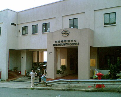
白普理叁養中心 Address: 亞公角山路 17 沙田区, 新界 street in 沙田 Sha Tin
Attractions near 白普理叁養中心
- 白普理寧養中心 Bradbury Hospice
- The Jockey Club Home for Hospice, Shatin
- 善寧之家
- 亞公角山路
- 賽馬會善寧之家 Jockey Club Home For Hospice
- 賽馬會耆智園 Jockey Club Centre For Positive Ageing
- 沙田醫院停車場
- 亞公角食水配水庫
- 沙田醫院調遷大樓 Shatin Hospital Decanting Building
- 沙田慈氏護養院 Cheshire Home Shatin
- 白端良小屋
- 沙田醫院 Shatin Hospital
- Shatin Hospital
- 沙田慈氏護養院
- Cheshire Home Shatin
- 沙田醫院
- 沙田市中心出口
- Shatin Hospital 沙田醫院
- Dr. Leung Chi Wang (梁智宏醫生)
- 慈氏護養院
How to get to popular attractions in 沙田 Sha Tin with public transit
- 旦王花, 元朗 Yuen Long
- Pacific Place, 中西區 Central And Western
- 龍寶酒家, 深水埗 Sham Shui Po
- Watami 和民居食屋, 香港島 Islands
- Jadewater 南灣御園, 南區 Southern
- 香辣軒, 南區 Southern
- La Grove 原築, 元朗 Yuen Long
- Ammo Restaurant & Bar, 中西區 Central And Western
- 美麗華商場, 油尖旺 Yau Tsim Mong
- SK Beach Club 海灣會, 西貢 Sai Kung
- 廉政公署總部, 東區 Eastern
- Ming Kee Seafood Restaurant 明記海鮮酒家, 香港島 Islands
- The Peak, 中西區 Central And Western
- Toys"R"Us 玩具反斗城, 沙田 Sha Tin
- Wealthy Heights 威豪閣, 中西區 Central And Western
- Hong Kong School of Motoring 香港駕駛學院, 南區 Southern
- Elm Tree Towers 愉富大廈, 灣仔 Wan Chai
- 置地廣塲, 中西區 Central And Western
- 海洋公園, 南區 Southern
- 囍慶