
How to get to 金马伦道 in 油尖旺 Yau Tsim Mong by Subway or Bus?

See 金马伦道, 油尖旺 Yau Tsim Mong, on the map

Directions to 金马伦道 (油尖旺 Yau Tsim Mong) with public transportation

The following transit lines have routes that pass near 金马伦道

  • BusBus:
  • SubwaySubway:

How to get to 金马伦道 by Bus?

Click on the Bus route to see step by step directions with maps, line arrival times and updated time schedules.

How to get to 金马伦道 by Subway?

Click on the Subway route to see step by step directions with maps, line arrival times and updated time schedules.

Bus stations near 金马伦道 in 油尖旺 Yau Tsim Mong

  • 金馬倫道 Cameron Road,1 min walk,
  • 九龍清真寺 Kowloon Mosque,2 min walk,
  • 海防道及樂道交界 Haiphong Road, Junction With Lock Road,3 min walk,
  • 加拿分道, 金輝大廈外 Carnarvon Road, Outside Golden Glory Mansion,3 min walk,
  • 聖安德烈堂 St. Andrew's Church,3 min walk,
  • 北京道誠信大廈外 Peking Road Outside Mary Building,4 min walk,
  • 金巴利道 Kimberly Road,4 min walk,
  • 漢口道 35 號 Hankow Road, 35,4 min walk,
  • 栢麗購物大道 Park Lane,4 min walk,
  • 金巴利道 Kimberley Road,5 min walk,
  • 九龍公園徑 Kowloon Park Drive,7 min walk,

Subway stations near 金马伦道 in 油尖旺 Yau Tsim Mong

  • 尖沙咀 Tsim Sha Tsui,2 min walk,
  • 尖東 East Tsim Sha Tsui,2 min walk,

Ferry stations near 金马伦道 in 油尖旺 Yau Tsim Mong

  • 天星碼頭(尖沙咀) Star Ferry Pier (Tsim Sha Tsui),7 min walk,
  • 尖沙咀1號梯台 Tsim Sha Tsui Landing No.1,9 min walk,

Bus lines to 金马伦道 in 油尖旺 Yau Tsim Mong

  • 1,竹園邨 Chuk Yuen Estate - 尖沙咀碼頭 Star Ferry,
  • 1A,中秀茂坪 Sau Mau Ping (Central) - 尖沙咀碼頭 Star Ferry,
  • 2,尖沙咀碼頭 Star Ferry - 蘇屋 So Uk,
  • H2K,中環(天星碼頭) Central (Star Ferry) - 西九文化區(循環線) West Kowloon Cultural District (Circular),
  • 6,尖沙咀碼頭 Star Ferry - 荔枝角 Lai Chi Kok,
  • 9,彩福 Choi Fook - 尖沙咀東(麼地道) Tsim Sha Tsui East (Mody Road),
  • NA20,黃埔花園 Whampoa Garden - 機場/港珠澳大橋香港口岸 Airport / HZMB Hong Kong Port,
  • A21,紅磡站 Hung Hom Station - 機場 Airport,
  • N21,尖沙咀(天星碼頭) Tsim Sha Tsui (Star Ferry) - 機場 Airport,
  • N21A,尖沙咀(天星碼頭) Tsim Sha Tsui (Star Ferry) - 機場 Airport,
  • 26,順天 Shun Tin - 尖沙咀東 Tsim Sha Tsui East,
  • 26X,尖沙咀東 Tsim Sha Tsui East - 順天 Shun Tin,
  • 98D,坑口(北) Hang Hau (North) - 尖沙咀東 Tsim Sha Tsui East,
  • 98P,坑口(北) Hang Hau (North) / 康盛花園 Hong Sing Garden - 尖沙咀東 Tsim Sha Tsui East,
  • 203S,澤安邨 Chak On Estate - 尖沙咀東(麼地道) Tsim Sha Tsui East (Mody Road),
  • N216,油塘 Yau Tong - 紅磡站 Hung Hom Station,
  • N241,紅磡站 Hung Hom Station - 青衣(長宏邨) Tsing Yi (Cheung Wang Estate),
  • 270A,上水 Sheung Shui - 尖沙咀東(麼地道) Tsim Sha Tsui East (Mody Road),
  • 270C,粉嶺(聯和墟) Fanling (Luen Wo Hui) - 尖沙咀東(麼地道) Tsim Sha Tsui East (Mody Road),
  • 790,清水灣半島 Oscar By The Sea - 尖沙咀(麼地道) Tsim Sha Tsui (Mody Road),
Questions & Answers
  • What are the closest stations to 金马伦道?

    The closest stations to 金马伦道 are:

    • 金馬倫道 Cameron Road is 18 meters away, 1 min walk.
    • 尖沙咀 Tsim Sha Tsui is 62 meters away, 2 min walk.
    • 尖東 East Tsim Sha Tsui is 62 meters away, 2 min walk.
    • 九龍清真寺 Kowloon Mosque is 144 meters away, 2 min walk.
    • 海防道及樂道交界 Haiphong Road, Junction With Lock Road is 167 meters away, 3 min walk.
    • 加拿分道, 金輝大廈外 Carnarvon Road, Outside Golden Glory Mansion is 168 meters away, 3 min walk.
    • 聖安德烈堂 St. Andrew's Church is 175 meters away, 3 min walk.
    • 北京道誠信大廈外 Peking Road Outside Mary Building is 210 meters away, 4 min walk.
    • 金巴利道 Kimberly Road is 256 meters away, 4 min walk.
    • 漢口道 35 號 Hankow Road, 35 is 260 meters away, 4 min walk.
    • 栢麗購物大道 Park Lane is 278 meters away, 4 min walk.
    • 金巴利道 Kimberley Road is 308 meters away, 5 min walk.
    • 天星碼頭(尖沙咀) Star Ferry Pier (Tsim Sha Tsui) is 468 meters away, 7 min walk.
    • 九龍公園徑 Kowloon Park Drive is 511 meters away, 7 min walk.
    • 尖沙咀1號梯台 Tsim Sha Tsui Landing No.1 is 608 meters away, 9 min walk.
  • Which Bus lines stop near 金马伦道?

    These Bus lines stop near 金马伦道: 1A, 2, 213X, 234X, 280X, 281A, 9

  • Which Subway lines stop near 金马伦道?

    These Subway lines stop near 金马伦道: 屯馬綫 TUEN MA LINE, 荃灣綫 TSUEN WAN LINE

  • What’s the nearest subway station to 金马伦道 in 油尖旺 Yau Tsim Mong?

    The nearest subway stations to 金马伦道 in 油尖旺 Yau Tsim Mong are 尖沙咀 Tsim Sha Tsui and 尖東 East Tsim Sha Tsui. The closest one is a 2 min walk away.

  • What’s the nearest bus stop to 金马伦道 in 油尖旺 Yau Tsim Mong?

    The nearest bus stop to 金马伦道 in 油尖旺 Yau Tsim Mong is 金馬倫道 Cameron Road. It’s a 1 min walk away.

  • What’s the nearest ferry station to 金马伦道 in 油尖旺 Yau Tsim Mong?

    The nearest ferry station to 金马伦道 in 油尖旺 Yau Tsim Mong is 天星碼頭(尖沙咀) Star Ferry Pier (Tsim Sha Tsui). It’s a 7 min walk away.

  • What time is the first Subway to 金马伦道 in 油尖旺 Yau Tsim Mong?

    The 荃灣綫 TSUEN WAN LINE is the first Subway that goes to 金马伦道 in 油尖旺 Yau Tsim Mong. It stops nearby at 6:03 AM.

  • What time is the last Subway to 金马伦道 in 油尖旺 Yau Tsim Mong?

    The 屯馬綫 TUEN MA LINE is the last Subway that goes to 金马伦道 in 油尖旺 Yau Tsim Mong. It stops nearby at 12:37 AM.

  • What time is the first Bus to 金马伦道 in 油尖旺 Yau Tsim Mong?

    The 610S is the first Bus that goes to 金马伦道 in 油尖旺 Yau Tsim Mong. It stops nearby at 3:00 AM.

  • What time is the last Bus to 金马伦道 in 油尖旺 Yau Tsim Mong?

    The A21 is the last Bus that goes to 金马伦道 in 油尖旺 Yau Tsim Mong. It stops nearby at 12:50 AM.

  • What time is the first Ferry to 金马伦道 in 油尖旺 Yau Tsim Mong?

    The 尖沙咀 - 中環 is the first Ferry that goes to 金马伦道 in 油尖旺 Yau Tsim Mong. It stops nearby at 6:30 AM.

  • What time is the last Ferry to 金马伦道 in 油尖旺 Yau Tsim Mong?

    The 尖沙咀 - 中環 is the last Ferry that goes to 金马伦道 in 油尖旺 Yau Tsim Mong. It stops nearby at 11:36 PM.

  • How much is the Subway fare to 金马伦道?

    The Subway fare to 金马伦道 costs about $3.90 - $24.00.

  • How much is the Bus fare to 金马伦道?

    The Bus fare to 金马伦道 costs about $5.20 - $9.80.

See 金马伦道, 油尖旺 Yau Tsim Mong, on the map

The Most Popular Urban Mobility App in 油尖旺 Yau Tsim Mong.
All local mobility options in one app

Public Transit to 金马伦道 in 油尖旺 Yau Tsim Mong

Wondering how to get to 金马伦道 in 油尖旺 Yau Tsim Mong, Hong Kong? Moovit helps you find the best way to get to 金马伦道 with step-by-step directions from the nearest public transit station.

Moovit provides free maps and live directions to help you navigate through your city. View schedules, routes, timetables, and find out how long does it take to get to 金马伦道 in real time.

Looking for the nearest stop or station to 金马伦道? Check out this list of stops closest to your destination: 金馬倫道 Cameron Road; 尖沙咀 Tsim Sha Tsui; 尖東 East Tsim Sha Tsui; 九龍清真寺 Kowloon Mosque; 海防道及樂道交界 Haiphong Road; 加拿分道; 聖安德烈堂 St. Andrew's Church; 北京道誠信大廈外 Peking Road Outside Mary Building; 金巴利道 Kimberly Road; 漢口道 35 號 Hankow Road; 栢麗購物大道 Park Lane; 金巴利道 Kimberley Road; 天星碼頭(尖沙咀) Star Ferry Pier (Tsim Sha Tsui); 九龍公園徑 Kowloon Park Drive; 尖沙咀1號梯台 Tsim Sha Tsui Landing No.1.

Bus:Subway:

Want to see if there’s another route that gets you there at an earlier time? Moovit helps you find alternative routes or times. Get directions from and directions to 金马伦道 easily from the Moovit App or Website.

We make riding to 金马伦道 easy, which is why over 1.5 million users, including users in 油尖旺 Yau Tsim Mong, trust Moovit as the best app for public transit. You don’t need to download an individual bus app or train app, Moovit is your all-in-one transit app that helps you find the best bus time or train time available.

For information on prices of Subway and Bus, costs and ride fares to 金马伦道, please check the Moovit app.

Use the app to navigate to popular places including to the airport, hospital, stadium, grocery store, mall, coffee shop, school, college, and university.

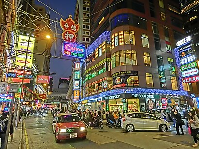
金马伦道 Address: 香港尖沙咀金马伦道 street in 油尖旺 Yau Tsim Mong

金马伦道, 油尖旺 Yau Tsim Mong

Cameron Road (Chinese: 金馬倫道) is a street in Tsim Sha Tsui, Kowloon, Hong Kong.Wiki

How to get to 金马伦道 with public transit - About the place

Public transit lines with stations closest to 金马伦道 in 油尖旺 Yau Tsim Mong

Subway lines with stations closest to 金马伦道 in 油尖旺 Yau Tsim Mong

Bus lines with stations closest to 金马伦道 in 油尖旺 Yau Tsim Mong

Ferry lines with stations closest to 金马伦道 in 油尖旺 Yau Tsim Mong

Easier to get to 金马伦道 in…