Directions to Dundas, Ontario (Hamilton) with public transportation
The following transit lines have routes that pass near Dundas, Ontario
How to get to Dundas, Ontario by bus?
Click on the bus route to see step by step directions with maps, line arrival times and updated time schedules.
Bus stops near Dundas, Ontario in Hamilton
- King at Mcmurray, 6 min walk,
Bus lines to Dundas, Ontario in Hamilton
- 05, 5 - Head Street,
What are the closest stations to Dundas, Ontario?
The closest stations to Dundas, Ontario are:
- King at Mcmurray is 409 meters away, 6 min walk.
Which bus line stops near Dundas, Ontario?
05
What’s the nearest bus stop to Dundas, Ontario in Hamilton?
The nearest bus stop to Dundas, Ontario in Hamilton is King at Mcmurray. It’s a 6 min walk away.
What time is the first bus to Dundas, Ontario in Hamilton?
The 05 is the first bus that goes to Dundas, Ontario in Hamilton. It stops nearby at 4:53 AM.
What time is the last bus to Dundas, Ontario in Hamilton?
The 05 is the last bus that goes to Dundas, Ontario in Hamilton. It stops nearby at 1:57 AM.
How much is the bus fare to Dundas, Ontario?
The bus fare to Dundas, Ontario costs about $2.50 - $9.10.
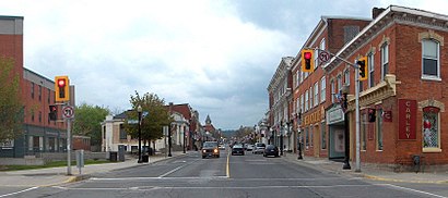
See Dundas, Ontario, Hamilton, on the map
Public Transit to Dundas, Ontario in Hamilton
Wondering how to get to Dundas, Ontario in Hamilton, Canada? Moovit helps you find the best way to get to Dundas, Ontario with step-by-step directions from the nearest public transit station.
Moovit provides free maps and live directions to help you navigate through your city. View schedules, routes, timetables, and find out how long does it take to get to Dundas, Ontario in real time.
Looking for the nearest stop or station to Dundas, Ontario? Check out this list of stops closest to your destination: King at Mcmurray.
Bus: 05.
Want to see if there’s another route that gets you there at an earlier time? Moovit helps you find alternative routes or times. Get directions from and directions to Dundas, Ontario easily from the Moovit App or Website.
We make riding to Dundas, Ontario easy, which is why over 1.5 million users, including users in Hamilton, trust Moovit as the best app for public transit. You don’t need to download an individual bus app or train app, Moovit is your all-in-one transit app that helps you find the best bus time or train time available.
For information on prices of bus, costs and ride fares to Dundas, Ontario, please check the Moovit app.
Use the app to navigate to popular places including to the airport, hospital, stadium, grocery store, mall, coffee shop, school, college, and university.
Location: Hamilton, Toronto
Popular routes to Dundas, Ontario, Hamilton
Attractions near Dundas, Ontario
Tirecraft,Le Bigoudi Hair Salon,Rsco Chartered Profess,Market Street Arena, Dundas.,Kairos Cuts,Sell It 2 Wear It Inc. Consignment Boutique,Mason Athletics,TND Streetwear,Printed Word,Ten Toen Shoe Shop,Cootes Paradise Bar & Bistro,Ahead Academics Tutoring Co.,Desjardins Massage,Hamilton Air Force Association,A&W,Chambers Bar & Grill,Sports Medicine Experts,Reverly Beauty Bar Inc,Green Ash Decor,Graham & BrooksHow to get to popular attractions in Hamilton with public transit
River Street, Toronto,SkyDome, Toronto,Mimico Go Station, Toronto,Dixie GO Station, Mississauga,Joseph Brant Hospital, Burlington,555 Rexdale Boulevard, Toronto,Seneca College Markham Campus, Markham,Toronto Courthouse, Toronto,Mount Pleasant GO Station, Brampton,Humber College - Lakeshore Campus, Toronto,UTM, Mississauga,124 Eglinton Avenue West, Toronto,Providence HealthCare, Toronto,Fonthill, Pelham,325 Milner Avenue, Toronto,Richmond Hill Centre Terminal, Richmond Hill,Mackenzie Health, Richmond Hill,Pickering Town Centre, Pickering,Aldershot VIA/GO Station, Burlington,Midland Avenue, TorontoGet around Toronto by public transit!
Traveling around Toronto has never been so easy. See step by step directions as you travel to any attraction, street or major public transit station. View bus and train schedules, arrival times, service alerts and detailed routes on a map, so you know exactly how to get to anywhere in Toronto.
When traveling to any destination around Toronto use Moovit's Live Directions with Get Off Notifications to know exactly where and how far to walk, how long to wait for your line, and how many stops are left. Moovit will alert you when it's time to get off — no need to constantly re-check whether yours is the next stop.
Wondering how to use public transit in Toronto or how to pay for public transit in Toronto? Moovit public transit app can help you navigate your way with public transit easily, and at minimum cost. It includes public transit fees, ticket prices, and costs. Looking for a map of Toronto public transit lines? Moovit public transit app shows all public transit maps in Toronto with all Bus, Train, Subway, Streetcar and Ferry routes and stops on an interactive map.
Toronto has 5 transit type(s), including: Bus, Train, Subway, Streetcar and Ferry, operated by several transit agencies, including TTC, TTC Streetcar, Toronto Subway, Brampton Transit, MiWay, York Region Transit, GO Transit Bus, GO Transit, Durham Region Transit, UP Express, Grand River Transit, Guelph Transit, grt, Hamilton Street Railway, Burlington Transit