在地图上查看Maris Stella High School、Southeast
在Southeast, 坐公交地铁怎么去Maris Stella High School
以下路线停靠Maris Stella High School附近
公交:
地铁:
坐公交怎么去Maris Stella High School?
点击公交线路,在地图上查看详细的指南、还有实时到站时间以及最新的发车时刻。
坐地铁怎么去Maris Stella High School?
点击地铁线路,在地图上查看详细的指南、还有实时到站时间以及最新的发车时刻。
Southeast中Maris Stella High School附近的地铁个车站
- Bartley (CC12),步行4分钟,
- Potong Pasir (NE10),步行13分钟,
Southeast中Maris Stella High School附近的公交个车站
- Bartley Rd - Opp Bartley Chr CH (62081),步行4分钟,
- Bartley Rd - Bartley Stn Exit A (62071),步行4分钟,
- Upp Paya Lebar Rd - Wisma Aupe (62021),步行11分钟,
- Upp Paya Lebar Rd - Aft Bartley Rd (62011),步行12分钟,
- Upp Paya Lebar Rd - Paya Lebar Gdns (62029),步行13分钟,
Southeast中公交线路至 Maris Stella High School
- 28,Toa Payoh Int,
- 93,Harbourfront Int,
- 129,St. Michael's Ter,
- 146,Bartley Rd,
- 158,Serangoon Int,
- 22,Ang Mo Kio Int ↔ Eunos Int,
- 24,Ang Mo Kio Int ↺ Changi Airport,
- 43,Punggol Temp Int ↔ Upp East Coast Ter,
- 58,Bishan Int ↔ Pasir Ris Int,
- 62,Punggol Temp Int ↺ Sims Ave,
- 70,Yio Chu Kang Int ↔ Shenton Way Ter,
- 80,Sengkang Int ↔ HarbourFront Int,
- 70M,Yio Chu Kang Int ↺ Temasek Ave,
- 76,Yio Chu Kang Int,
- 58A,Tampines Ave 10 (Bef Tpe),
- 62A,Aljunied Rd (Aljunied Stn),
- 70A,Temasek Ave (Opp the Ritz Carlton),
- 80A,Aljunied Rd (Aljunied MRT Stn),
Maris Stella High School附近的公交站在哪里?
Maris Stella High School附近的公交站是:
- Bartley (CC12) 在170米外,步行需要4分钟。
- Bartley Rd - Opp Bartley Chr CH (62081) 在181米外,步行需要4分钟。
- Bartley Rd - Bartley Stn Exit A (62071) 在212米外,步行需要4分钟。
- Upp Paya Lebar Rd - Wisma Aupe (62021) 在707米外,步行需要11分钟。
- Upp Paya Lebar Rd - Aft Bartley Rd (62011) 在830米外,步行需要12分钟。
- Upp Paya Lebar Rd - Paya Lebar Gdns (62029) 在876米外,步行需要13分钟。
- Potong Pasir (NE10) 在944米外,步行需要13分钟。
哪些公交线路在 Maris Stella High School附近停靠?
这些公交线路在Maris Stella High School附近停靠: 129, 146, 158, 28, 93。
哪条 地铁 线路在 Maris Stella High School 附近停靠?
CIRCLE LINE
在Southeast,离Maris Stella High School最近的地铁 车站在哪里?
在Southeast中离Maris Stella High School最近的地铁 车站是Bartley (CC12)。 这是一个 4分 的步行路程。
在Southeast,离Maris Stella High School最近的公交 公交站在哪里?
距离Southeast的Maris Stella High School最近的公交 站点是Bartley Rd - Opp Bartley Chr CH (62081) and Bartley Rd - Bartley Stn Exit A (62071)。 最近的一个步行路程为 4分。
到Maris Stella High School的公交票价是多少?
前往 Maris Stella High School 的 公交 票价约为 $1.09 - $2.18。
到Maris Stella High School的地铁票价是多少?
前往 Maris Stella High School 的 地铁 票价约为 $0.49 - $2.37。
在地图上查看Maris Stella High School、Southeast
搭乘公共交通前往SoutheastMaris Stella High School
想知道如何去Maris Stella High School?在新加坡Southeast,Moovit帮助你找到坐公交地铁去Maris Stella High School的最佳路线。
Moovit提供的免费地图信息、以及路线跟踪功能助你无忧出行。还可以查看发车时间、线路详情、班次等,实时掌握达到Maris Stella High School的时间。
在找Maris Stella High School附近的公交地铁站?快来看最靠近目的地的站点列表: Bartley (CC12); Bartley Rd - Opp Bartley Chr CH (62081); Bartley Rd - Bartley Stn Exit A (62071); Upp Paya Lebar Rd - Wisma Aupe (62021); Upp Paya Lebar Rd - Aft Bartley Rd (62011); Upp Paya Lebar Rd - Paya Lebar Gdns (62029); Potong Pasir (NE10).
公交:地铁:
想知道有没有其它线路可以更快到达?Moovit也可以帮你找到替代路线。快在App或者网站上搜索从Maris Stella High School出发或者到达的路线吧。
前往Maris Stella High School更简单!这就是为什么成千上万的用户,包括Southeast的乘客,信任Moovit作为他们公交出行的最佳选择。不需要下载多个公交或者地铁App,有了Moovit,囊括所有的公共交通方式,帮你找到最合适的公交地铁出发时间。
Use the app to navigate to popular places including to the airport, hospital, stadium, grocery store, mall, coffee shop, school, college, and university.
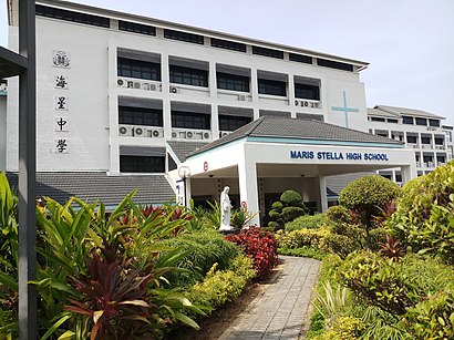
Maris Stella High School 地址:Southeast的Bartley Road街道
海星中学(Maris Stella High School,简称MSHS)是新加坡一所天主教男子中学校。它是新加坡的特别辅助计划学校之一。Wiki
![如何坐公交去Maris Stella High School - 景点简介](https://upload.wikimedia.org/wikipedia/commons/thumb/7/72/MSHS2018.jpg/410px-MSHS2018.jpg)
Maris Stella High School附近的景点
- PT.Snip Indonesia Perkasa
- Bartley Greenrise
- 25 Mount Vernon Rd
- Maris Stella High Pri
- Maris Stella High School Primary
- Bartley Beacon
- wings counselling centre
- Ramakrishna Mission Sarada Kindergarten
- Bus Stop 62079
- Bartley Christian Church
- Gym @ Bartley Residences
- Ramakrishna Mission
- 4 How Sun Drive
- Bartley MRT Station (CC12)
- 7a Lor How Sun
- 179 Bartley Road
- 20 How Sun Dr
- Bartley Residences Lor How Sun
- Mount Vernon Road
- SP SERVICES 1a Woodleigh Park
怎么去Southeast的旅游景点
- Samsung Asia Pte. Ltd. (Regional & Singapore Office), Southwest
- Nex, Southeast
- HarbourFront Departure Hall, Singapore
- Compass One, Northeast
- Prime Supermarket, Southwest
- Asia Pacific Breweries Limited, Southwest
- The Coffee Bean & Tea Leaf, Singapore
- 美世界地铁站, Southwest
- Blue Riverview Playground, Northwest
- Blk 18 @ TradeHub 21, Southwest
- Jelutung Harbour Park, Northwest
- PUTIEN Restaurant 莆田菜馆, Singapore
- Monterey Park, Southwest
- NUS FASS AS1, Southwest
- Jurong Logistics Hub, Southwest
- TCC – The Connoisseur Concerto, Singapore
- Bus Stop 59561 (Blk 798), Singapore
- MINDEF, Northwest
- UNIQLO, Singapore
- Sanofi Aventis, Southwest
Southeast交通攻略!
Moovit会给你详细的路线指南,带你到达Southeast的旅游景点或者公交枢纽站。<br>Moovit会告诉你路线途经的站点、首末班车、时刻表、到站时间,甚至在发生变动时发送出行提示。在Southeast,无论去哪儿,都找得到坐公交前往的最佳路线
担心在Southeast坐过站或下错车?Moovit贴心设计了路线跟踪功能,实时为你更新车辆的到站时间、还有几站到达、并在到站前提醒你下车。再也不用担心下错车!
想知道如何在Southeast使用公共交通或如何支付Southeast的公共交通费用? Moovit 公共交通应用程序可以帮助你以最低的成本轻松搭乘公共交通。本应用程序包括公共交通费、门票价格和费用。正在寻找 Southeast 公共交通线路的地图? Moovit 公共交通应用程序在交互式地图上显示 Southeast 的所有公共交通地图以及所有 地铁 或 公交 路线和站点。
Southeast包含2公共交通工具,包括地铁 或 公交,由有多家公共交通运营企业,包括SMRT, SBS Transit, SMRT, MRT/LRT Replacement Services, SBS Transit, SBS Transit, SMRT, Tower Transit, Go-Ahead Singapore, Premium Bus, City Direct Bus, Changi Airport, Sentosa Development Corporation, Sentosa Development Corporation 和 Cross Border Bus