Directions to Reston, Virginia (Fairfax County) with public transportation
The following transit lines have routes that pass near Reston, Virginia
How to get to Reston, Virginia by bus?
Click on the bus route to see step by step directions with maps, line arrival times and updated time schedules.
How to get to Reston, Virginia by metro?
Click on the metro route to see step by step directions with maps, line arrival times and updated time schedules.
Bus stops near Reston, Virginia in Fairfax County
- Bluemont Way And Library St (Rtc L), 3 min walk,
- Reston Town Ctr, 3 min walk,
- Reston Town Ctr Bay C, 4 min walk,
Metro stations near Reston, Virginia in Fairfax County
- Wiehle-Reston, 26 min walk,
Bus lines to Reston, Virginia in Fairfax County
- 552, 552 Wiehle Metro,
- 559, 559 Wiehle Metro,
- 950, 950 Herndon Metro,
- 574, 574 Reston - Town Ctr,
- RIBS5, Ribs 5 Reston Town Ctr - Herndon,
- 605, 605 Reston - Town Ctr,
- RIBS2, Ribs 2 Herndon Metro,
- RIBS1, Ribs 1 Lake Anne - Reston Town Ctr,
- RIBS3, Ribs 3 Hunters Woods - Reston Town Ctr,
- RIBS4, Ribs 4 North Point - Reston Town Ctr,
What are the closest stations to Reston, Virginia?
The closest stations to Reston, Virginia are:
- Bluemont Way And Library St (Rtc L) is 145 yards away, 3 min walk.
- Reston Town Ctr is 199 yards away, 3 min walk.
- Reston Town Ctr Bay C is 238 yards away, 4 min walk.
- Wiehle-Reston is 2215 yards away, 26 min walk.
Which bus lines stop near Reston, Virginia?
These bus lines stop near Reston, Virginia: 552, 574, 605, RIBS1.
Which metro line stops near Reston, Virginia?
METRORAIL SILVER LINE
What’s the nearest metro station to Reston, Virginia in Fairfax County?
The nearest metro station to Reston, Virginia in Fairfax County is Wiehle-Reston. It’s a 26 min walk away.
What’s the nearest bus stop to Reston, Virginia in Fairfax County?
The nearest bus stops to Reston, Virginia in Fairfax County are Bluemont Way And Library St (Rtc L) and Reston Town Ctr. The closest one is a 3 min walk away.
What time is the first metro to Reston, Virginia in Fairfax County?
The METRORAIL SILVER LINE is the first metro that goes to Reston, Virginia in Fairfax County. It stops nearby at 5:00 AM.
What time is the last metro to Reston, Virginia in Fairfax County?
The METRORAIL SILVER LINE is the last metro that goes to Reston, Virginia in Fairfax County. It stops nearby at 12:56 AM.
What time is the first bus to Reston, Virginia in Fairfax County?
The 950 is the first bus that goes to Reston, Virginia in Fairfax County. It stops nearby at 4:10 AM.
What time is the last bus to Reston, Virginia in Fairfax County?
The 950 is the last bus that goes to Reston, Virginia in Fairfax County. It stops nearby at 1:26 AM.
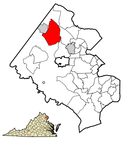
See Reston, Virginia, Fairfax County, on the map
Public Transit to Reston, Virginia in Fairfax County
Wondering how to get to Reston, Virginia in Fairfax County, United States? Moovit helps you find the best way to get to Reston, Virginia with step-by-step directions from the nearest public transit station.
Moovit provides free maps and live directions to help you navigate through your city. View schedules, routes, timetables, and find out how long does it take to get to Reston, Virginia in real time.
Looking for the nearest stop or station to Reston, Virginia? Check out this list of stops closest to your destination: Bluemont Way And Library St (Rtc L); Reston Town Ctr; Reston Town Ctr Bay C; Wiehle-Reston.
Bus: 552, 574, 605, RIBS1, 559, 950, RIBS5.Metro: METRORAIL SILVER LINE.
Want to see if there’s another route that gets you there at an earlier time? Moovit helps you find alternative routes or times. Get directions from and directions to Reston, Virginia easily from the Moovit App or Website.
We make riding to Reston, Virginia easy, which is why over 1.5 million users, including users in Fairfax County, trust Moovit as the best app for public transit. You don’t need to download an individual bus app or train app, Moovit is your all-in-one transit app that helps you find the best bus time or train time available.
For information on prices of bus and metro, costs and ride fares to Reston, Virginia, please check the Moovit app.
Use the app to navigate to popular places including to the airport, hospital, stadium, grocery store, mall, coffee shop, school, college, and university.
Location: Fairfax County, Washington, D.C. - Baltimore, MD
Popular routes to Reston, Virginia, Fairfax County
- From West St & Church CirFrom Northern Pkwy & Mcclean Blvd FS EbFrom Craigmont Rd & Westview Mall Opp WbFrom Ring Rd & Aacc EbFrom Belair Rd & Overlea Ave NbFrom Baltimore Annapolis Blvd & Marbury Rd SbFrom 301 Hospital Dr EbFrom Security Square MallFrom Holabird & Searles FS WbFrom Back River Neck Rd & Lanflair Rd Sb
Attractions near Reston, Virginia
Reston Tow Truck,Town Center VSS,RTC,ATHLETA,Makers Union Pub for the People,Look Dine-in Cinemas Reston,Lopez & Wu,Gin Dance Company,Amanda J. Sutton, SLP,M W Jones & Co.,R. Bruce Hall & Associates,Metro Premier Homes,Code42 Software,Finity It,Aeronomy,Government Marketing and Procurement,Rainmaker Associates,Ainovation,Progressive Digital Products,ImprovebuildHow to get to popular attractions in Fairfax County with public transit
Corduroy, Washington,Defense Threat Reduction Agency, Fairfax County,Wilde Lake High School, Howard County,World Bank C Building, Washington,Exit 69 - US 29 (Lee Hwy) / SR 237 (Washington Blvd) / Sycamore St, Arlington County,I-695 @ Exit 26 (York Rd / MD 45), Baltimore County,White Marsh Mall, Baltimore County,I-95 Exit 80 - Belcamp (MD 543), Harford County,I-66 Exit 67: Dulles Toll Road (VA-267), Fairfax County,Library Of Congress, Washington,Cooks Lane, Baltimore,Francis C. Hammond Middle School, Alexandria,Northrop Grumman Square 1, Anne Arundel County,Bob & Edith's Diner, Arlington County,Kensington Park, Montgomery County,U.S. 301 Park and Ride, Charles County,Oxon Hill High School, Prince George's County,Liberty Crossing, Fairfax County,Harvest Fare, Baltimore,Weller Road Elementary School, Montgomery CountyGet around Washington, D.C. - Baltimore, MD by public transit!
Traveling around Washington, D.C. - Baltimore, MD has never been so easy. See step by step directions as you travel to any attraction, street or major public transit station. View bus and train schedules, arrival times, service alerts and detailed routes on a map, so you know exactly how to get to anywhere in Washington, D.C. - Baltimore, MD.
When traveling to any destination around Washington, D.C. - Baltimore, MD use Moovit's Live Directions with Get Off Notifications to know exactly where and how far to walk, how long to wait for your line, and how many stops are left. Moovit will alert you when it's time to get off — no need to constantly re-check whether yours is the next stop.
Wondering how to use public transit in Washington, D.C. - Baltimore, MD or how to pay for public transit in Washington, D.C. - Baltimore, MD? Moovit public transit app can help you navigate your way with public transit easily, and at minimum cost. It includes public transit fees, ticket prices, and costs. Looking for a map of Washington, D.C. - Baltimore, MD public transit lines? Moovit public transit app shows all public transit maps in Washington, D.C. - Baltimore, MD with all Bus, Train, Metro, Light Rail and Ferry routes and stops on an interactive map.
Washington, D.C. - Baltimore, MD has 5 transit type(s), including: Bus, Train, Metro, Light Rail and Ferry, operated by several transit agencies, including WMATA, Montgomery County Ride On, Montgomery County MD Ride On, Fairfax Connector, TheBus, PRTC, DC Circulator, DASH - Alexandria, Arlington Transit (ART), DC Streetcar, RTA of Central Maryland, FRED, MDOT MTA, Marc, Virginia Railway Express (VRE)