Archway Station (W) stop - Sunday schedule
| Line | Direction | Time |
|---|---|---|
| 390 | Victoria | 03:01 |
| 134 | Warren Street | 03:09 |
| N20 | Trafalgar Square | 03:29 |
| 390 | Victoria | 03:33 |
| 134 | Warren Street | 03:39 |
| N20 | Trafalgar Square | 03:59 |
| 390 | Victoria | 04:03 |
| 134 | Warren Street | 04:09 |
| N20 | Trafalgar Square | 04:29 |
| 390 | Victoria | 04:35 |
| 134 | Warren Street | 04:39 |
| 390 | Victoria | 04:55 |
| N20 | Trafalgar Square | 04:59 |
| 41 | Archway | 05:03 |
| 134 | Warren Street | 05:09 |
| 390 | Victoria | 05:15 |
| 41 | Archway | 05:23 |
| N20 | Trafalgar Square | 05:29 |
| 390 | Victoria | 05:35 |
| 134 | Warren Street | 05:39 |
| 41 | Archway | 05:43 |
| 134 | Warren Street | 05:54 |
| 390 | Victoria | 05:55 |
| 41 | Archway | 06:03 |
| 134 | Warren Street | 06:09 |
See Archway Station (W), Upper Holloway, on the map
Directions to Archway Station (W) (Upper Holloway) with public transport
The following transport lines have routes that pass near Archway Station (W)
 Bus:
Bus: - Train:
- Tube:
How to get to Archway Station (W) by bus?
Click on the bus route to see step by step directions with maps, line arrival times and updated time schedules.
How to get to Archway Station (W) by train?
Click on the train route to see step by step directions with maps, line arrival times and updated time schedules.
How to get to Archway Station (W) by Tube?
Click on the Tube route to see step by step directions with maps, line arrival times and updated time schedules.
Bus stations near Archway Station (W) in Upper Holloway
- Elthorne Road (P),3 min walk,
- Archway Station (C),4 min walk,
- Pemberton Gardens (S),5 min walk,
- Archway Road (N),7 min walk,
- Archway Station (G),7 min walk,
Tube stations near Archway Station (W) in Upper Holloway
- Archway,6 min walk,
- Holloway Road,24 min walk,
- Finsbury Park,28 min walk,
Bus lines to Archway Station (W) in Upper Holloway
- 17,London Bridge - Archway,
- N41,Tottenham Hale - Trafalgar Square,
- 43,London Bridge - Friern Barnet,
- 263,Barnet Hospital - Highbury Barn,
- N271,Moorgate, Finsbury Square - North Finchley,
- 4,Blackfriars Station - Archway,
- W5,Harringay, Superstores - Archway,
- C11,Brent Cross, Shopping Centre - Archway Station,
- 143,Archway - Brent Cross, Shopping Centre,
- 210,Brent Cross, Shopping Centre - Finsbury Park Station,
- N20,Barnet Church,
- 134,Warren Street,
- 390,Victoria,
- 41,Tottenham Hale,
- 234,Barnet, the Spires,
What are the nearest stations to Archway Station (W)?
The nearest stations to Archway Station (W) are:
- Elthorne Road (P) is 160 meters away, 3 min walk.
- Archway Station (C) is 233 meters away, 4 min walk.
- Pemberton Gardens (S) is 320 meters away, 5 min walk.
- Archway is 398 meters away, 6 min walk.
- Archway Road (N) is 464 meters away, 7 min walk.
- Archway Station (G) is 514 meters away, 7 min walk.
- Holloway Road is 1787 meters away, 24 min walk.
- Finsbury Park is 2097 meters away, 28 min walk.
Which bus lines stop near Archway Station (W)?
These bus lines stop near Archway Station (W): 134, 210, 263, 390, 43, C11.
Which train line stops near Archway Station (W)?
OVERGROUND
Which Tube line stops near Archway Station (W)?
PICCADILLY
What’s the nearest Tube station to Archway Station (W) in Upper Holloway?
The nearest Tube station to Archway Station (W) in Upper Holloway is Archway. It’s a 6 min walk away.
What’s the nearest bus stop to Archway Station (W) in Upper Holloway?
The nearest bus stop to Archway Station (W) in Upper Holloway is Elthorne Road (P). It’s a 3 min walk away.
What time is the first Tube to Archway Station (W) in Upper Holloway?
The VICTORIA is the first Tube that goes to Archway Station (W) in Upper Holloway. It stops nearby at 05:24.
What time is the last Tube to Archway Station (W) in Upper Holloway?
The PICCADILLY is the last Tube that goes to Archway Station (W) in Upper Holloway. It stops nearby at 00:51.
What time is the first bus to Archway Station (W) in Upper Holloway?
The N20 is the first bus that goes to Archway Station (W) in Upper Holloway. It stops nearby at 03:00.
What time is the last bus to Archway Station (W) in Upper Holloway?
The 390 is the last bus that goes to Archway Station (W) in Upper Holloway. It stops nearby at 03:54.
See Archway Station (W), Upper Holloway, on the map
Public transport to Archway Station (W) stop (ID: W) in Upper Holloway
Looking for directions to Archway Station (W) in Upper Holloway, United Kingdom?
Download the Moovit App to find the current schedule and step-by-step directions for Bus, Train or Tube routes that pass through Archway Station (W).
Looking for the nearest stops closest to Archway Station (W) ? Check out this list of closest stops to your destination: Elthorne Road (P); Archway Station (C); Pemberton Gardens (S); Archway; Archway Road (N); Archway Station (G); Holloway Road; Finsbury Park.
Bus:Train:Tube:
We make riding on public transit to Archway Station (W) easy, which is why over 1.5 million users, including users in Upper Holloway trust Moovit as the best app for public transit.
Use the app to navigate to popular places including to the airport, hospital, stadium, grocery store, mall, coffee shop, school, college, and university.
Archway Station (W) stop’s code is W
The first line to this stop is 390, at 03:01, and the last line is N20 at 02:59.
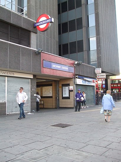
25 Junction Road, London, England, United Kingdom
This stop serves London Buses’s lines
Bus stops near Archway Station (W)
Elthorne Road (P),Archway Station (C),Pemberton Gardens (S),Archway Road (N),Archway Station (G)Popular public transport stations in Upper Holloway
Hospital, Horsham,Sainsbury's West Hove, Portslade,Chesham,Darent Valley Hospital,Green Park / Constitution Hill (E),Colney Fields Retail Park, London Colney,Mile End,Hounslow Central,London Bridge,West Ruislip,Shacklewell Lane (G),Beddington / Asda (W),Tottenham Hotspur Football Club (T),Grove Park (RB),Pinner,Ashurst (Kent),The Polka Theatre (SW),Feltham,Wandsworth Town Hall (P),Bromley Civic Centre (T)Get around Upper Holloway by public transport!
Travelling around Upper Holloway has never been so easy. See step by step directions as you travel to any attraction, street or major public transport station. View bus and train timetables, arrival times, service alerts and detailed routes on a map, so you know exactly how to get to anywhere in Upper Holloway.
When travelling to any destination around Upper Holloway use Moovit's Live Directions with Get Off Notifications to know exactly where and how far to walk, how long to wait for your line , and how many stops are left. Moovit will alert you when it’s time to get off — no need to constantly re-check whether yours is the next stop.
Wondering how to use public transport in Upper Holloway or how to pay for public transport in Upper Holloway? Moovit public transport app can help you navigate your way with public transport easily, and at minimum cost. It includes public transport fees, ticket prices, and costs. Looking for a map of Upper Holloway public transport lines? Moovit public transport app shows all public transport maps in Upper Holloway with all bus, train or Tube routes and stops on an interactive map.
Upper Holloway has 3 transport type(s), including: bus, train or Tube, operated by several transport agencies, including London Underground, London Buses, Transport for London, London Tramlink, Transport for London, National Rail, Bluestar, Berry's Coaches, Oxford Bus Company, Stagecoach West, Community First Wessex, Cresta Coaches, D & P Boat Hire, First Portsmouth, Fareham & Gosport and FYTbus