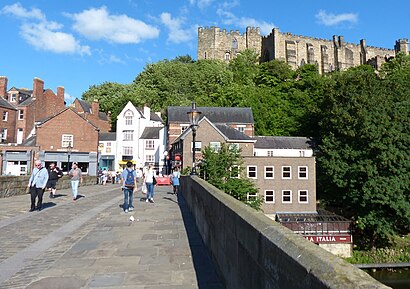
Directions to Aykley Heads (County Durham) with public transport
The following transport lines have routes that pass near Aykley Heads
How to get to Aykley Heads by bus?
Click on the bus route to see step by step directions with maps, line arrival times and updated time schedules.
How to get to Aykley Heads by train?
Click on the train route to see step by step directions with maps, line arrival times and updated time schedules.
Bus stops near Aykley Heads in County Durham
- Blackie Boy, Durham, 3 min walk,
- New College, Framwellgate Moor, 5 min walk,
- High Carr Road, Framwellgate Moor, 5 min walk,
- Holmlands Crescent, Framwellgate Moor, 5 min walk,
- Dryburn Hospital - Old Entrance, Durham, 6 min walk,
- Aykley Heads - For University Hospital, Durham, 9 min walk,
Train station near Aykley Heads in County Durham
- Durham, 12 min walk,
Bus lines to Aykley Heads in County Durham
- ED1, Houghall,
- X5, Castleside,
- X15, Consett,
- 16, Stanley,
- 16A, Shotley Bridge,
- 16B, Consett,
- 51, Stanhope,
- 52, East Hedleyhope,
- X12, Durham,
- X20, Langley Park,
- 21, Brandon,
- N21, Durham,
- X21, West Auckland,
- X46, Crook - Durham,
- 50, South Shields - Durham,
- 50S, Chester-le-Street - Durham,
- 62, Durham - Brasside,
- 64, Gilesgate Moor - Arnison Centre,
- 6, Durham - West Auckland,
- 7, Harrowgate Hill - Darlington,
What are the nearest stations to Aykley Heads?
The nearest stations to Aykley Heads are:
- Blackie Boy, Durham is 156 meters away, 3 min walk.
- New College, Framwellgate Moor is 351 meters away, 5 min walk.
- High Carr Road, Framwellgate Moor is 361 meters away, 5 min walk.
- Holmlands Crescent, Framwellgate Moor is 376 meters away, 5 min walk.
- Dryburn Hospital - Old Entrance, Durham is 452 meters away, 6 min walk.
- Aykley Heads - For University Hospital, Durham is 647 meters away, 9 min walk.
- Durham is 882 meters away, 12 min walk.
Which bus lines stop near Aykley Heads?
These bus lines stop near Aykley Heads: 50, 64, X20, X21.
Which train line stops near Aykley Heads?
LONDON NORTH EASTERN RAILWAY (London Kings Cross)
What’s the nearest train station to Aykley Heads in County Durham?
The nearest train station to Aykley Heads in County Durham is Durham. It’s a 12 min walk away.
What’s the nearest bus station to Aykley Heads in County Durham?
The nearest bus station to Aykley Heads in County Durham is Blackie Boy, Durham. It’s a 3 min walk away.
What time is the first train to Aykley Heads in County Durham?
The TRANSPENNINE EXPRESS is the first train that goes to Aykley Heads in County Durham. It stops nearby at 08:01.
What time is the last train to Aykley Heads in County Durham?
The LONDON NORTH EASTERN RAILWAY is the last train that goes to Aykley Heads in County Durham. It stops nearby at 01:17.
What time is the first bus to Aykley Heads in County Durham?
The 50 is the first bus that goes to Aykley Heads in County Durham. It stops nearby at 06:45.
What time is the last bus to Aykley Heads in County Durham?
The 64 is the last bus that goes to Aykley Heads in County Durham. It stops nearby at 23:43.
See Aykley Heads, County Durham, on the map
Public Transit to Aykley Heads in County Durham
Wondering how to get to Aykley Heads in County Durham, United Kingdom? Moovit helps you find the best way to get to Aykley Heads with step-by-step directions from the nearest public transit station.
Moovit provides free maps and live directions to help you navigate through your city. View schedules, routes, timetables, and find out how long does it take to get to Aykley Heads in real time.
Looking for the nearest stop or station to Aykley Heads? Check out this list of stops closest to your destination: Blackie Boy; New College; High Carr Road; Holmlands Crescent; Dryburn Hospital - Old Entrance; Aykley Heads - For University Hospital; Durham.
Bus: 50, 64, X20, X21, ED1, X5, X15, 16, 16A, X12, 21, N21, X46, 50S, 62, 6, 7, 65, 20.Train: LONDON NORTH EASTERN RAILWAY, CROSSCOUNTRY, NORTHERN, TRANSPENNINE EXPRESS.
Want to see if there’s another route that gets you there at an earlier time? Moovit helps you find alternative routes or times. Get directions from and directions to Aykley Heads easily from the Moovit App or Website.
We make riding to Aykley Heads easy, which is why over 1.5 million users, including users in County Durham, trust Moovit as the best app for public transit. You don’t need to download an individual bus app or train app, Moovit is your all-in-one transit app that helps you find the best bus time or train time available.
For information on prices of bus and train, costs and ride fares to Aykley Heads, please check the Moovit app.
Use the app to navigate to popular places including to the airport, hospital, stadium, grocery store, mall, coffee shop, school, college, and university.
Aykley Heads Address: Durham street in County Durham
Places Near Aykley Heads (County Durham)
How to get to popular places in North East and Cumbria with public transport
Get around County Durham by public transport!
Travelling around County Durham has never been so easy. See step by step directions as you travel to any attraction, street or major public transport station. View bus and train timetables, arrival times, service alerts and detailed routes on a map, so you know exactly how to get to anywhere in County Durham.
When travelling to any destination around County Durham use Moovit's Live Directions with Get Off Notifications to know exactly where and how far to walk, how long to wait for your line , and how many stops are left. Moovit will alert you when it’s time to get off — no need to constantly re-check whether yours is the next stop.
Wondering how to use public transport in County Durham or how to pay for public transport in County Durham? Moovit public transport app can help you navigate your way with public transport easily, and at minimum cost. It includes public transport fees, ticket prices, and costs. Looking for a map of County Durham public transport lines? Moovit public transport app shows all public transport maps in County Durham with all Bus, Train, Underground and Ferry routes and stops on an interactive map.
North East and Cumbria has 4 transport type(s), including: Bus, Train, Underground and Ferry, operated by several transport agencies, including National Rail, Stanley Travel, Cumbria Classic Coaches, Stagecoach Cumbria and North Lancashire, Weardale Motor Services, Stagecoach North East, Peter Hogg of Jedburgh, JH Coaches, Go North East, Arriva North East, Hodgsons, Borders Buses, Tyne and Wear Metro, Ferryhill Village Travel and Upper Coquetdale Community Transport