Directions to Barnes Station station with public transport
The following transport lines have routes that pass near Barnes Station
How to get to Barnes Station station by bus?
Click on the bus route to see step by step directions with maps, line arrival times and updated time schedules.
How to get to Barnes Station station by train?
Click on the train route to see step by step directions with maps, line arrival times and updated time schedules.
How to get to Barnes Station station by Tube?
Click on the Tube route to see step by step directions with maps, line arrival times and updated time schedules.
Bus stops near Barnes Station
- Queen's Ride (M), 5 min walk,
- Rosslyn Park Rugby Football Club (S), 5 min walk,
- Beverley Road (N), 7 min walk,
- Barnes, 8 min walk,
- Gipsy Lane (F), 8 min walk,
River Bus station near Barnes Station
- Putney Pier, 26 min walk,
Tube station near Barnes Station
- Putney Bridge, 35 min walk,
Bus lines to Barnes Station station
- 33, Castelnau, Lonsdale Road,
- N33, Hammersmith,
- 337, Richmond,
- 493, Tooting, St. George's Hospital,
- 969, Roehampton Vale,
- N72, East Acton,
- N74, Baker Street Station,
- 265, Tolworth,
- 419, Richmond,
- 485, Wandsworth,
- SOUTH WESTERN RAILWAY, Staines,
- SOUTH WESTERN RAILWAY, Bus Replacement: Kingston,
- 430, South Kensington,
What are the nearest stations to Barnes Station?
The nearest stations to Barnes Station are:
- Queen's Ride (M) is 330 meters away, 5 min walk.
- Rosslyn Park Rugby Football Club (S) is 339 meters away, 5 min walk.
- Beverley Road (N) is 481 meters away, 7 min walk.
- Barnes is 579 meters away, 8 min walk.
- Gipsy Lane (F) is 585 meters away, 8 min walk.
- Putney Pier is 1982 meters away, 26 min walk.
- Putney Bridge is 2646 meters away, 35 min walk.
Which bus lines stop near Barnes Station?
These bus lines stop near Barnes Station: 265, 33, 337.
Which train line stops near Barnes Station?
SOUTH WESTERN RAILWAY (Twickenham)
Which Tube line stops near Barnes Station?
DISTRICT (Wimbledon)
What’s the nearest bus station to Barnes Station?
The nearest bus stations to Barnes Station are Queen's Ride (M) and Rosslyn Park Rugby Football Club (S). The closest one is a 5 min walk away.
What’s the nearest River Bus station to Barnes Station?
The nearest River Bus station to Barnes Station is Putney Pier. It’s a 26 min walk away.
What time is the first Tube to Barnes Station?
The DISTRICT is the first Tube that goes to Barnes Station. It stops nearby at 06:40.
What time is the last Tube to Barnes Station?
The DISTRICT is the last Tube that goes to Barnes Station. It stops nearby at 01:03.
What time is the first train to Barnes Station?
The SOUTH WESTERN RAILWAY is the first train that goes to Barnes Station. It stops nearby at 06:33.
What time is the last train to Barnes Station?
The SOUTH WESTERN RAILWAY is the last train that goes to Barnes Station. It stops nearby at 00:22.
What time is the first bus to Barnes Station?
The N74 is the first bus that goes to Barnes Station. It stops nearby at 03:15.
What time is the last bus to Barnes Station?
The N74 is the last bus that goes to Barnes Station. It stops nearby at 03:19.
What time is the first River Bus to Barnes Station?
The RB6 is the first River Bus that goes to Barnes Station. It stops nearby at 09:47.
What time is the last River Bus to Barnes Station?
The RB6 is the last River Bus that goes to Barnes Station. It stops nearby at 23:10.
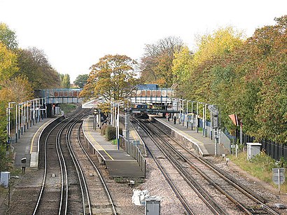
See Barnes Station on the map
Public Transportation to Barnes Station
How to get to Barnes Station in Barnes, United Kingdom?
It’s easy with Moovit. Type in your street address and Moovit’s route finder will locate the fastest way to get you there! Not sure where to get off on the street? Download the Moovit App to find live directions (including where to get off on Barnes Station), see timetables and get the estimated arrival times for your favourite bus, train or Tube lines.
Looking for the nearest stop or station to Barnes Station? Check out this list of closest stops available to your destination: Queen's Ride (M); Rosslyn Park Rugby Football Club (S); Beverley Road (N); Barnes; Gipsy Lane (F); Putney Pier; Putney Bridge.
Bus: 265, 33, 337, N33, 493, 969, N72, N74, 419, 485, SOUTH WESTERN RAILWAY, SOUTH WESTERN RAILWAY.Train: SOUTH WESTERN RAILWAY.Tube: DISTRICT.River Bus: RB2, RB6.
Download the Moovit App to see the current schedule and routes available for Barnes. No need to install a special bus app to check the bus time or a train app to get train time. Moovit is the only all-in-one transport app that helps you get where you need to go.
We make riding on public transit to Barnes Station easy, which is why over 1.5 million users, including users in Barnes trust Moovit as the best app for public transport.
Use the app to navigate to popular places including to the airport, hospital, stadium, grocery store, mall, coffee shop, school, college, and university.
Location: Barnes, London
Popular routes to Barnes Station station
Popular routes from Barnes Station station
Streets near Barnes Station, Barnes
Get around Barnes by public transport!
Travelling around Barnes has never been so easy. See step by step directions as you travel to any attraction, street or major public transport station. View bus and train timetables, arrival times, service alerts and detailed routes on a map, so you know exactly how to get to anywhere in Barnes.
When travelling to any destination around Barnes use Moovit's Live Directions with Get Off Notifications to know exactly where and how far to walk, how long to wait for your line , and how many stops are left. Moovit will alert you when it’s time to get off — no need to constantly re-check whether yours is the next stop.
Wondering how to use public transport in Barnes or how to pay for public transport in Barnes? Moovit public transport app can help you navigate your way with public transport easily, and at minimum cost. It includes public transport fees, ticket prices, and costs. Looking for a map of Barnes public transport lines? Moovit public transport app shows all public transport maps in Barnes with all Bus, Train, Tube, Tramlink, River Bus and DLR routes and stops on an interactive map.
London has 6 transport type(s), including: Bus, Train, Tube, Tramlink, River Bus and DLR, operated by several transport agencies, including London Buses, Transport for London, London Underground, London River Services, National Rail, Luton Airport Shuttle, Bayliss Executive Travel, Edward Thomas, Metrobus, Coggeshall Community Bus, Tendring Community Transport, Sullivan Buses, Z & S Transport, Central Connect and Compass Travel