Directions to Cardinal Newman College station (Preston) with public transport
The following transport lines have routes that pass near Cardinal Newman College
How to get to Cardinal Newman College station by bus?
Click on the bus route to see step by step directions with maps, line arrival times and updated time schedules.
How to get to Cardinal Newman College station by train?
Click on the train route to see step by step directions with maps, line arrival times and updated time schedules.
Bus stops near Cardinal Newman College in Preston
- Cardinal Newman College, 4 min walk,
- Frenchwood Avenue, 7 min walk,
- Queen Street, 8 min walk,
- Pole Street (Stand I), 9 min walk,
- Percy Street, 11 min walk,
- London Road, 11 min walk,
- St Mary's Street, 12 min walk,
Train station near Cardinal Newman College in Preston
- Preston, 39 min walk,
Bus lines to Cardinal Newman College station in Preston
- 59, Preston Bus Stn Stand 38,
- 61, Preston Newman Coll,
- 68, Cardinal Newman College,
- 109, Preston,
- 112, Willow Road,
- 113, Civic Centre,
- 125, Chorley Inter Std N,
- 125C, Myerscough College,
- 152, Blackburn Bus Stn,
- 721, School Service,
- P1, Walton-Le-Dale Park & Ride,
- 1, Longridge, Opp, Po,
- 1A, Gamull Lane,
- 1S, Longridge,
- 6, James Hall Distribution Ctr,
- 8, Preston Bus Stn,
- 9, Moor Nook,
- 16, Preston Bus Stn,
- 19, Larches,
- 20, Lea, Aldfield Avenue,
What are the nearest stations to Cardinal Newman College?
The nearest stations to Cardinal Newman College are:
- Cardinal Newman College is 164 meters away, 4 min walk.
- Frenchwood Avenue is 454 meters away, 7 min walk.
- Queen Street is 556 meters away, 8 min walk.
- Pole Street (Stand I) is 577 meters away, 9 min walk.
- Percy Street is 692 meters away, 11 min walk.
- London Road is 726 meters away, 11 min walk.
- St Mary's Street is 811 meters away, 12 min walk.
- Preston is 3064 meters away, 39 min walk.
Which bus lines stop near Cardinal Newman College?
These bus lines stop near Cardinal Newman College: 112, 113, 125, 437, 59, 61.
Which train line stops near Cardinal Newman College?
NORTHERN (Preston)
What’s the nearest bus stop to Cardinal Newman College in Preston?
The nearest bus stop to Cardinal Newman College in Preston is Cardinal Newman College. It’s a 4 min walk away.
What time is the first train to Cardinal Newman College in Preston?
The CALEDONIAN SLEEPER is the first train that goes to Cardinal Newman College in Preston. It stops nearby at 04:35.
What time is the last train to Cardinal Newman College in Preston?
The CALEDONIAN SLEEPER is the last train that goes to Cardinal Newman College in Preston. It stops nearby at 04:35.
What time is the first bus to Cardinal Newman College in Preston?
The 1A is the first bus that goes to Cardinal Newman College in Preston. It stops nearby at 04:51.
What time is the last bus to Cardinal Newman College in Preston?
The NORTHERN is the last bus that goes to Cardinal Newman College in Preston. It stops nearby at 02:02.
See Cardinal Newman College, Preston, on the map
Public Transit to Cardinal Newman College in Preston
Wondering how to get to Cardinal Newman College in Preston, United Kingdom? Moovit helps you find the best way to get to Cardinal Newman College with step-by-step directions from the nearest public transit station.
Moovit provides free maps and live directions to help you navigate through your city. View schedules, routes, timetables, and find out how long does it take to get to Cardinal Newman College in real time.
Looking for the nearest stop or station to Cardinal Newman College? Check out this list of stops closest to your destination: Cardinal Newman College; Frenchwood Avenue; Queen Street; Pole Street (Stand I); Percy Street; London Road; St Mary's Street; Preston.
Bus: 112, 113, 125, 437, 59, 61, 68, 109, 125C, P1, 1, 1A, 1S, 6, 8, 664, 941.Train: NORTHERN, AVANTI WEST COAST, AVANTI WEST COAST, CALEDONIAN SLEEPER.
Want to see if there’s another route that gets you there at an earlier time? Moovit helps you find alternative routes or times. Get directions from and directions to Cardinal Newman College easily from the Moovit App or Website.
We make riding to Cardinal Newman College easy, which is why over 1.5 million users, including users in Preston, trust Moovit as the best app for public transit. You don’t need to download an individual bus app or train app, Moovit is your all-in-one transit app that helps you find the best bus time or train time available.
For information on prices of bus and train, costs and ride fares to Cardinal Newman College, please check the Moovit app.
Use the app to navigate to popular places including to the airport, hospital, stadium, grocery store, mall, coffee shop, school, college, and university.
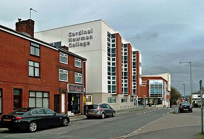
Cardinal Newman College Address: Manchester Road street in Preston
Directions to Cardinal Newman College station (Preston) with public transport
How to get to popular places in North West with public transport
Get around Preston by public transport!
Travelling around Preston has never been so easy. See step by step directions as you travel to any attraction, street or major public transport station. View bus and train timetables, arrival times, service alerts and detailed routes on a map, so you know exactly how to get to anywhere in Preston.
When travelling to any destination around Preston use Moovit's Live Directions with Get Off Notifications to know exactly where and how far to walk, how long to wait for your line , and how many stops are left. Moovit will alert you when it’s time to get off — no need to constantly re-check whether yours is the next stop.
Wondering how to use public transport in Preston or how to pay for public transport in Preston? Moovit public transport app can help you navigate your way with public transport easily, and at minimum cost. It includes public transport fees, ticket prices, and costs. Looking for a map of Preston public transport lines? Moovit public transport app shows all public transport maps in Preston with all Bus, Train, Light rail and Ferry routes and stops on an interactive map.
North West has 4 transport type(s), including: Bus, Train, Light rail and Ferry, operated by several transport agencies, including National Rail, Blackpool Transport, Metrolink, Foreign Support, Archway Travel, The Blackburn Bus Company, D & G Bus, B & J Travel, Pendle Coaches, Anthony's Travel, Mikro Coaches, Express Travel, Saunders of Preston, Mario Coaches and Pilkingtonbus