Directions to Liverpool Women's Hospital with public transportation
The following transport lines have routes that pass near Liverpool Women's Hospital
How to get to Liverpool Women's Hospital by bus?
Click on the bus route to see step by step directions with maps, line arrival times and updated time schedules.
How to get to Liverpool Women's Hospital by train?
Click on the train route to see step by step directions with maps, line arrival times and updated time schedules.
Bus stops near Liverpool Women's Hospital
- Crown Street, 3 min walk,
- Chancellor Court, 3 min walk,
Train stations near Liverpool Women's Hospital
- Liverpool Central, 16 min walk,
- Liverpool Lime Street, 19 min walk,
Bus routes to Liverpool Women's Hospital
- N1, Wembley Road,
- 86, Church Road,
- 86, Liverpool South Parkway,
- 86A, Gaskill Road,
- 86C, Liverpool One Bus Station,
- 201, Morrisons,
- 600, Archbishop Blanch,
- 699, Brownlow Hill,
- 76, Halewood Shopping Centre,
- 204, Belle Vale Bus Station,
What are the nearest stations to Liverpool Women's Hospital?
The nearest stations to Liverpool Women's Hospital are:
- Crown Street is 151 meters away, 3 min walk.
- Chancellor Court is 198 meters away, 3 min walk.
- Liverpool Central is 1204 meters away, 16 min walk.
- Liverpool Lime Street is 1462 meters away, 19 min walk.
Which bus lines stop near Liverpool Women's Hospital?
These bus lines stop near Liverpool Women's Hospital: 76, 86, 86A, 86C.
Which train line stops near Liverpool Women's Hospital?
MERSEYRAIL (Liverpool Central)
What’s the nearest train station to Liverpool Women's Hospital?
The nearest train station to Liverpool Women's Hospital is Liverpool Central. It’s a 16 min walk away.
What’s the nearest bus station to Liverpool Women's Hospital?
The nearest bus stations to Liverpool Women's Hospital are Crown Street and Chancellor Court. The closest one is a 3 min walk away.
What time is the first train to Liverpool Women's Hospital?
The TRANSPENNINE EXPRESS is the first train that goes to Liverpool Women's Hospital. It stops nearby at 05:20.
What time is the last train to Liverpool Women's Hospital?
The AVANTI WEST COAST is the last train that goes to Liverpool Women's Hospital. It stops nearby at 00:47.
What time is the first bus to Liverpool Women's Hospital?
The 86A is the first bus that goes to Liverpool Women's Hospital. It stops nearby at 04:31.
What time is the last bus to Liverpool Women's Hospital?
The NORTHERN is the last bus that goes to Liverpool Women's Hospital. It stops nearby at 01:50.
See Liverpool Women's Hospital on the map
Public Transportation to Liverpool Women's Hospital
Wondering how to get to Liverpool Women's Hospital, United Kingdom? Moovit helps you find the best way to get to Liverpool Women's Hospital with step-by-step directions from the nearest public transit station.
Moovit provides free maps and live directions to help you navigate through your city. View schedules, routes, timetables, and find out how long does it take to get to Liverpool Women's Hospital in real time.
Looking for the nearest stop or station to Liverpool Women's Hospital? Check out this list of stops closest to your destination: Crown Street; Chancellor Court; Liverpool Central; Liverpool Lime Street.
Bus: 76, 86, 86A, 86C, N1, 204.Train: MERSEYRAIL, AVANTI WEST COAST, AVANTI WEST COAST, EAST MIDLANDS RAILWAY, NORTHERN, NORTHERN.
Want to see if there’s another route that gets you there at an earlier time? Moovit helps you find alternative routes or times. Get directions from and directions to Liverpool Women's Hospital easily from the Moovit App or Website.
We make riding to Liverpool Women's Hospital easy, which is why over 1.5 million users, including users in Liverpool, trust Moovit as the best app for public transit. You don’t need to download an individual bus app or train app, Moovit is your all-in-one transit app that helps you find the best bus time or train time available.
For information on prices of bus and train, costs and ride fares to Liverpool Women's Hospital, please check the Moovit app.
Use the app to navigate to popular places including to the airport, hospital, stadium, grocery store, mall, coffee shop, school, college, and university.
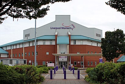
Liverpool Women's Hospital Address: Upper Parliament Street street in Liverpool
Popular routes to Liverpool Women's Hospital
Places Near Liverpool Women's Hospital
Get around Liverpool by public transport!
Travelling around Liverpool has never been so easy. See step by step directions as you travel to any attraction, street or major public transport station. View bus and train timetables, arrival times, service alerts and detailed routes on a map, so you know exactly how to get to anywhere in Liverpool.
When travelling to any destination around Liverpool use Moovit's Live Directions with Get Off Notifications to know exactly where and how far to walk, how long to wait for your line , and how many stops are left. Moovit will alert you when it’s time to get off — no need to constantly re-check whether yours is the next stop.
Wondering how to use public transport in Liverpool or how to pay for public transport in Liverpool? Moovit public transport app can help you navigate your way with public transport easily, and at minimum cost. It includes public transport fees, ticket prices, and costs. Looking for a map of Liverpool public transport lines? Moovit public transport app shows all public transport maps in Liverpool with all Bus, Train, Light rail and Ferry routes and stops on an interactive map.
North West has 4 transport type(s), including: Bus, Train, Light rail and Ferry, operated by several transport agencies, including National Rail, Blackpool Transport, Metrolink, Archway Travel, The Blackburn Bus Company, D & G Bus, Mikro Coaches, Pilkingtonbus, Arriva Wales, A2B Travel, Rosso, Arriva North West, Blackburn Private Hire, Al's Coaches and Moving People