City Square A stop - Saturday schedule
| Line | Direction | Time |
|---|---|---|
| 4 | Seacroft | 05:59 |
| 4F | Seacroft | 06:28 |
| 16A | Whinmoor | 06:37 |
| 4 | Seacroft | 07:01 |
| 16 | Whinmoor | 07:31 |
| 4F | Seacroft | 07:34 |
| 16A | Whinmoor | 07:59 |
| 4 | Seacroft | 08:05 |
| 16 | Whinmoor | 08:29 |
| 4F | Seacroft | 08:34 |
| 16 | Whinmoor | 08:51 |
| 4 | Seacroft | 08:55 |
| 16 | Whinmoor | 09:10 |
| 4F | Seacroft | 09:14 |
| 4 | Seacroft | 09:35 |
| 16 | Whinmoor | 09:35 |
| 4F | Seacroft | 09:54 |
| 16 | Whinmoor | 09:59 |
| 4 | Seacroft | 10:15 |
| 16 | Whinmoor | 10:18 |
| 4F | Seacroft | 10:34 |
| 16 | Whinmoor | 10:45 |
| 4 | Seacroft | 10:59 |
| 16 | Whinmoor | 11:08 |
| 4F | Seacroft | 11:17 |
See City Square A, Leeds, on the map
Directions to City Square A (Leeds) with public transport
The following transport lines have routes that pass near City Square A
 Bus:
Bus: - Train:
How to get to City Square A by bus?
Click on the bus route to see step by step directions with maps, line arrival times and updated time schedules.
How to get to City Square A by train?
Click on the train route to see step by step directions with maps, line arrival times and updated time schedules.
Bus stations near City Square A in Leeds
- City Square B,1 min walk,
- City Square D,1 min walk,
- City Square E,2 min walk,
- Wellington J,3 min walk,
- City Square F,3 min walk,
- Civic S,3 min walk,
- City Square I,3 min walk,
- City Square H,3 min walk,
- Civic Q,4 min walk,
- Civic P,5 min walk,
Train stations near City Square A in Leeds
- Leeds,20 min walk,
Bus lines to City Square A in Leeds
- 229,Huddersfield Town Centre,
- 254,Leeds City Centre,
- 255,Halifax Town Centre,
- 4,Pudsey,
- 4F,Pudsey,
- X11,Bradford City Centre,
- 16,Bramley,
- 16A,Pudsey,
- 81,Leeds City Centre,
- 1,Beeston,
- 1B,Beckett Park,
- N1,Leeds City Centre,
- A1,Leeds Bradford Airport,
- 33,Otley,
- 34,Otley,
- 42,Farnley,
- 55,Leeds City Centre,
- 60,Leeds City Centre,
- 60A,Keighley,
- 65,Morley,
What are the nearest stations to City Square A?
The nearest stations to City Square A are:
- City Square B is 44 meters away, 1 min walk.
- City Square D is 68 meters away, 1 min walk.
- City Square E is 79 meters away, 2 min walk.
- Wellington J is 157 meters away, 3 min walk.
- City Square F is 168 meters away, 3 min walk.
- Civic S is 168 meters away, 3 min walk.
- City Square I is 176 meters away, 3 min walk.
- City Square H is 191 meters away, 3 min walk.
- Civic Q is 290 meters away, 4 min walk.
- Civic P is 319 meters away, 5 min walk.
- Leeds is 1485 meters away, 20 min walk.
Which bus lines stop near City Square A?
These bus lines stop near City Square A: 201, 203, 229, 56, 60A, 7, A1, X6.
Which train line stops near City Square A?
NORTHERN
What’s the nearest train station to City Square A in Leeds?
The nearest train station to City Square A in Leeds is Leeds. It’s a 20 min walk away.
What’s the nearest bus stop to City Square A in Leeds?
The nearest bus stops to City Square A in Leeds are City Square B and City Square D. The closest one is a 1 min walk away.
What time is the first train to City Square A in Leeds?
The TRANSPENNINE EXPRESS is the first train that goes to City Square A in Leeds. It stops nearby at 03:18.
What time is the last train to City Square A in Leeds?
The TRANSPENNINE EXPRESS is the last train that goes to City Square A in Leeds. It stops nearby at 03:17.
What time is the first bus to City Square A in Leeds?
The 72 is the first bus that goes to City Square A in Leeds. It stops nearby at 05:04.
What time is the last bus to City Square A in Leeds?
The N1 is the last bus that goes to City Square A in Leeds. It stops nearby at 02:53.
How much is the train fare to City Square A?
The train fare to City Square A costs about £5.30.
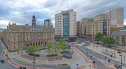
City Square A station
 Taken by Enrico G.
See City Square A, Leeds, on the map
Public transport to City Square A stop (ID: 45025317) in Leeds
Looking for directions to City Square A in Leeds, United Kingdom?
Download the Moovit App to find the current schedule and step-by-step directions for Bus or Train routes that pass through City Square A.
Looking for the nearest stops closest to City Square A ? Check out this list of closest stops to your destination: City Square B; City Square D; City Square E; Wellington J; City Square F; Civic S; City Square I; City Square H; Civic Q; Civic P; Leeds.
Bus:Train:
We make riding on public transit to City Square A easy, which is why over 1.5 million users, including users in Leeds trust Moovit as the best app for public transit.
Use the app to navigate to popular places including to the airport, hospital, stadium, grocery store, mall, coffee shop, school, college, and university.
City Square A stop’s code is 45025317
The first line to this stop is 4, at 05:59, and the last line is 4F at 23:15.
10 Infirmary Street, Leeds, England, United Kingdom
This stop serves First Leeds’s lines
Bus stops near City Square A
City Square B,City Square D,City Square E,Wellington J,City Square F,Civic S,City Square I,City Square H,Civic Q,Civic PTrain station near City Square A
LeedsPopular public transport stations in Leeds
Scarborough Hospital,Beverley Road Tesco,Wath Comprehensive School/Festival Road,York Hospital,Page Hall Road/Rushby Street,King Lane,Hathersage,Lambert Street,Heckmondwike Road Church Ln,Hornsea Cliff Road,Marmaduke Street,Kingswood Health Centre,Nun Monkton Lane End,County Hall,Jackson Avenue,Wellington P,Cleethorpes,The Springs A,Thomas Street/St Johns RoadGet around Leeds by public transport!
Travelling around Leeds has never been so easy. See step by step directions as you travel to any attraction, street or major public transport station. View bus and train timetables, arrival times, service alerts and detailed routes on a map, so you know exactly how to get to anywhere in Leeds.
When travelling to any destination around Leeds use Moovit's Live Directions with Get Off Notifications to know exactly where and how far to walk, how long to wait for your line , and how many stops are left. Moovit will alert you when it’s time to get off — no need to constantly re-check whether yours is the next stop.
Wondering how to use public transport in Leeds or how to pay for public transport in Leeds? Moovit public transport app can help you navigate your way with public transport easily, and at minimum cost. It includes public transport fees, ticket prices, and costs. Looking for a map of Leeds public transport lines? Moovit public transport app shows all public transport maps in Leeds with all bus or train routes and stops on an interactive map.
Leeds has 2 transport type(s), including: bus or train, operated by several transport agencies, including First Leeds, First South Yorkshire, First York, First West Yorkshire Ltd, Arriva Yorkshire, Stagecoach Yorkshire, National Rail, First Bradford, First Halifax, Calder Valley & Huddersfield, East Yorkshire, The Keighley Bus Company, South Yorkshire Future Tram, The Harrogate Bus Company, National Rail and TM Travel