City Square F stop - Thursday schedule
| Line | Direction | Time |
|---|---|---|
| 15 | Leeds City Centre | 05:44 |
| 33 | Guiseley | 06:03 |
| 14 | Pudsey | 06:10 |
| 34 | Otley | 06:13 |
| 15 | Leeds City Centre | 06:14 |
| 60 | Keighley | 06:23 |
| 15 | Farnley | 06:25 |
| 33 | Guiseley | 06:33 |
| 15 | Leeds City Centre | 06:44 |
| 508 | Halifax Town Centre | 06:46 |
| 34 | Otley | 06:48 |
| 60 | Keighley | 06:49 |
| 15 | Farnley | 06:55 |
| 33 | Guiseley | 07:03 |
| 14 | Pudsey | 07:10 |
| 15 | Leeds City Centre | 07:16 |
| 34 | Otley | 07:18 |
| 60 | Keighley | 07:19 |
| 15 | Farnley | 07:25 |
| 14 | Leeds City Centre | 07:29 |
| 33 | Guiseley | 07:33 |
| 14 | Pudsey | 07:40 |
| 34 | Otley | 07:48 |
| 15 | Leeds City Centre | 07:49 |
| 60 | Keighley | 07:50 |
See City Square F, Leeds, on the map
Directions to City Square F (Leeds) with public transport
The following transport lines have routes that pass near City Square F
 Bus:
Bus: - Train:
How to get to City Square F by bus?
Click on the bus route to see step by step directions with maps, line arrival times and updated time schedules.
How to get to City Square F by train?
Click on the train route to see step by step directions with maps, line arrival times and updated time schedules.
Bus stations near City Square F in Leeds
- City Square G,2 min walk,
- City Square H,2 min walk,
- City Square I,2 min walk,
- City Square B,3 min walk,
- Headrow A,3 min walk,
- City Square A,3 min walk,
- City Square D,3 min walk,
- Headrow R,3 min walk,
- City Square E,3 min walk,
- Civic P,3 min walk,
Train stations near City Square F in Leeds
- Burley Park,43 min walk,
- Leeds,51 min walk,
Bus lines to City Square F in Leeds
- 1,Beeston,
- 1B,Beckett Park,
- 55,Cottingley,
- 65,Morley,
- 75,Middleton,
- 444,Wakefield City Centre,
- 446,Sandal,
- 5,Leeds,
- 5A,Leeds,
- 19,Leeds - Garfoth,
- 19A,Garfoth - Leeds,
- 163,Leeds - Pontefract,
- 229,Huddersfield Town Centre,
- 254,Leeds City Centre,
- 255,Halifax Town Centre,
- 42,Farnley,
- 4,Pudsey,
- 4F,Pudsey,
- 16,Bramley,
- 16A,Whinmoor,
What are the nearest stations to City Square F?
The nearest stations to City Square F are:
- City Square G is 65 meters away, 2 min walk.
- City Square H is 95 meters away, 2 min walk.
- City Square I is 118 meters away, 2 min walk.
- City Square B is 149 meters away, 3 min walk.
- Headrow A is 160 meters away, 3 min walk.
- City Square A is 168 meters away, 3 min walk.
- City Square D is 188 meters away, 3 min walk.
- Headrow R is 194 meters away, 3 min walk.
- City Square E is 199 meters away, 3 min walk.
- Civic P is 203 meters away, 3 min walk.
- Burley Park is 3317 meters away, 43 min walk.
- Leeds is 3920 meters away, 51 min walk.
Which bus lines stop near City Square F?
These bus lines stop near City Square F: 201, 203, 229, 52, 6, 60A, A1, X6.
Which train line stops near City Square F?
NORTHERN
What’s the nearest bus stop to City Square F in Leeds?
The nearest bus stops to City Square F in Leeds are City Square G, City Square H and City Square I. The closest one is a 2 min walk away.
What time is the first train to City Square F in Leeds?
The TRANSPENNINE EXPRESS is the first train that goes to City Square F in Leeds. It stops nearby at 03:18.
What time is the last train to City Square F in Leeds?
The TRANSPENNINE EXPRESS is the last train that goes to City Square F in Leeds. It stops nearby at 03:17.
What time is the first bus to City Square F in Leeds?
The 72 is the first bus that goes to City Square F in Leeds. It stops nearby at 04:49.
What time is the last bus to City Square F in Leeds?
The N1 is the last bus that goes to City Square F in Leeds. It stops nearby at 02:53.
How much is the train fare to City Square F?
The train fare to City Square F costs about £5.30.
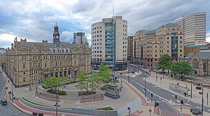
City Square F station
 Taken by Ay G.
See City Square F, Leeds, on the map
Public transport to City Square F stop (ID: 45024000) in Leeds
Looking for directions to City Square F in Leeds, United Kingdom?
Download the Moovit App to find the current schedule and step-by-step directions for Bus or Train routes that pass through City Square F.
Looking for the nearest stops closest to City Square F ? Check out this list of closest stops to your destination: City Square G; City Square H; City Square I; City Square B; Headrow A; City Square A; City Square D; Headrow R; City Square E; Civic P; Burley Park; Leeds.
Bus:Train:
We make riding on public transit to City Square F easy, which is why over 1.5 million users, including users in Leeds trust Moovit as the best app for public transit.
Use the app to navigate to popular places including to the airport, hospital, stadium, grocery store, mall, coffee shop, school, college, and university.
City Square F stop’s code is 45024000
The first line to this stop is 15, at 05:44, and the last line is 33 at 23:33.
11-12 Park Row, Leeds, England, United Kingdom
This stop serves First Leeds, The Keighley Bus Company and First Halifax’s lines
Popular routes to City Square F, Leeds
Popular routes from City Square F, Leeds
Bus stops near City Square F
City Square G,City Square H,City Square I,City Square B,Headrow A,City Square A,City Square D,Headrow R,City Square E,Civic PPopular public transport stations in Leeds
Commonside/Barber Road,Beverley Armstrong Way,Dale Hill Road/Haids Road,Lane Head Rd Shaw Edge Farm,Civic N,Piccadilly Motors,Flat Street/Fs2,Colton Retail Park,Cotton Mill Beck,Kingswood Health Centre,Cricket Inn Road/Cricket Inn Crescent,Aquarium Top Stop Y,Fox Lane/Jaunty Mount,Darnall,Sugarwell Court,Oxclose/Oxclose Park Road North,Goole Rawcliffe Road,Airedale Hospital (Stop B),War Memorial Hospital,Cultural GGet around Leeds by public transport!
Travelling around Leeds has never been so easy. See step by step directions as you travel to any attraction, street or major public transport station. View bus and train timetables, arrival times, service alerts and detailed routes on a map, so you know exactly how to get to anywhere in Leeds.
When travelling to any destination around Leeds use Moovit's Live Directions with Get Off Notifications to know exactly where and how far to walk, how long to wait for your line , and how many stops are left. Moovit will alert you when it’s time to get off — no need to constantly re-check whether yours is the next stop.
Wondering how to use public transport in Leeds or how to pay for public transport in Leeds? Moovit public transport app can help you navigate your way with public transport easily, and at minimum cost. It includes public transport fees, ticket prices, and costs. Looking for a map of Leeds public transport lines? Moovit public transport app shows all public transport maps in Leeds with all bus or train routes and stops on an interactive map.
Leeds has 2 transport type(s), including: bus or train, operated by several transport agencies, including First Leeds, First South Yorkshire, First York, First West Yorkshire Ltd, Arriva Yorkshire, Stagecoach Yorkshire, National Rail, First Bradford, First Halifax, Calder Valley & Huddersfield, East Yorkshire, The Keighley Bus Company, South Yorkshire Future Tram, The Harrogate Bus Company, National Rail and TM Travel