Euston Station (H) stop - Saturday schedule
| Line | Direction | Time |
|---|---|---|
| N73 | Oxford Circus | 03:11 |
| N205 | Paddington | 03:17 |
| 390 | Victoria | 03:22 |
| N73 | Oxford Circus | 03:26 |
| N205 | Paddington | 03:37 |
| N73 | Oxford Circus | 03:41 |
| 390 | Victoria | 03:54 |
| N73 | Oxford Circus | 03:56 |
| N205 | Paddington | 03:57 |
| N73 | Oxford Circus | 04:11 |
| N205 | Paddington | 04:17 |
| 390 | Victoria | 04:24 |
| N73 | Oxford Circus | 04:26 |
| N205 | Paddington | 04:37 |
| N73 | Oxford Circus | 04:41 |
| 390 | Victoria | 04:56 |
| N73 | Oxford Circus | 04:56 |
| N205 | Paddington | 04:57 |
| N73 | Oxford Circus | 05:11 |
| 390 | Victoria | 05:16 |
| N205 | Paddington | 05:17 |
| N73 | Oxford Circus | 05:26 |
| 390 | Victoria | 05:31 |
| 30 | Marble Arch | 05:37 |
| 18 | Sudbury | 05:43 |
See Euston Station (H), Somers Town, on the map
Directions to Euston Station (H) (Somers Town) with public transport
The following transport lines have routes that pass near Euston Station (H)
 Bus:
Bus: - Train:
- Tube:
How to get to Euston Station (H) by bus?
Click on the bus route to see step by step directions with maps, line arrival times and updated time schedules.
How to get to Euston Station (H) by train?
Click on the train route to see step by step directions with maps, line arrival times and updated time schedules.
How to get to Euston Station (H) by Tube?
Click on the Tube route to see step by step directions with maps, line arrival times and updated time schedules.
Bus stations near Euston Station (H) in Somers Town
- Euston Bus Station (F),2 min walk,
- Euston (Az),2 min walk,
- Upper Woburn Place / Euston Road (L),3 min walk,
- Euston Bus Station (AP),3 min walk,
- Euston Square Station (P),3 min walk,
- University College Hospital / Euston Rd (Y),5 min walk,
Train stations near Euston Station (H) in Somers Town
- Euston Station,3 min walk,
Tube stations near Euston Station (H) in Somers Town
- Euston Square,3 min walk,
- Russell Square,11 min walk,
Bus lines to Euston Station (H) in Somers Town
- N5,Trafalgar Square,
- N20,Barnet Church,
- 18,Euston,
- 1,Canada Water,
- 68,Euston,
- 91,Crouch End,
- N91,Trafalgar Square,
- 253,Euston,
- N253,Tottenham Court Road,
- 30,Hackney Wick - Marble Arch,
- 73,Stoke Newington - Oxford Circus,
- N73,Walthamstow Central - Oxford Circus,
- 205,Bow Church - Paddington,
- N205,Leyton, Downsell Road - Paddington,
- 390,Victoria - Archway,
- 134,Warren Street,
What are the nearest stations to Euston Station (H)?
The nearest stations to Euston Station (H) are:
- Euston Bus Station (F) is 91 meters away, 2 min walk.
- Euston (Az) is 106 meters away, 2 min walk.
- Upper Woburn Place / Euston Road (L) is 163 meters away, 3 min walk.
- Euston Bus Station (AP) is 175 meters away, 3 min walk.
- Euston Station is 182 meters away, 3 min walk.
- Euston Square Station (P) is 192 meters away, 3 min walk.
- Euston Square is 195 meters away, 3 min walk.
- University College Hospital / Euston Rd (Y) is 333 meters away, 5 min walk.
- Russell Square is 835 meters away, 11 min walk.
Which bus lines stop near Euston Station (H)?
These bus lines stop near Euston Station (H): 1, 134, 18, 390, 68.
Which train lines stop near Euston Station (H)?
These train lines stop near Euston Station (H): OVERGROUND, THAMESLINK.
Which Tube lines stop near Euston Station (H)?
These Tube lines stop near Euston Station (H): CIRCLE, HAMMERSMITH & CITY, METROPOLITAN, VICTORIA.
What’s the nearest Tube station to Euston Station (H) in Somers Town?
The nearest Tube station to Euston Station (H) in Somers Town is Euston Square. It’s a 3 min walk away.
What’s the nearest train station to Euston Station (H) in Somers Town?
The nearest train station to Euston Station (H) in Somers Town is Euston Station. It’s a 3 min walk away.
What’s the nearest bus stop to Euston Station (H) in Somers Town?
The nearest bus stops to Euston Station (H) in Somers Town are Euston Bus Station (F) and Euston (Az). The closest one is a 2 min walk away.
What time is the first Tube to Euston Station (H) in Somers Town?
The CIRCLE is the first Tube that goes to Euston Station (H) in Somers Town. It stops nearby at 05:00.
What time is the last Tube to Euston Station (H) in Somers Town?
The CIRCLE is the last Tube that goes to Euston Station (H) in Somers Town. It stops nearby at 00:52.
What time is the first train to Euston Station (H) in Somers Town?
The WEST MIDLANDS RAILWAY is the first train that goes to Euston Station (H) in Somers Town. It stops nearby at 04:37.
What time is the last train to Euston Station (H) in Somers Town?
The CALEDONIAN SLEEPER is the last train that goes to Euston Station (H) in Somers Town. It stops nearby at 08:00.
What time is the first bus to Euston Station (H) in Somers Town?
The 134 is the first bus that goes to Euston Station (H) in Somers Town. It stops nearby at 03:00.
What time is the last bus to Euston Station (H) in Somers Town?
The N253 is the last bus that goes to Euston Station (H) in Somers Town. It stops nearby at 03:41.
How much is the bus fare to Euston Station (H)?
The bus fare to Euston Station (H) costs about £1.75.
How much is the Tube fare to Euston Station (H)?
The Tube fare to Euston Station (H) costs about £1.70 - £7.90.
How much is the train fare to Euston Station (H)?
The train fare to Euston Station (H) costs about £1.90 - £15.30.
See Euston Station (H), Somers Town, on the map
Public transport to Euston Station (H) stop (ID: H) in Somers Town
Looking for directions to Euston Station (H) in Somers Town, United Kingdom?
Download the Moovit App to find the current schedule and step-by-step directions for Tube, Bus or Train routes that pass through Euston Station (H).
Looking for the nearest stops closest to Euston Station (H) ? Check out this list of closest stops to your destination: Euston Bus Station (F); Euston (Az); Upper Woburn Place / Euston Road (L); Euston Bus Station (AP); Euston Station; Euston Square Station (P); Euston Square; University College Hospital / Euston Rd (Y); Russell Square.
Bus:Train:Tube:
We make riding on public transit to Euston Station (H) easy, which is why over 1.5 million users, including users in Somers Town trust Moovit as the best app for public transit.
Use the app to navigate to popular places including to the airport, hospital, stadium, grocery store, mall, coffee shop, school, college, and university.
Euston Station (H) stop’s code is H
The first line to this stop is N73, at 03:11, and the last line is N205 at 02:57.
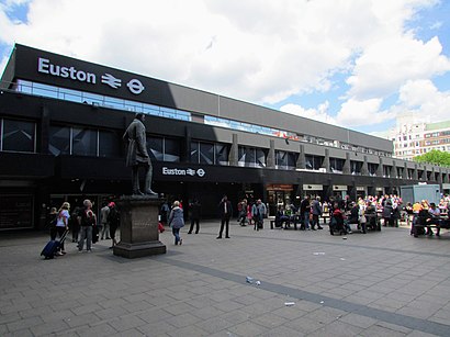
173-177 Euston Road, London, England, United Kingdom
This stop serves London Buses’s lines
Bus stops near Euston Station (H)
Euston Bus Station (F),Euston (Az),Upper Woburn Place / Euston Road (L),Euston Bus Station (AP),Euston Square Station (P),University College Hospital / Euston Rd (Y)Train station near Euston Station (H)
Euston StationPopular public transport stations in Somers Town
Brixton Academy (B),Purley,Kilburn Park Station (KB),Church Street (N),Barking & Dagenham College (T),Ealing Broadway,Tenniswood Road,Kennington,Enfield Town Church Street (C),East London Cemetery,Palmers College, Grays,Bromley South Station (Y),Streatham Hill,Eton College, Eton,South Kensington,Harlesden Station (HA),Festival Leisure Park, Basildon,Park House School, Wash Common,Princes Park, Dartford,Chase Farm Hospital / Main EntranceGet around Somers Town by public transport!
Travelling around Somers Town has never been so easy. See step by step directions as you travel to any attraction, street or major public transport station. View bus and train timetables, arrival times, service alerts and detailed routes on a map, so you know exactly how to get to anywhere in Somers Town.
When travelling to any destination around Somers Town use Moovit's Live Directions with Get Off Notifications to know exactly where and how far to walk, how long to wait for your line , and how many stops are left. Moovit will alert you when it’s time to get off — no need to constantly re-check whether yours is the next stop.
Wondering how to use public transport in Somers Town or how to pay for public transport in Somers Town? Moovit public transport app can help you navigate your way with public transport easily, and at minimum cost. It includes public transport fees, ticket prices, and costs. Looking for a map of Somers Town public transport lines? Moovit public transport app shows all public transport maps in Somers Town with all Tube, bus or train routes and stops on an interactive map.
Somers Town has 3 transport type(s), including: Tube, bus or train, operated by several transport agencies, including London Underground, London Buses, Transport for London, London Tramlink, Transport for London, National Rail, Bluestar, Berry's Coaches, Oxford Bus Company, Stagecoach West, Community First Wessex, Cresta Coaches, D & P Boat Hire, First Portsmouth, Fareham & Gosport and FYTbus