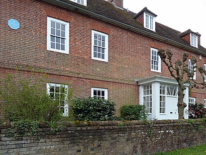
Directions to Farleys House (Wealden) with public transport
The following transport lines have routes that pass near Farleys House
How to get to Farleys House by bus?
Click on the bus route to see step by step directions with maps, line arrival times and updated time schedules.
Bus stops near Farleys House in Wealden
- Chiddingly School, Muddles Green, 5 min walk,
Bus lines to Farleys House in Wealden
- 318, Golden Cross,
What are the nearest stations to Farleys House?
The nearest stations to Farleys House are:
- Chiddingly School, Muddles Green is 349 meters away, 5 min walk.
Which bus lines stop near Farleys House?
These bus lines stop near Farleys House: 28, 54.
What’s the nearest bus stop to Farleys House in Wealden?
The nearest bus stop to Farleys House in Wealden is Chiddingly School, Muddles Green. It’s a 5 min walk away.
See Farleys House, Wealden, on the map
Public Transit to Farleys House in Wealden
Wondering how to get to Farleys House in Wealden, United Kingdom? Moovit helps you find the best way to get to Farleys House with step-by-step directions from the nearest public transit station.
Moovit provides free maps and live directions to help you navigate through your city. View schedules, routes, timetables, and find out how long does it take to get to Farleys House in real time.
Looking for the nearest stop or station to Farleys House? Check out this list of stops closest to your destination: Chiddingly School.
Bus: 28, 54, 318.
Want to see if there’s another route that gets you there at an earlier time? Moovit helps you find alternative routes or times. Get directions from and directions to Farleys House easily from the Moovit App or Website.
We make riding to Farleys House easy, which is why over 1.5 million users, including users in Wealden, trust Moovit as the best app for public transit. You don’t need to download an individual bus app or train app, Moovit is your all-in-one transit app that helps you find the best bus time or train time available.
For information on prices of bus and train, costs and ride fares to Farleys House, please check the Moovit app.
Use the app to navigate to popular places including to the airport, hospital, stadium, grocery store, mall, coffee shop, school, college, and university.
Location: Wealden, London
Attractions near Farleys House
The Aviary,Farleys House and Gall,Hale Farm Campsite,Chiddingly,Golden Cross,Nash Street Farm Boot Fair,Golden Cross Holiday Park Hailsham,A22 Golden Cross,The Wattle- Sussex Trug Baskets,Happy Days Cafe, Holmes Hill,Cookmere,BN27 4BT,Whitesmith A22,Rainbow Farm Boot Fair,Blackbrooks Garden Centres,Cutnedge Joinery,The Shaw Barn,Lower Dicker,Polgate,Blackbrooks HailshamHow to get to popular attractions in Wealden with public transportation
Sainsbury's, Chiswick,Bognor Regis, Bognor Regis,Winnersh, Wokingham,Eltham, Eltham,Emirates Stadium, Highbury,The Shard, Borough,Whitgift Centre, Croydon,Imperial War Museum, Elephant & Castle,Covent Garden Station, Covent Garden,Bus Station, Bedford,Portobello Road Market, Notting Hill,Harpenden, Harpenden,Gatwick Airport, Crawley,Starbucks, Chiswick,Kingston Hospital, Norbiton,Ikea, Neasden,Berkhamsted Railway Station (BKM), Berkhamsted,Middlesex University, Hendon,Whipps Cross University Hospital, Upper Walthamstow,Queens Hospital, RomfordGet around London by public transport!
Travelling around London has never been so easy. See step by step directions as you travel to any attraction, street or major public transport station. View bus and train timetables, arrival times, service alerts and detailed routes on a map, so you know exactly how to get to anywhere in London.
When travelling to any destination around London use Moovit's Live Directions with Get Off Notifications to know exactly where and how far to walk, how long to wait for your line , and how many stops are left. Moovit will alert you when it’s time to get off — no need to constantly re-check whether yours is the next stop.
Wondering how to use public transport in London or how to pay for public transport in London? Moovit public transport app can help you navigate your way with public transport easily, and at minimum cost. It includes public transport fees, ticket prices, and costs. Looking for a map of London public transport lines? Moovit public transport app shows all public transport maps in London with all Bus, Train, Tube, Tramlink, River Bus and DLR routes and stops on an interactive map.
London has 6 transport type(s), including: Bus, Train, Tube, Tramlink, River Bus and DLR, operated by several transport agencies, including London Underground, London Buses, Transport for London, London Tramlink, National Rail, Bluestar, Berry's Coaches, Oxford Bus Company, Stagecoach West, Community First Wessex, Cresta Coaches, D & P Boat Hire, First Portsmouth, Fareham & Gosport, FYTbus, IFS Cloud Cable Car