Directions to Hoddesdon with public transportation
The following transport lines have routes that pass near Hoddesdon
How to get to Hoddesdon by bus?
Click on the bus route to see step by step directions with maps, line arrival times and updated time schedules.
How to get to Hoddesdon by train?
Click on the train route to see step by step directions with maps, line arrival times and updated time schedules.
Bus stops near Hoddesdon
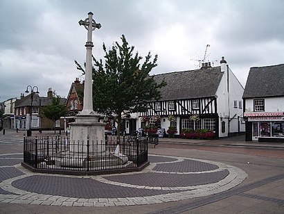
- Clock Tower, Hoddesdon, 1 min walk,
Train stations near Hoddesdon
- Broxbourne, 50 min walk,
Bus routes to Hoddesdon
- 25, Cheshunt,
- 310, Waltham Cross,
- 341, Hatfield,
- C392, Harlow Town Centre,
- 641, Hertford,
- 907, Stevenage,
- 25B, Broxbourne,
What are the nearest stations to Hoddesdon?
The nearest stations to Hoddesdon are:
- Clock Tower, Hoddesdon is 40 meters away, 1 min walk.
- Broxbourne is 3869 meters away, 50 min walk.
Which bus lines stop near Hoddesdon?
These bus lines stop near Hoddesdon: 310, 907.
Which train line stops near Hoddesdon?
GREATER ANGLIA
What’s the nearest bus stop to Hoddesdon?
The nearest bus stop to Hoddesdon is Clock Tower, Hoddesdon. It’s a 1 min walk away.
What time is the first train to Hoddesdon?
The STANSTED EXPRESS is the first train that goes to Hoddesdon. It stops nearby at 06:05.
What time is the last train to Hoddesdon?
The GREATER ANGLIA is the last train that goes to Hoddesdon. It stops nearby at 00:30.
What time is the first bus to Hoddesdon?
The 310 is the first bus that goes to Hoddesdon. It stops nearby at 07:15.
What time is the last bus to Hoddesdon?
The 310 is the last bus that goes to Hoddesdon. It stops nearby at 21:10.
See Hoddesdon on the map
Public Transportation to Hoddesdon
Wondering how to get to Hoddesdon, United Kingdom? Moovit helps you find the best way to get to Hoddesdon with step-by-step directions from the nearest public transit station.
Moovit provides free maps and live directions to help you navigate through your city. View schedules, routes, timetables, and find out how long does it take to get to Hoddesdon in real time.
Looking for the nearest stop or station to Hoddesdon? Check out this list of stops closest to your destination: Clock Tower; Broxbourne.
Bus: 310, 907, 25, 341, C392, 641, 25B.Train: GREATER ANGLIA, STANSTED EXPRESS.
Want to see if there’s another route that gets you there at an earlier time? Moovit helps you find alternative routes or times. Get directions from and directions to Hoddesdon easily from the Moovit App or Website.
We make riding to Hoddesdon easy, which is why over 1.5 million users, including users in Hoddesdon, trust Moovit as the best app for public transit. You don’t need to download an individual bus app or train app, Moovit is your all-in-one transit app that helps you find the best bus time or train time available.
For information on prices of bus, train and Tube, costs and ride fares to Hoddesdon, please check the Moovit app.
Use the app to navigate to popular places including to the airport, hospital, stadium, grocery store, mall, coffee shop, school, college, and university.
Hoddesdon Address: High Street street in Hoddesdon
Popular routes to Hoddesdon
Popular routes from Hoddesdon
Attractions near Hoddesdon
Electric Punch Tattoo,Bairstow Eves,Lydias Charity,Tond3i,Hoddesdon Clock Tower,Sunrise Computer Training Hoddesdon,Torrino Limited,Cheshunt & Waltham Mercury,Lanes,Chester Buildings Management Company Limited,Sherwood Grange Residents Association Limited,Dot Media,Stewart & Stewart Design Limited,Stafford House Freehold Company Limited,Unicorn Painting Contractors Limited,Cfa Archaeology,S F Norris,The Old School Wormley Residents Association Limited,LDN Noise,M J Game LimitedHow to get to popular attractions in Hoddesdon with public transportation
Kingston upon Thames, Kingston,Oxford Circus, Soho,Gatwick Airport, Crawley,Virgin Active, Acton,High Wycombe Bus Station, High Wycombe,Whetstone Audi, Whetstone,Muswell Hill, Muswell Hill,Whipps Cross University Hospital, Upper Walthamstow,Bognor Regis, Bognor Regis,Emirates Stadium, Highbury,Madame Tussauds, Marylebone,Arlesey Railway Station (ARL), Central Bedfordshire,Camden Market Hall, Camden Town,Marble Arch, Mayfair,Bus Station, Bedford,Woolwich, Woolwich,Hammersmith, Hammersmith,National Gallery, Charing Cross,Borough Market, Borough,Trafalgar Square, Charing CrossGet around London by public transport!
Travelling around London has never been so easy. See step by step directions as you travel to any attraction, street or major public transport station. View bus and train timetables, arrival times, service alerts and detailed routes on a map, so you know exactly how to get to anywhere in London.
When travelling to any destination around London use Moovit's Live Directions with Get Off Notifications to know exactly where and how far to walk, how long to wait for your line , and how many stops are left. Moovit will alert you when it’s time to get off — no need to constantly re-check whether yours is the next stop.
Wondering how to use public transport in London or how to pay for public transport in London? Moovit public transport app can help you navigate your way with public transport easily, and at minimum cost. It includes public transport fees, ticket prices, and costs. Looking for a map of London public transport lines? Moovit public transport app shows all public transport maps in London with all Bus, Train, Tube, Tramlink, River Bus and DLR routes and stops on an interactive map.
London has 6 transport type(s), including: Bus, Train, Tube, Tramlink, River Bus and DLR, operated by several transport agencies, including London Underground, London Buses, Transport for London, London Tramlink, National Rail, Bluestar, Berry's Coaches, Oxford Bus Company, Stagecoach West, Community First Wessex, Cresta Coaches, D & P Boat Hire, First Portsmouth, Fareham & Gosport, FYTbus, IFS Cloud Cable Car