Directions to Irrawang High School (Raymond Terrace) with public transport
The following transport lines have routes that pass near Irrawang High School
How to get to Irrawang High School by bus?
Click on the bus route to see step by step directions with maps, line arrival times and updated time schedules.
Bus stops near Irrawang High School in Raymond Terrace
- Mount Hall Rd opp Irrawang High School, 5 min walk,
- Irrawang High School, Mount Hall Rd, 5 min walk,
- Irrawang High School Bus Bay Mt Hall Rd, 5 min walk,
- Benjamin Lee Dr opp Robert Campbell Dr, 7 min walk,
Bus lines to Irrawang High School in Raymond Terrace
- 135, Nelson Bay to Raymond Terrace,
- 136, Stockton to Raymond Terrace via Medowie,
- 137, Lemon Tree Passage to Raymond Terrace via Medowie,
- 140, Newcastle Interchange to Raymond Terrace,
- 145, Newcastle Airport to Green Hills Shopping Centre via Raymond Terrace,
- 0161, Raymond Terrace PS to Hunter River HS,
- S630, Raymond Terrace Schools to Callaghan & Waratah Schools,
- 1201, Lemon Tree Passage to St Brigids PS & Hunter River HS,
- 1231, Oyster Cove & Salt Ash to Raymond Terrace PS,
- 1261, Tregenna St to Maitland HS,
- 1291, Bellevue & Lakeside to San Clemente HS,
- 1294, All Saints College St Peters Campus to Raymond Terrace,
- 1311, Medowie & Richardson to Newcastle Grammar,
- 1353, Tomaree HS to Lemon Tree Passage,
- 1361, Medowie to Irrawang HS,
- 1383, Wirreandra PS to Abundance & Lisadell Rds,
- 1433, Medowie Christian College to Medowie,
- 1441, Campvale to Hunter Valley Grammar,
- 1492, Bishop Tyrell College to Raymond Terrace,
- 1642, St Michaels PS to Lemon Tree Passage,
What are the nearest stations to Irrawang High School?
The nearest stations to Irrawang High School are:
- Mount Hall Rd opp Irrawang High School is 248 meters away, 5 min walk.
- Irrawang High School, Mount Hall Rd is 266 meters away, 5 min walk.
- Irrawang High School Bus Bay Mt Hall Rd is 274 meters away, 5 min walk.
- Benjamin Lee Dr opp Robert Campbell Dr is 387 meters away, 7 min walk.
Which bus lines stop near Irrawang High School?
These bus lines stop near Irrawang High School: 140, 145.
What’s the nearest bus station to Irrawang High School in Raymond Terrace?
The nearest bus stations to Irrawang High School in Raymond Terrace are Mount Hall Rd opp Irrawang High School, Irrawang High School, Mount Hall Rd and Irrawang High School Bus Bay Mt Hall Rd. The closest one is a 5 min walk away.
What time is the first bus to Irrawang High School in Raymond Terrace?
The 140 is the first bus that goes to Irrawang High School in Raymond Terrace. It stops nearby at 06:57.
What time is the last bus to Irrawang High School in Raymond Terrace?
The 140 is the last bus that goes to Irrawang High School in Raymond Terrace. It stops nearby at 19:56.
See Irrawang High School, Raymond Terrace, on the map
Public Transit to Irrawang High School in Raymond Terrace
Wondering how to get to Irrawang High School in Raymond Terrace, Australia? Moovit helps you find the best way to get to Irrawang High School with step-by-step directions from the nearest public transit station.
Moovit provides free maps and live directions to help you navigate through your city. View schedules, routes, timetables, and find out how long does it take to get to Irrawang High School in real time.
Looking for the nearest stop or station to Irrawang High School? Check out this list of stops closest to your destination: Mount Hall Rd opp Irrawang High School; Irrawang High School; Irrawang High School Bus Bay Mt Hall Rd; Benjamin Lee Dr opp Robert Campbell Dr.
Bus: 140, 145, 135, 136, 137, 0037, 0111, 0143, 0144, S620, 1641, 1211.
Want to see if there’s another route that gets you there at an earlier time? Moovit helps you find alternative routes or times. Get directions from and directions to Irrawang High School easily from the Moovit App or Website.
We make riding to Irrawang High School easy, which is why over 1.5 million users, including users in Raymond Terrace, trust Moovit as the best app for public transit. You don’t need to download an individual bus app or train app, Moovit is your all-in-one transit app that helps you find the best bus time or train time available.
For information on prices of bus and train, costs and ride fares to Irrawang High School, please check the Moovit app.
Use the app to navigate to popular places including to the airport, hospital, stadium, grocery store, mall, coffee shop, school, college, and university.
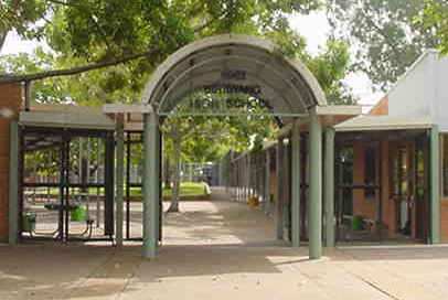
Irrawang High School Address: Mount Hall Road street in Raymond Terrace
Places Near Irrawang High School (Raymond Terrace)
How to get to popular places in Sydney with public transport
Get around Raymond Terrace by public transport!
Travelling around Raymond Terrace has never been so easy. See step by step directions as you travel to any attraction, street or major public transport station. View bus and train timetables, arrival times, service alerts and detailed routes on a map, so you know exactly how to get to anywhere in Raymond Terrace.
When travelling to any destination around Raymond Terrace use Moovit's Live Directions with Get Off Notifications to know exactly where and how far to walk, how long to wait for your line , and how many stops are left. Moovit will alert you when it’s time to get off — no need to constantly re-check whether yours is the next stop.
Wondering how to use public transport in Raymond Terrace or how to pay for public transport in Raymond Terrace? Moovit public transport app can help you navigate your way with public transport easily, and at minimum cost. It includes public transport fees, ticket prices, and costs. Looking for a map of Raymond Terrace public transport lines? Moovit public transport app shows all public transport maps in Raymond Terrace with all Bus, Train, Metro, Light rail and Ferry routes and stops on an interactive map.
Sydney has 5 transport type(s), including: Bus, Train, Metro, Light rail and Ferry, operated by several transport agencies, including Matthew Leeson, Worrick John Shaw Pty Ltd, PA & SN Livingstone, Gosel's Bus Service, BBB BUSES PTY LTD, Martins Albury, GB & SL HOWLETT PTY LTD, John Matthews, SM & RM Maguire, CTC Buses, Apple City Tours, Wilson's Coachlines, Daniel Simmons, Remmit and Sons and Train Replacement Bus Services