Directions to Lobethal with public transportation
The following transport lines have routes that pass near Lobethal
Directions to Lobethal with public transportation
The following transport lines have routes that pass near Lobethal
How to get to Lobethal by bus?
Click on the bus route to see step by step directions with maps, line arrival times and updated time schedules.
Bus routes to Lobethal
- 830F,Lobethal to City,
- 834,Verdun to Lobethal,
- 834A,Lobethal to Verdun,
- 835,Lobethal to Mt Barker,
- 835A,Mt Barker to Lobethal,
- 874,Oakbank School to Lobethal,
- 879,Woodside to Heathfield High School,
- 880,Lobethal (School Bus),
What are the nearest stations to Lobethal?
The nearest stations to Lobethal are:
- Stop 73 Main St - West side is 216 meters away, 3 min walk.
- Stop 73 Main St - East side is 239 meters away, 4 min walk.
Which bus line stops near Lobethal?
835A
What’s the nearest bus stop to Lobethal?
The nearest bus stop to Lobethal is Stop 73 Main St - West side. It’s a 3 min walk away.
How much is the bus fare to Lobethal?
The bus fare to Lobethal costs about $2.40 - $4.25.
See Lobethal on the map
Public Transportation to Lobethal
Wondering how to get to Lobethal, Australia? Moovit helps you find the best way to get to Lobethal with step-by-step directions from the nearest public transit station.
Moovit provides free maps and live directions to help you navigate through your city. View schedules, routes, timetables, and find out how long does it take to get to Lobethal in real time.
Looking for the nearest stop or station to Lobethal? Check out this list of stops closest to your destination: Stop 73 Main St - West side; Stop 73 Main St - East side.
Bus: 835A, 830F, 834, 834A, 835, 880.
Want to see if there’s another route that gets you there at an earlier time? Moovit helps you find alternative routes or times. Get directions from and directions to Lobethal easily from the Moovit App or Website.
We make riding to Lobethal easy, which is why over 1.5 million users, including users in Lobethal, trust Moovit as the best app for public transit. You don’t need to download an individual bus app or train app, Moovit is your all-in-one transit app that helps you find the best bus time or train time available.
For information on prices of bus, costs and ride fares to Lobethal, please check the Moovit app.
Use the app to navigate to popular places including to the airport, hospital, stadium, grocery store, mall, coffee shop, school, college, and university.
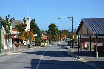
Lobethal Address: Bartholomew Avenue street in Lobethal
Popular routes to Lobethal
- From Morphettville Racecourse Tram StopFrom Stop AO25 and AO26 King William Rd - East sideFrom Stop 83 Maltarra Rd - West sideFrom Stop AO24 King William Rd - East sideFrom Stop 74 Hamblynn Rd - South East sideFrom Zone B Glenelg Interchange - West sideFrom Stop 74A Hamblynn Rd - West sideFrom Stop 74A Hamblynn Rd - East sideFrom Zone A Smithfield InterchangeFrom Stop See Differently - West side
Popular routes from Lobethal
Attractions near Lobethal
Lobethal Christmas Lights,Emma and Ivy,Marcel G Smith,Deep Creek,Rachel Jayne Sulliva,Dr Linda Porteous,Wise Employment,Charlston Turn,The Trustee for JB and,Charleston Primary School,Tomich Wines,Melba's Chocolate Factory,Barrister's Block Wines,St Mark's Anglican Church,Laundromat,Woodside Vets,Woodside Saturday Market,Adelaide Hills Council,Woodside Recreation Grounds,Woodside Uniting ChurchHow to get to popular attractions in Lobethal with public transportation
Ingle Farm Shopping Centre, Ingle Farm,Coromandel Valley, Coromandel Valley,Hamilton Secondary School, Mitchell Park,Henley Beach, Henley Beach,Flinders University Interchange, Bedford Park,Elder Park, Adelaide,Westfield Tea Tree Plaza, Modbury,Flinders Medical Centre Interchange, Bedford Park,Victoria Square/Tartanyangga, Adelaide,Adelaide Entertainment Centre, Hindmarsh,Aldinga Central Shopping Centre, Aldinga Beach,Foodland, Pasadena,Willaston, Willaston,Adelaide Secondary School of English, West Croydon,Watermark Hotel, Glenelg North,Norwood Morialta High School (Senior Campus), Magill,Ashford Hospital, Keswick,Adelaide High School, Adelaide,Cabra Dominican College, Cumberland Park,Adelaide Show Grounds, GoodwoodGet around Adelaide by public transport!
Travelling around Adelaide has never been so easy. See step by step directions as you travel to any attraction, street or major public transport station. View bus and train timetables, arrival times, service alerts and detailed routes on a map, so you know exactly how to get to anywhere in Adelaide.
When travelling to any destination around Adelaide use Moovit's Live Directions with Get Off Notifications to know exactly where and how far to walk, how long to wait for your line , and how many stops are left. Moovit will alert you when it’s time to get off — no need to constantly re-check whether yours is the next stop.
Wondering how to use public transport in Adelaide or how to pay for public transport in Adelaide? Moovit public transport app can help you navigate your way with public transport easily, and at minimum cost. It includes public transport fees, ticket prices, and costs. Looking for a map of Adelaide public transport lines? Moovit public transport app shows all public transport maps in Adelaide with all Bus, Train and Light rail routes and stops on an interactive map.
Adelaide has 3 transport type(s), including: Bus, Train and Light rail, operated by several transport agencies, including Adelaide Metro (Busways), SouthLink, Torrens Transit, Adelaide Metro Train, Adelaide Metro (Torrens Connect), Adelaide Metro (Industrial Service - Torrens Transit), Adelaide Metro (School Service - SouthLink), Adelaide Metro (School Service - Torrens Transit), Adelaide Metro (School Service - Busways)