Directions to London Borough of Haringey (Wood Green) with public transport
The following transport lines have routes that pass near London Borough of Haringey
How to get to London Borough of Haringey by bus?
Click on the bus route to see step by step directions with maps, line arrival times and updated time schedules.
How to get to London Borough of Haringey by train?
Click on the train route to see step by step directions with maps, line arrival times and updated time schedules.
How to get to London Borough of Haringey by Tube?
Click on the Tube route to see step by step directions with maps, line arrival times and updated time schedules.
Bus stations near London Borough of Haringey in Wood Green
- Wightman Road (E),4 min walk,
- Brampton Park Road (KA),7 min walk,
- Wood Green Shopping City (J),7 min walk,
- Brampton Park Road (K),8 min walk,
Tube stations near London Borough of Haringey in Wood Green
- Bounds Green,17 min walk,
Train stations near London Borough of Haringey in Wood Green
- Harringay,20 min walk,
Bus lines to London Borough of Haringey in Wood Green
- 41,Tottenham Hale - Archway,
- N41,Tottenham Hale - Trafalgar Square,
- N91,Trafalgar Square - Cockfosters,
- 144,Edmonton Green - Muswell Hill,
- W4,Tottenham Hale, Ferry Lane - Oakthorpe Park,
- 29,Trafalgar Square - Wood Green,
- N29,Trafalgar Square - Enfield,
- 67,Dalston Junction - Wood Green,
- 141,London Bridge - Palmers Green, North Circular Road,
- 230,Wood Green - Upper Walthamstow,
- 121,Turnpike Lane Station - Enfield Island Village,
- 184,Barnet, Chesterfield Road - Turnpike Lane Station,
- 221,Turnpike Lane Station - Edgware,
- 232,Turnpike Lane Station - St Raphael's,
- 329,Wood Green - Enfield,
- 123,Wood Green,
What are the nearest stations to London Borough of Haringey?
The nearest stations to London Borough of Haringey are:
- Wightman Road (E) is 230 meters away, 4 min walk.
- Brampton Park Road (KA) is 476 meters away, 7 min walk.
- Wood Green Shopping City (J) is 539 meters away, 7 min walk.
- Brampton Park Road (K) is 611 meters away, 8 min walk.
- Bounds Green is 1281 meters away, 17 min walk.
- Harringay is 1569 meters away, 20 min walk.
Which bus lines stop near London Borough of Haringey?
These bus lines stop near London Borough of Haringey: 141, 144, 232, 29, 41, 67.
Which train line stops near London Borough of Haringey?
GREAT NORTHERN
Which Tube line stops near London Borough of Haringey?
PICCADILLY
What’s the nearest Tube station to London Borough of Haringey in Wood Green?
The nearest Tube station to London Borough of Haringey in Wood Green is Bounds Green. It’s a 17 min walk away.
What’s the nearest train station to London Borough of Haringey in Wood Green?
The nearest train station to London Borough of Haringey in Wood Green is Harringay. It’s a 20 min walk away.
What’s the nearest bus stop to London Borough of Haringey in Wood Green?
The nearest bus stop to London Borough of Haringey in Wood Green is Wightman Road (E). It’s a 4 min walk away.
What time is the first Tube to London Borough of Haringey in Wood Green?
The PICCADILLY is the first Tube that goes to London Borough of Haringey in Wood Green. It stops nearby at 05:21.
What time is the last Tube to London Borough of Haringey in Wood Green?
The PICCADILLY is the last Tube that goes to London Borough of Haringey in Wood Green. It stops nearby at 01:01.
What time is the first train to London Borough of Haringey in Wood Green?
The GREAT NORTHERN is the first train that goes to London Borough of Haringey in Wood Green. It stops nearby at 05:00.
What time is the last train to London Borough of Haringey in Wood Green?
The GREAT NORTHERN is the last train that goes to London Borough of Haringey in Wood Green. It stops nearby at 00:48.
What time is the first bus to London Borough of Haringey in Wood Green?
The N91 is the first bus that goes to London Borough of Haringey in Wood Green. It stops nearby at 03:00.
What time is the last bus to London Borough of Haringey in Wood Green?
The 123 is the last bus that goes to London Borough of Haringey in Wood Green. It stops nearby at 03:49.
How much is the Tube fare to London Borough of Haringey?
The Tube fare to London Borough of Haringey costs about £1.90 - £4.40.
How much is the bus fare to London Borough of Haringey?
The bus fare to London Borough of Haringey costs about £1.75.
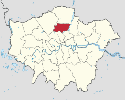
See London Borough of Haringey, Wood Green, on the map
Public Transit to London Borough of Haringey in Wood Green
Wondering how to get to London Borough of Haringey in Wood Green, United Kingdom? Moovit helps you find the best way to get to London Borough of Haringey with step-by-step directions from the nearest public transit station.
Moovit provides free maps and live directions to help you navigate through your city. View schedules, routes, timetables, and find out how long does it take to get to London Borough of Haringey in real time.
Looking for the nearest stop or station to London Borough of Haringey? Check out this list of stops closest to your destination: Wightman Road (E); Brampton Park Road (KA); Wood Green Shopping City (J); Brampton Park Road (K); Bounds Green; Harringay.
Bus:141144232294167N41N91W4N29121184221329123Train:GREAT NORTHERNTube:PICCADILLY
Want to see if there’s another route that gets you there at an earlier time? Moovit helps you find alternative routes or times. Get directions from and directions to London Borough of Haringey easily from the Moovit App or Website.
We make riding to London Borough of Haringey easy, which is why over 1.5 million users, including users in Wood Green, trust Moovit as the best app for public transit. You don’t need to download an individual bus app or train app, Moovit is your all-in-one transit app that helps you find the best bus time or train time available.
For information on prices of Tube, bus and train, costs and ride fares to London Borough of Haringey, please check the Moovit app.
Use the app to navigate to popular places including to the airport, hospital, stadium, grocery store, mall, coffee shop, school, college, and university.
London Borough of Haringey Address: London Borough of Haringey, London, UK street in Wood Green
Attractions near London Borough of Haringey
Cristina Masse,Horuscom Services Limited,Wnse Limited,Cranleigh,Virgin Media Business,Barnaby S Property Lettings Limited,Mym Capital Limited,Hampshire Heights Freeholds Limited,Weissmandl Group Limited,Jamessutton Limited,Middle Lane Investments Limited,Goddingtonroad Limited,B Dari,The Laundry Man App,Yacine Construction Limited,Ybm Technology Limited,Loose Lips,Hornsey Hammocks,Hornsey Park Road,Big BusHow to get to popular attractions in Wood Green with public transportation
Ilford, Ilford,Victoria Bus Station, Westminster,Whipps Cross University Hospital, Upper Walthamstow,Southall, Southall,Waterloo Station, Waterloo,Portobello Road Market, Notting Hill,Wembley, Wembley,Cineworld, Chichester (Town),Queens Hospital, Romford,Stansted Airport, Stansted,St Thomas' Hospital, Waterloo,Berkhamsted Railway Station (BKM), Berkhamsted,Churchill Square, Brighton And Hove,Merton, Wimbledon,Terminal 4, Heathrow,Waitrose, Surbiton,Eltham, Eltham,The Shard, Borough,Madame Tussauds, Marylebone,Cassiobury Park, WatfordGet around Wood Green by public transport!
Travelling around Wood Green has never been so easy. See step by step directions as you travel to any attraction, street or major public transport station. View bus and train timetables, arrival times, service alerts and detailed routes on a map, so you know exactly how to get to anywhere in Wood Green.
When travelling to any destination around Wood Green use Moovit's Live Directions with Get Off Notifications to know exactly where and how far to walk, how long to wait for your line , and how many stops are left. Moovit will alert you when it’s time to get off — no need to constantly re-check whether yours is the next stop.
Wondering how to use public transport in Wood Green or how to pay for public transport in Wood Green? Moovit public transport app can help you navigate your way with public transport easily, and at minimum cost. It includes public transport fees, ticket prices, and costs. Looking for a map of Wood Green public transport lines? Moovit public transport app shows all public transport maps in Wood Green with all Tube, bus or train routes and stops on an interactive map.
Wood Green has 3 transport type(s), including: Tube, bus or train, operated by several transport agencies, including London Underground, London Buses, Transport for London, London Tramlink, Transport for London, National Rail, Bluestar, Berry's Coaches, Oxford Bus Company, Stagecoach West, Community First Wessex, Cresta Coaches, D & P Boat Hire, First Portsmouth, Fareham & Gosport and FYTbus