Directions to Waterloo Station station with public transport
The following transport lines have routes that pass near Waterloo Station
How to get to Waterloo Station station by bus?
Click on the bus route to see step by step directions with maps, line arrival times and updated time schedules.
How to get to Waterloo Station station by train?
Click on the train route to see step by step directions with maps, line arrival times and updated time schedules.
How to get to Waterloo Station station by Tube?
Click on the Tube route to see step by step directions with maps, line arrival times and updated time schedules.
Bus stops near Waterloo Station
- Waterloo Station / Tenison Way (J), 2 min walk,
- Waterloo Station / Tenison Way (H), 2 min walk,
- Waterloo Station / Tenison Way (K), 2 min walk,
- London Waterloo, 3 min walk,
- Waterloo Station / Upper Taxi Road (C), 4 min walk,
- Waterloo Road (L), 4 min walk,
- Waterloo Station / Waterloo Road (F), 4 min walk,
- London Eye, Waterloo, 8 min walk,
Tube station near Waterloo Station
- Waterloo, 3 min walk,
Train station near Waterloo Station
- Waterloo East, 4 min walk,
River Bus stations near Waterloo Station
- Festival Pier, 11 min walk,
- London Eye Waterloo Pier, 12 min walk,
Bus lines to Waterloo Station station
- 59, Smithfield, St Bartholomew's Hospital,
- 243, Waterloo,
- 139, Waterloo,
- 176, Tottenham Court Road,
- 1, Canada Water - Hampstead Heath,
- N1, Thamesmead - Tottenham Court Road,
- SL6, Russell Square - West Croydon,
- 68, Euston - West Norwood,
- N68, Tottenham Court Road - Old Coulsdon,
- N171, Tottenham Court Road - Hither Green Station,
- 188, Tottenham Court Road - North Greenwich,
- SOUTH WESTERN RAILWAY, Frome,
- SOUTH WESTERN RAILWAY, Bus Replacement: Twickenham,
- 11, Fulham Broadway,
- 77, Waterloo,
- N343, New Cross Gate,
- 381, Peckham,
- N381, Whitehall, Horse Guards,
- C10, Canada Water Bus Station,
- 76, Waterloo, County Hall,
What are the nearest stations to Waterloo Station?
The nearest stations to Waterloo Station are:
- Waterloo Station / Tenison Way (J) is 104 meters away, 2 min walk.
- Waterloo Station / Tenison Way (H) is 118 meters away, 2 min walk.
- Waterloo Station / Tenison Way (K) is 130 meters away, 2 min walk.
- London Waterloo is 217 meters away, 3 min walk.
- Waterloo is 220 meters away, 3 min walk.
- Waterloo Station / Upper Taxi Road (C) is 235 meters away, 4 min walk.
- Waterloo Road (L) is 245 meters away, 4 min walk.
- Waterloo Station / Waterloo Road (F) is 263 meters away, 4 min walk.
- Waterloo East is 300 meters away, 4 min walk.
- London Eye, Waterloo is 528 meters away, 8 min walk.
- Festival Pier is 799 meters away, 11 min walk.
- London Eye Waterloo Pier is 861 meters away, 12 min walk.
Which bus lines stop near Waterloo Station?
These bus lines stop near Waterloo Station: 11, 139, 172, 176, 341, 76, A7.
Which train lines stop near Waterloo Station?
These train lines stop near Waterloo Station: SOUTH WESTERN RAILWAY, SOUTHEASTERN, THAMESLINK.
Which Tube lines stop near Waterloo Station?
These Tube lines stop near Waterloo Station: BAKERLOO, JUBILEE, NORTHERN, WATERLOO & CITY.
What’s the nearest Tube station to Waterloo Station?
The nearest Tube station to Waterloo Station is Waterloo. It’s a 3 min walk away.
What’s the nearest train station to Waterloo Station?
The nearest train station to Waterloo Station is Waterloo East. It’s a 4 min walk away.
What’s the nearest bus station to Waterloo Station?
The nearest bus stations to Waterloo Station are Waterloo Station / Tenison Way (J), Waterloo Station / Tenison Way (H) and Waterloo Station / Tenison Way (K). The closest one is a 2 min walk away.
What’s the nearest River Bus station to Waterloo Station?
The nearest River Bus station to Waterloo Station is Festival Pier. It’s a 11 min walk away.
What time is the first Tube to Waterloo Station?
The JUBILEE is the first Tube that goes to Waterloo Station. It stops nearby at 05:30.
What time is the last Tube to Waterloo Station?
The JUBILEE is the last Tube that goes to Waterloo Station. It stops nearby at 00:50.
What time is the first train to Waterloo Station?
The SOUTH WESTERN RAILWAY is the first train that goes to Waterloo Station. It stops nearby at 05:08.
What time is the last train to Waterloo Station?
The SOUTH WESTERN RAILWAY is the last train that goes to Waterloo Station. It stops nearby at 00:39.
What time is the first bus to Waterloo Station?
The 139 is the first bus that goes to Waterloo Station. It stops nearby at 03:00.
What time is the last bus to Waterloo Station?
The 243 is the last bus that goes to Waterloo Station. It stops nearby at 04:13.
What time is the first River Bus to Waterloo Station?
The RB6 is the first River Bus that goes to Waterloo Station. It stops nearby at 11:56.
What time is the last River Bus to Waterloo Station?
The RB6 is the last River Bus that goes to Waterloo Station. It stops nearby at 16:36.
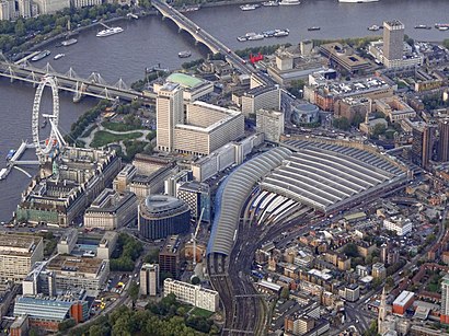
See Waterloo Station on the map
Public Transportation to Waterloo Station
Wondering how to get to Waterloo Station, United Kingdom? Moovit helps you find the best way to get to Waterloo Station with step-by-step directions from the nearest public transit station.
Moovit provides free maps and live directions to help you navigate through your city. View schedules, routes, timetables, and find out how long does it take to get to Waterloo Station in real time.
Looking for the nearest stop or station to Waterloo Station? Check out this list of stops closest to your destination: Waterloo Station / Tenison Way (J); Waterloo Station / Tenison Way (H); Waterloo Station / Tenison Way (K); London Waterloo; Waterloo; Waterloo Station / Upper Taxi Road (C); Waterloo Road (L); Waterloo Station / Waterloo Road (F); Waterloo East; London Eye; Festival Pier; London Eye Waterloo Pier.
Bus: 11, 139, 172, 176, 341, 76, A7, 59, 243, 1, N1, SL6, 68, N68.Train: SOUTH WESTERN RAILWAY, SOUTHEASTERN, THAMESLINK.Tube: BAKERLOO, JUBILEE, NORTHERN, WATERLOO & CITY.River Bus: THAMES RIVER SERVICES.
Want to see if there’s another route that gets you there at an earlier time? Moovit helps you find alternative routes or times. Get directions from and directions to Waterloo Station easily from the Moovit App or Website.
We make riding to Waterloo Station easy, which is why over 1.5 million users, including users in Waterloo, trust Moovit as the best app for public transit. You don’t need to download an individual bus app or train app, Moovit is your all-in-one transit app that helps you find the best bus time or train time available.
For information on prices of Tube, bus, train and DLR, costs and ride fares to Waterloo Station, please check the Moovit app.
Use the app to navigate to popular places including to the airport, hospital, stadium, grocery store, mall, coffee shop, school, college, and university.
Waterloo Station Address: Station Approach street in Waterloo
Popular routes to Waterloo Station station
Popular routes from Waterloo Station station
Places Near Waterloo Station
How to get to popular places in London with public transport
Get around Waterloo by public transport!
Travelling around Waterloo has never been so easy. See step by step directions as you travel to any attraction, street or major public transport station. View bus and train timetables, arrival times, service alerts and detailed routes on a map, so you know exactly how to get to anywhere in Waterloo.
When travelling to any destination around Waterloo use Moovit's Live Directions with Get Off Notifications to know exactly where and how far to walk, how long to wait for your line , and how many stops are left. Moovit will alert you when it’s time to get off — no need to constantly re-check whether yours is the next stop.
Wondering how to use public transport in Waterloo or how to pay for public transport in Waterloo? Moovit public transport app can help you navigate your way with public transport easily, and at minimum cost. It includes public transport fees, ticket prices, and costs. Looking for a map of Waterloo public transport lines? Moovit public transport app shows all public transport maps in Waterloo with all Bus, Train, Tube, Tramlink, River Bus and DLR routes and stops on an interactive map.
London has 6 transport type(s), including: Bus, Train, Tube, Tramlink, River Bus and DLR, operated by several transport agencies, including London Buses, Transport for London, London Underground, London River Services, National Rail, Luton Airport Shuttle, Bayliss Executive Travel, Edward Thomas, Metrobus, Coggeshall Community Bus, Tendring Community Transport, Sullivan Buses, Z & S Transport, Central Connect and Compass Travel