Lower Marsh (A) stop - Tuesday schedule
| Line | Direction | Time |
|---|---|---|
| 12 | Oxford Circus | 03:03 |
| 159 | Oxford Circus | 03:06 |
| N53 | Whitehall, Horse Guards | 03:07 |
| 453 | Marylebone | 03:08 |
| N155 | Aldwych | 03:10 |
| N109 | Oxford Circus | 03:18 |
| 148 | White City | 03:24 |
| N155 | Aldwych | 03:30 |
| 12 | Oxford Circus | 03:33 |
| 159 | Oxford Circus | 03:36 |
| N53 | Whitehall, Horse Guards | 03:37 |
| 453 | Marylebone | 03:38 |
| N109 | Oxford Circus | 03:48 |
| N155 | Aldwych | 03:50 |
| 148 | White City | 03:54 |
| 12 | Oxford Circus | 04:03 |
| 159 | Oxford Circus | 04:06 |
| N53 | Whitehall, Horse Guards | 04:07 |
| 453 | Marylebone | 04:08 |
| N155 | Aldwych | 04:10 |
| N109 | Oxford Circus | 04:18 |
| 148 | White City | 04:24 |
| N155 | Aldwych | 04:30 |
| 12 | Oxford Circus | 04:32 |
| 159 | Oxford Circus | 04:36 |
Directions to Lower Marsh (A) stop (Waterloo) with public transport
The following transport lines have routes that pass near Lower Marsh (A)
How to get to Lower Marsh (A) stop by bus?
Click on the bus route to see step by step directions with maps, line arrival times and updated time schedules.
How to get to Lower Marsh (A) stop by train?
Click on the train route to see step by step directions with maps, line arrival times and updated time schedules.
How to get to Lower Marsh (A) stop by Tube?
Click on the Tube route to see step by step directions with maps, line arrival times and updated time schedules.
Tube stations near Lower Marsh (A) station in Waterloo
- Waterloo, 2 min walk,
Bus stops near Lower Marsh (A) stop in Waterloo
- Lambeth North Station (B), 3 min walk,
- Lambeth North Station (A), 3 min walk,
- St Thomas' Hospital (B), 3 min walk,
- St Thomas' Hospital / County Hall (E), 3 min walk,
- Lower Marsh (K), 4 min walk,
- County Hall (G), 5 min walk,
- Lambeth Road / Kennington Road (H), 6 min walk,
Train stations near Lower Marsh (A) station in Waterloo
- Waterloo East, 3 min walk,
River Bus stations near Lower Marsh (A) station in Waterloo
- London Eye Waterloo Pier, 6 min walk,
- Westminster Pier, 8 min walk,
Bus lines to Lower Marsh (A) stop in Waterloo
- 12, Dulwich Library - Oxford Circus,
- 53, Lambeth North, Lower Marsh - Plumstead Station,
- N53, Whitehall, Horse Guards - Plumstead Station,
- 148, White City - Camberwell Green,
- N155, Aldwych - Morden,
- 453, Marylebone - Deptford Bridge,
- 3, Victoria,
- N3, Bromley North,
- 59, Smithfield, St Bartholomew's Hospital,
- N109, Croydon Town Centre,
- 159, Oxford Circus,
- C10, Canada Water Bus Station,
- 77, Tooting Station,
- 11, Fulham Broadway,
- N381, Whitehall, Horse Guards,
- 76, Waterloo, County Hall,
- 381, Peckham,
- 344, Clapham Junction,
What are the nearest stations to Lower Marsh (A)?
The nearest stations to Lower Marsh (A) are:
- Waterloo is 150 meters away, 2 min walk.
- Lambeth North Station (B) is 163 meters away, 3 min walk.
- Waterloo East is 177 meters away, 3 min walk.
- Lambeth North Station (A) is 204 meters away, 3 min walk.
- St Thomas' Hospital (B) is 208 meters away, 3 min walk.
- St Thomas' Hospital / County Hall (E) is 211 meters away, 3 min walk.
- Lower Marsh (K) is 268 meters away, 4 min walk.
- County Hall (G) is 347 meters away, 5 min walk.
- Lambeth Road / Kennington Road (H) is 441 meters away, 6 min walk.
- London Eye Waterloo Pier is 456 meters away, 6 min walk.
- Westminster Pier is 590 meters away, 8 min walk.
Which bus lines stop near Lower Marsh (A)?
These bus lines stop near Lower Marsh (A): 11, 12, 453, 76, 77.
Which train lines stop near Lower Marsh (A)?
These train lines stop near Lower Marsh (A): SOUTH WESTERN RAILWAY, SOUTHEASTERN.
Which Tube lines stop near Lower Marsh (A)?
These Tube lines stop near Lower Marsh (A): BAKERLOO, JUBILEE, NORTHERN.
What’s the nearest Tube station to Lower Marsh (A) in Waterloo?
The nearest Tube station to Lower Marsh (A) in Waterloo is Waterloo. It’s a 2 min walk away.
What’s the nearest train station to Lower Marsh (A) in Waterloo?
The nearest train station to Lower Marsh (A) in Waterloo is Waterloo East. It’s a 3 min walk away.
What’s the nearest bus station to Lower Marsh (A) in Waterloo?
The nearest bus stations to Lower Marsh (A) in Waterloo are Lambeth North Station (B), Lambeth North Station (A), St Thomas' Hospital (B) and St Thomas' Hospital / County Hall (E). The closest one is a 3 min walk away.
What’s the nearest River Bus station to Lower Marsh (A) in Waterloo?
The nearest River Bus station to Lower Marsh (A) in Waterloo is London Eye Waterloo Pier. It’s a 6 min walk away.
What time is the first Tube to Lower Marsh (A) in Waterloo?
The JUBILEE is the first Tube that goes to Lower Marsh (A) in Waterloo. It stops nearby at 03:28.
What time is the last Tube to Lower Marsh (A) in Waterloo?
The JUBILEE is the last Tube that goes to Lower Marsh (A) in Waterloo. It stops nearby at 00:50.
What time is the first train to Lower Marsh (A) in Waterloo?
The SOUTHEASTERN is the first train that goes to Lower Marsh (A) in Waterloo. It stops nearby at 07:30.
What time is the last train to Lower Marsh (A) in Waterloo?
The SOUTHEASTERN is the last train that goes to Lower Marsh (A) in Waterloo. It stops nearby at 00:53.
What time is the first bus to Lower Marsh (A) in Waterloo?
The 12 is the first bus that goes to Lower Marsh (A) in Waterloo. It stops nearby at 03:00.
What time is the last bus to Lower Marsh (A) in Waterloo?
The 76 is the last bus that goes to Lower Marsh (A) in Waterloo. It stops nearby at 03:48.
What time is the first River Bus to Lower Marsh (A) in Waterloo?
The RB6 is the first River Bus that goes to Lower Marsh (A) in Waterloo. It stops nearby at 09:07.
What time is the last River Bus to Lower Marsh (A) in Waterloo?
The RB6 is the last River Bus that goes to Lower Marsh (A) in Waterloo. It stops nearby at 23:33.
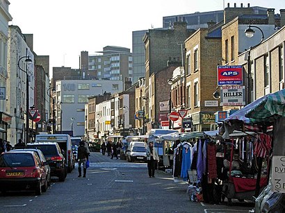
Lower Marsh (A) station
 Taken by Martin K.
See Lower Marsh (A) stop, Waterloo, on the map
Public transport to Lower Marsh (A) stop (ID: A) in Waterloo
Looking for directions to Lower Marsh (A) in Waterloo, United Kingdom?
Download the Moovit App to find the current schedule and step-by-step directions for Bus, Tube or Train routes that pass through Lower Marsh (A).
Looking for the nearest stops closest to Lower Marsh (A) ? Check out this list of closest stops to your destination: Waterloo; Lambeth North Station (B); Waterloo East; Lambeth North Station (A); St Thomas' Hospital (B); St Thomas' Hospital / County Hall (E); Lower Marsh (K); County Hall (G); Lambeth Road / Kennington Road (H); London Eye Waterloo Pier; Westminster Pier.
Bus: 11, 12, 453, 76, 77, 53, N53, 148, N155, 3, N3, 59, N109, 159, N381.Train: SOUTH WESTERN RAILWAY, SOUTHEASTERN.Tube: BAKERLOO, JUBILEE, NORTHERN, WATERLOO & CITY.River Bus: RB1, RB6.
We make riding on public transit to Lower Marsh (A) easy, which is why over 1.5 million users, including users in Waterloo trust Moovit as the best app for public transit.
Use the app to navigate to popular places including to the airport, hospital, stadium, grocery store, mall, coffee shop, school, college, and university.
Lower Marsh (A) stop’s code is A
The first line to this stop is 12, at 03:03, and the last line is 148 at 02:54.
131 Westminster Bridge Road, London, England, United Kingdom
This stop serves London Buses’s lines
Lower Marsh is a street in the Waterloo neighbourhood of London, England. It is adjacent to Waterloo railway station in the London Borough of Lambeth. It is the location of Lower Marsh Market.Wiki
Tube station near Lower Marsh (A) station
Bus stops near Lower Marsh (A) stop
Train station near Lower Marsh (A) station
Popular public transport stations in Waterloo
Get around Waterloo by public transport!
Travelling around Waterloo has never been so easy. See step by step directions as you travel to any attraction, street or major public transport station. View bus and train timetables, arrival times, service alerts and detailed routes on a map, so you know exactly how to get to anywhere in Waterloo.
When travelling to any destination around Waterloo use Moovit's Live Directions with Get Off Notifications to know exactly where and how far to walk, how long to wait for your line , and how many stops are left. Moovit will alert you when it’s time to get off — no need to constantly re-check whether yours is the next stop.
Wondering how to use public transport in Waterloo or how to pay for public transport in Waterloo? Moovit public transport app can help you navigate your way with public transport easily, and at minimum cost. It includes public transport fees, ticket prices, and costs. Looking for a map of Waterloo public transport lines? Moovit public transport app shows all public transport maps in Waterloo with all Bus, Train, Tube, Tramlink, River Bus and DLR routes and stops on an interactive map.
London has 6 transport type(s), including: Bus, Train, Tube, Tramlink, River Bus and DLR, operated by several transport agencies, including London Underground, London Buses, Transport for London, London Tramlink, National Rail, Bluestar, Berry's Coaches, Oxford Bus Company, Stagecoach West, Community First Wessex, Cresta Coaches, First Portsmouth, Fareham & Gosport, IFS Cloud Cable Car, FYTbus and Gosport-Portsmouth Ferry