Mitchells Pl. station - Tuesday schedule
| Line | Direction | Time |
|---|---|---|
| CENTRAL LINE | - | 03:11 |
| CENTRAL LINE | - | 03:28 |
| CENTRAL LINE | - | 03:45 |
| CENTRAL LINE | - | 03:48 |
| CENTRAL LINE | - | 03:53 |
| CENTRAL LINE | - | 04:03 |
| CENTRAL LINE | - | 04:15 |
| CENTRAL LINE | - | 04:23 |
| CENTRAL LINE | - | 04:28 |
| CENTRAL LINE | - | 04:33 |
| CENTRAL LINE | - | 04:43 |
| CENTRAL LINE | - | 04:53 |
| CENTRAL LINE | - | 04:58 |
| CENTRAL LINE | - | 05:08 |
| CENTRAL LINE | - | 05:15 |
| CENTRAL LINE | - | 05:18 |
| CENTRAL LINE | - | 05:35 |
| CENTRAL LINE | - | 05:40 |
| CENTRAL LINE | - | 05:55 |
| CENTRAL LINE | - | 06:10 |
| CENTRAL LINE | - | 06:28 |
| CENTRAL LINE | - | 06:40 |
| CENTRAL LINE | - | 07:03 |
| CENTRAL LINE | - | 07:03 |
| CENTRAL LINE | - | 07:23 |
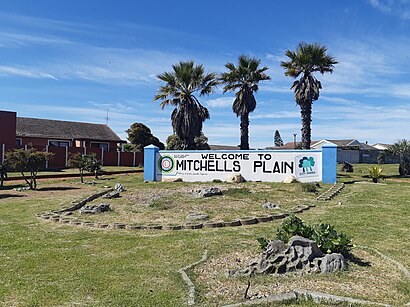
Directions to Mitchells Pl. station (Mitchells Plain) with public transport
The following transport lines have routes that pass near Mitchells Pl.
How to get to Mitchells Pl. station by bus?
Click on the bus route to see step by step directions with maps, line arrival times and updated time schedules.
How to get to Mitchells Pl. station by train?
Click on the train route to see step by step directions with maps, line arrival times and updated time schedules.
Bus stops near Mitchells Pl. stop in Mitchells Plain
- Mitchells Plain, 7 min walk,
- Rocklands, 10 min walk,
- Town Centre, 16 min walk,
Train stations near Mitchells Pl. station in Mitchells Plain
- Lentegeur, 33 min walk,
Bus lines to Mitchells Pl. station in Mitchells Plain
- D03, Civic Centre,
- D04, Kapteinsklip,
- ALEXANDRA HOSP - ROCKLANDS, Rocklands,
- ALEXANDRA HOSP - TOWN CENTRE, Alexandra Hosp - Town Centre,
- ARTSCAPE - TOWN CENTRE, Artscape - Town Centre,
- ATHLONE IND - TOWN CENTRE, Athlone Ind - Town Centre,
- BAYVIEW - TOWN CENTRE, Bayview - Town Centre,
- BEACON VALLEY - TOWN CENTRE, Beacon Valley - Town Centre,
- BELGRAVIA IND - TOWN CENTRE, Belgravia Ind - Town Centre,
- BELLVILLE - TOWN CENTRE, Bellville - Town Centre,
- BLAAUWBERG - TOWN CENTRE, Blaauwberg - Town Centre,
- BLAAUWBERG RD - TOWN CENTRE, Blaauwberg Rd - Town Centre,
- BLACKHEATH - TOWN CENTRE, Blackheath - Town Centre,
- BLUE ROUTE CENTRE - TOWN CENTRE, Blue Route Centre - Town Centre,
- AIRPORT IND 1 - TOWN CENTRE, Airport Ind 1 - Town Centre,
- AIRPORT IND 2 - TOWN CENTRE, Airport Ind 2 - Town Centre,
What are the nearest stations to Mitchells Pl.?
The nearest stations to Mitchells Pl. are:
- Mitchells Plain is 477 meters away, 7 min walk.
- Rocklands is 770 meters away, 10 min walk.
- Town Centre is 1199 meters away, 16 min walk.
- Lentegeur is 2571 meters away, 33 min walk.
Which bus line stops near Mitchells Pl.?
D04 (Platform 11 Civic Centre→Kapteinsklip)
Which train line stops near Mitchells Pl.?
CENTRAL LINE
What’s the nearest bus station to Mitchells Pl. in Mitchells Plain?
The nearest bus station to Mitchells Pl. in Mitchells Plain is Mitchells Plain. It’s a 7 min walk away.
What time is the first train to Mitchells Pl. in Mitchells Plain?
The CENTRAL LINE is the first train that goes to Mitchells Pl. in Mitchells Plain. It stops nearby at 03:01.
What time is the last train to Mitchells Pl. in Mitchells Plain?
The CENTRAL LINE is the last train that goes to Mitchells Pl. in Mitchells Plain. It stops nearby at 03:01.
What time is the first bus to Mitchells Pl. in Mitchells Plain?
The D04 is the first bus that goes to Mitchells Pl. in Mitchells Plain. It stops nearby at 04:11.
What time is the last bus to Mitchells Pl. in Mitchells Plain?
The D04 is the last bus that goes to Mitchells Pl. in Mitchells Plain. It stops nearby at 20:39.
See Mitchells Pl. station, Mitchells Plain, on the map
Public transport to Mitchells Pl. station in Mitchells Plain
Looking for directions to Mitchells Pl. in Mitchells Plain, South Africa?
Download the Moovit App to find the current schedule and step-by-step directions for Train or Bus routes that pass through Mitchells Pl..
Looking for the nearest stops closest to Mitchells Pl. ? Check out this list of closest stops to your destination: Mitchells Plain; Rocklands; Town Centre; Lentegeur.
Bus: D04, D03, ALEXANDRA HOSP - ROCKLANDS, ALEXANDRA HOSP - TOWN CENTRE, ARTSCAPE - TOWN CENTRE, ATHLONE IND - TOWN CENTRE, BAYVIEW - TOWN CENTRE, BEACON VALLEY - TOWN CENTRE.Train: CENTRAL LINE.
We make riding on public transit to Mitchells Pl. easy, which is why over 1.5 million users, including users in Mitchells Plain trust Moovit as the best app for public transit.
Use the app to navigate to popular places including to the airport, hospital, stadium, grocery store, mall, coffee shop, school, college, and university.
The station has the following entrances: Seventh Ave and Etosha Way
The first line to this station is CENTRAL LINE, at 03:11, and the last line is CENTRAL LINE at 02:53.
This station serves Metrorail Western Cape’s lines
Popular routes from Mitchells Pl. station, Mitchells Plain
Train station near Mitchells Pl. station
Popular public transport stations in Mitchells Plain
Get around Mitchells Plain by public transport!
Travelling around Mitchells Plain has never been so easy. See step by step directions as you travel to any attraction, street or major public transport station. View bus and train timetables, arrival times, service alerts and detailed routes on a map, so you know exactly how to get to anywhere in Mitchells Plain.
When travelling to any destination around Mitchells Plain use Moovit's Live Directions with Get Off Notifications to know exactly where and how far to walk, how long to wait for your line , and how many stops are left. Moovit will alert you when it’s time to get off — no need to constantly re-check whether yours is the next stop.
Wondering how to use public transport in Mitchells Plain or how to pay for public transport in Mitchells Plain? Moovit public transport app can help you navigate your way with public transport easily, and at minimum cost. It includes public transport fees, ticket prices, and costs. Looking for a map of Mitchells Plain public transport lines? Moovit public transport app shows all public transport maps in Mitchells Plain with all Bus, Train and Funicular routes and stops on an interactive map.
Cape Town has 3 transport type(s), including: Bus, Train and Funicular, operated by several transport agencies, including MyCiTi, Golden Arrow, Metrorail Western Cape, City Sightseeing Cpt and Intercape