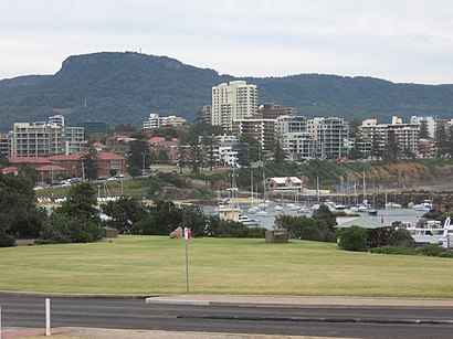
See Mount Keira, Mount Kembla, on the map
See Mount Keira, Mount Kembla, on the map

Public Transit to Mount Keira in Mount Kembla
Wondering how to get to Mount Keira in Mount Kembla, Australia? Moovit helps you find the best way to get to Mount Keira with step-by-step directions from the nearest public transit station.
Moovit provides free maps and live directions to help you navigate through your city. View schedules, routes, timetables, and find out how long does it take to get to Mount Keira in real time.
Want to see if there’s another route that gets you there at an earlier time? Moovit helps you find alternative routes or times. Get directions from and directions to Mount Keira easily from the Moovit App or Website.
We make riding to Mount Keira easy, which is why over 1.5 million users, including users in Mount Kembla, trust Moovit as the best app for public transit. You don’t need to download an individual bus app or train app, Moovit is your all-in-one transit app that helps you find the best bus time or train time available.
Use the app to navigate to popular places including to the airport, hospital, stadium, grocery store, mall, coffee shop, school, college, and university.
Location: Mount Kembla, Sydney

Attractions near Mount Keira
- Dendrobium Mine
- Tl 11 39
- Tl 11 40
- Tl 11 41
- Mount Kembla
- Illawarra Christian School Cordeaux Campus
- Soldiers & Miners Memorial
- Mt Kembla Hotel
- Mt Kembla Park
- Mount Brisbane
- Mount Nebo
- Robertson'S Knoll
- Rangers Den
- Nextra Figtree Newsagency
- Girl Guides Camp
- Girl Guides Hall
- Unanderra Public School
- Cordeaux Heights
- Figtree Zone Substation
- Church Of Christ
How to get to popular attractions in Mount Kembla with public transportation
- Chat Thai, Haymarket
- Lidcombe Station (Concourse), Lidcombe
- Sydney Airport (SYD), Mascot
- Ms. G's, Potts Point
- Panania Station, Panania
- Strathfield Station (Main Concourse), Strathfield (NSW)
- The M5/M7 Pyramid, Prestons
- Quakers Hill Station, Quakers Hill
- Lifestyle Fitness Australia, Erskineville
- Narrabeen, Narrabeen
- The Grounds of Alexandria, Alexandria
- Marquee, Pyrmont
- The Star Casino, Pyrmont
- Manly Wharf Bar
- Westfield Eastgardens, Eastgardens
- Dee Why, Dee Why
- The Eight Modern Chinese Restaurant, Haymarket
- Macarthur Station, Campbelltown (NSW)
- Terrigal Beach, Terrigal
- Minto Station, Minto