Penge East Station (Q) stop - Tuesday schedule
| Line | Direction | Time |
|---|---|---|
| 75 | Lewisham, Shopping Centre | 04:44 |
| 75 | Lewisham, Shopping Centre | 05:14 |
| 75 | Lewisham, Shopping Centre | 05:44 |
| 194 | Lower Sydenham | 05:57 |
| 75 | Lewisham, Shopping Centre | 06:04 |
| 194 | Lower Sydenham | 06:17 |
| 75 | Lewisham, Shopping Centre | 06:18 |
| 75 | Lewisham, Shopping Centre | 06:30 |
| 194 | Lower Sydenham | 06:32 |
| 75 | Lewisham, Shopping Centre | 06:41 |
| 194 | Lower Sydenham | 06:47 |
| 75 | Lewisham, Shopping Centre | 06:51 |
| 194 | Lower Sydenham | 07:00 |
| 75 | Lewisham, Shopping Centre | 07:01 |
| 75 | Lewisham, Shopping Centre | 07:11 |
| 194 | Lower Sydenham | 07:12 |
| 75 | Lewisham, Shopping Centre | 07:21 |
| 194 | Lower Sydenham | 07:23 |
| 75 | Lewisham, Shopping Centre | 07:31 |
| 75 | Lewisham, Shopping Centre | 07:32 |
| 194 | Lower Sydenham | 07:33 |
| 75 | Lewisham, Shopping Centre | 07:41 |
| 194 | Lower Sydenham | 07:43 |
| 75 | Lewisham, Shopping Centre | 07:43 |
| 75 | Lewisham, Shopping Centre | 07:51 |
See Penge East Station (Q) on the map
Directions to Penge East Station (Q) with public transportation
The following transport lines have routes that pass near Penge East Station (Q)
 Bus:
Bus: - Train:
How to get to Penge East Station (Q) by bus?
Click on the bus route to see step by step directions with maps, line arrival times and updated time schedules.
How to get to Penge East Station (Q) by train?
Click on the train route to see step by step directions with maps, line arrival times and updated time schedules.
Bus stations near Penge East Station (Q)
- Penge East Station (V),2 min walk,
- Penge East,2 min walk,
- High Street / Maple Road (D),8 min walk,
Train stations near Penge East Station (Q)
- Kent House,15 min walk,
- Anerley,18 min walk,
Tramlink stations near Penge East Station (Q)
- Beckenham Road Tram Stop,21 min walk,
Bus routes to Penge East Station (Q)
- 75,Lewisham, Shopping Centre,
- 194,West Croydon,
- SOUTHEASTERN,Ramsgate,
- SOUTHEASTERN,Bus Replacement: Orpington,
- 176,Tottenham Court Road - Penge,
- 197,Croydon Town Centre - Peckham,
- 227,Crystal Palace - Bromley North,
- 354,Bromley North - Penge,
What are the nearest stations to Penge East Station (Q)?
The nearest stations to Penge East Station (Q) are:
- Penge East Station (V) is 69 meters away, 2 min walk.
- Penge East is 84 meters away, 2 min walk.
- High Street / Maple Road (D) is 557 meters away, 8 min walk.
- Kent House is 1133 meters away, 15 min walk.
- Anerley is 1328 meters away, 18 min walk.
- Beckenham Road Tram Stop is 1624 meters away, 21 min walk.
Which bus lines stop near Penge East Station (Q)?
These bus lines stop near Penge East Station (Q): 176, 194, 75.
Which train lines stop near Penge East Station (Q)?
These train lines stop near Penge East Station (Q): OVERGROUND, SOUTHEASTERN.
What’s the nearest Tramlink station to Penge East Station (Q)?
The nearest Tramlink station to Penge East Station (Q) is Beckenham Road Tram Stop. It’s a 21 min walk away.
What’s the nearest train station to Penge East Station (Q)?
The nearest train station to Penge East Station (Q) is Kent House. It’s a 15 min walk away.
What’s the nearest bus stop to Penge East Station (Q)?
The nearest bus stops to Penge East Station (Q) are Penge East Station (V) and Penge East. The closest one is a 2 min walk away.
What time is the first Tramlink to Penge East Station (Q)?
The TRAM is the first Tramlink that goes to Penge East Station (Q). It stops nearby at 05:28.
What time is the last Tramlink to Penge East Station (Q)?
The TRAM is the last Tramlink that goes to Penge East Station (Q). It stops nearby at 01:13.
What time is the first train to Penge East Station (Q)?
The SOUTHEASTERN is the first train that goes to Penge East Station (Q). It stops nearby at 04:57.
What time is the last train to Penge East Station (Q)?
The SOUTHEASTERN is the last train that goes to Penge East Station (Q). It stops nearby at 00:47.
What time is the first bus to Penge East Station (Q)?
The 176 is the first bus that goes to Penge East Station (Q). It stops nearby at 03:05.
What time is the last bus to Penge East Station (Q)?
The 176 is the last bus that goes to Penge East Station (Q). It stops nearby at 03:45.
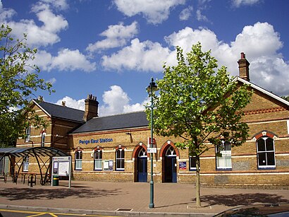
Penge East Station (Q) station
 Taken by Tanchira A.
See Penge East Station (Q) on the map
Public transport to Penge East Station (Q) stop (ID: Q)
Looking for directions to Penge East Station (Q) in Penge, United Kingdom?
Download the Moovit App to find the current schedule and step-by-step directions for Train or Bus routes that pass through Penge East Station (Q).
Looking for the nearest stops closest to Penge East Station (Q) ? Check out this list of closest stops to your destination: Penge East Station (V); Penge East; High Street / Maple Road (D); Kent House; Anerley; Beckenham Road Tram Stop.
Bus:Train:
We make riding on public transit to Penge East Station (Q) easy, which is why over 1.5 million users, including users in Penge trust Moovit as the best app for public transit.
Use the app to navigate to popular places including to the airport, hospital, stadium, grocery store, mall, coffee shop, school, college, and university.
Penge East Station (Q) stop’s code is Q
The first line to this stop is 75, at 04:44, and the last line is 75 at 01:49.
This stop serves London Buses’s lines
Tramlink station near Penge East Station (Q)
Beckenham Road Tram StopPopular public transport stations in Penge
High Wycombe,Lampton School,Petts Wood,Pinner,Clapham North,Northwood Hills,Harris Academy,Gloucester Road,Staff Entrance, Legoland,Hertford Regional College, Turnford,Green Park / Constitution Hill (E),Ilford,Bellevue Road / Trinity Road (E),Heathrow Terminal 2 Arrivals, Heathrow Airport,Stratford City Bus Station (X),Hatton Cross,Stratford High Street,Caterham Dene Hospital, Caterham,Royal Surrey Hospital, Guildford,Queens Park Rangers Football ClubGet around Penge by public transport!
Travelling around Penge has never been so easy. See step by step directions as you travel to any attraction, street or major public transport station. View bus and train timetables, arrival times, service alerts and detailed routes on a map, so you know exactly how to get to anywhere in Penge.
When travelling to any destination around Penge use Moovit's Live Directions with Get Off Notifications to know exactly where and how far to walk, how long to wait for your line , and how many stops are left. Moovit will alert you when it’s time to get off — no need to constantly re-check whether yours is the next stop.
Wondering how to use public transport in Penge or how to pay for public transport in Penge? Moovit public transport app can help you navigate your way with public transport easily, and at minimum cost. It includes public transport fees, ticket prices, and costs. Looking for a map of Penge public transport lines? Moovit public transport app shows all public transport maps in Penge with all train or bus routes and stops on an interactive map.
Penge has 2 transport type(s), including: train or bus, operated by several transport agencies, including London Underground, London Buses, Transport for London, London Tramlink, Transport for London, National Rail, Bluestar, Berry's Coaches, Oxford Bus Company, Stagecoach West, Community First Wessex, Cresta Coaches, D & P Boat Hire, First Portsmouth, Fareham & Gosport and FYTbus