Directions to Picabar station (Perth) with public transport
The following transport lines have routes that pass near Picabar
How to get to Picabar station by bus?
Click on the bus route to see step by step directions with maps, line arrival times and updated time schedules.
How to get to Picabar station by train?
Click on the train route to see step by step directions with maps, line arrival times and updated time schedules.
Bus stops near Picabar in Perth
- Wellington St Perth Stn Westbound, 2 min walk,
- Wellington St Perth Stn Eastbound, 2 min walk,
- Barrack St Perth Station Cat Id 4, 2 min walk,
- Perth Busport, 7 min walk,
Train stations near Picabar in Perth
- Elizabeth Quay Stn, 26 min walk,
- Perth Stn, 35 min walk,
Ferry station near Picabar in Perth
- Ferry Route Elizabeth Quay Jetty, 26 min walk,
Bus lines to Picabar station in Perth
- PERTH RED CAT, Matagarup Bridge,
- PERTH YELLOW CAT, Claisebrook Stn,
- 38, Cloverdale,
- 40, Galleria Bus Stn,
- 41, Bayswater Stn,
- 42, Maylands,
- 43, Maylands,
- 51, Perth Busport,
- 67, Mirrabooka Bus Stn,
- 68, Mirrabooka Bus Stn,
- 220, Armadale Senior High School,
- 221, Perth Busport,
- 230, Perth Busport,
- 905, Victoria Park Stn,
- 907, Perth Busport,
- 950, Galleria Bus Stn,
- 950X, Qeii Medical Ctr,
- 960, Curtin University Bus Stn,
- 980, Galleria Bus Stn,
- 909, Mandurah Stn,
What are the nearest stations to Picabar?
The nearest stations to Picabar are:
- Wellington St Perth Stn Westbound is 67 meters away, 2 min walk.
- Wellington St Perth Stn Eastbound is 88 meters away, 2 min walk.
- Barrack St Perth Station Cat Id 4 is 109 meters away, 2 min walk.
- Perth Busport is 496 meters away, 7 min walk.
- Elizabeth Quay Stn is 1976 meters away, 26 min walk.
- Ferry Route Elizabeth Quay Jetty is 2032 meters away, 26 min walk.
- Perth Stn is 2713 meters away, 35 min walk.
Which bus lines stop near Picabar?
These bus lines stop near Picabar: 40, 907, 910, 935, 950, 960, PERTH BLUE CAT.
Which train lines stop near Picabar?
These train lines stop near Picabar: AIRPORT LINE, ELLENBROOK LINE, MANDURAH LINE, MIDLAND LINE.
What’s the nearest train station to Picabar in Perth?
The nearest train station to Picabar in Perth is Elizabeth Quay Stn. It’s a 26 min walk away.
What’s the nearest bus station to Picabar in Perth?
The nearest bus stations to Picabar in Perth are Wellington St Perth Stn Westbound, Wellington St Perth Stn Eastbound and Barrack St Perth Station Cat Id 4. The closest one is a 2 min walk away.
What’s the nearest ferry station to Picabar in Perth?
The nearest ferry station to Picabar in Perth is Ferry Route Elizabeth Quay Jetty. It’s a 26 min walk away.
What time is the first train to Picabar in Perth?
The FREMANTLE LINE is the first train that goes to Picabar in Perth. It stops nearby at 03:20.
What time is the last train to Picabar in Perth?
The FREMANTLE LINE is the last train that goes to Picabar in Perth. It stops nearby at 00:38.
What time is the first bus to Picabar in Perth?
The 950 is the first bus that goes to Picabar in Perth. It stops nearby at 05:46.
What time is the last bus to Picabar in Perth?
The 907 is the last bus that goes to Picabar in Perth. It stops nearby at 00:18.
What time is the first ferry to Picabar in Perth?
The FERRY ROUTE ELIZABETH QUAY JETTY - FERRY ROUTE MENDS ST JETTY is the first ferry that goes to Picabar in Perth. It stops nearby at 07:30.
What time is the last ferry to Picabar in Perth?
The FERRY ROUTE ELIZABETH QUAY JETTY - FERRY ROUTE MENDS ST JETTY is the last ferry that goes to Picabar in Perth. It stops nearby at 21:55.
See Picabar, Perth, on the map
Public Transit to Picabar in Perth
Wondering how to get to Picabar in Perth, Australia? Moovit helps you find the best way to get to Picabar with step-by-step directions from the nearest public transit station.
Moovit provides free maps and live directions to help you navigate through your city. View schedules, routes, timetables, and find out how long does it take to get to Picabar in real time.
Looking for the nearest stop or station to Picabar? Check out this list of stops closest to your destination: Wellington St Perth Stn Westbound; Wellington St Perth Stn Eastbound; Barrack St Perth Station Cat Id 4; Perth Busport; Elizabeth Quay Stn; Ferry Route Elizabeth Quay Jetty; Perth Stn.
Bus: 40, 907, 910, 935, 950, 960, PERTH BLUE CAT, PERTH RED CAT, PERTH YELLOW CAT, 38, 41, 909.Train: AIRPORT LINE, ELLENBROOK LINE, MANDURAH LINE, MIDLAND LINE, YANCHEP LINE, ARMADALE LINE, FREMANTLE LINE.Ferry: FERRY ROUTE ELIZABETH QUAY JETTY - FERRY ROUTE MENDS ST JETTY.
Want to see if there’s another route that gets you there at an earlier time? Moovit helps you find alternative routes or times. Get directions from and directions to Picabar easily from the Moovit App or Website.
We make riding to Picabar easy, which is why over 1.5 million users, including users in Perth, trust Moovit as the best app for public transit. You don’t need to download an individual bus app or train app, Moovit is your all-in-one transit app that helps you find the best bus time or train time available.
For information on prices of bus and train, costs and ride fares to Picabar, please check the Moovit app.
Use the app to navigate to popular places including to the airport, hospital, stadium, grocery store, mall, coffee shop, school, college, and university.
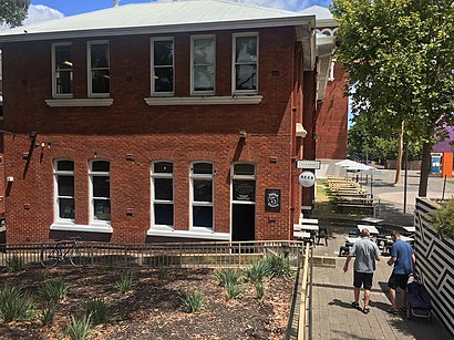
Picabar Address: Roe Street street in Perth
Places Near Picabar (Perth)
How to get to popular places in Perth with public transport
Get around Perth by public transport!
Travelling around Perth has never been so easy. See step by step directions as you travel to any attraction, street or major public transport station. View bus and train timetables, arrival times, service alerts and detailed routes on a map, so you know exactly how to get to anywhere in Perth.
When travelling to any destination around Perth use Moovit's Live Directions with Get Off Notifications to know exactly where and how far to walk, how long to wait for your line , and how many stops are left. Moovit will alert you when it’s time to get off — no need to constantly re-check whether yours is the next stop.
Wondering how to use public transport in Perth or how to pay for public transport in Perth? Moovit public transport app can help you navigate your way with public transport easily, and at minimum cost. It includes public transport fees, ticket prices, and costs. Looking for a map of Perth public transport lines? Moovit public transport app shows all public transport maps in Perth with all Bus, Train and Ferry routes and stops on an interactive map.
Perth has 3 transport type(s), including: Bus, Train and Ferry, operated by several transport agencies, including Transperth Ferry, Transperth, Transperth Rail, TransBusselton, TransGeraldton, TransCarnarvon, TransHedland, TransKarratha, Transwa, TransBunbury, TransAlbany, TransGoldfields, TransEsperance and Mandurah Bus Charter