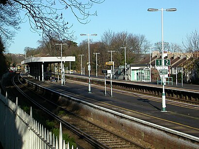
See Preston Park Station, Brighton And Hove, on the map
Directions to Preston Park Station (Brighton And Hove) with public transport
The following transport lines have routes that pass near Preston Park Station
 Bus:
Bus: - Train:
How to get to Preston Park Station by bus?
Click on the bus route to see step by step directions with maps, line arrival times and updated time schedules.
How to get to Preston Park Station by train?
Click on the train route to see step by step directions with maps, line arrival times and updated time schedules.
Bus stations near Preston Park Station in Brighton And Hove
- Harrington Road, Brighton,4 min walk,
- Preston Drove, Brighton,6 min walk,
- Preston Manor, Brighton,9 min walk,
- Top Of Woodruff Avenue, Brighton,10 min walk,
- Onslow Road, Brighton,11 min walk,
Train stations near Preston Park Station in Brighton And Hove
- London Road (Brighton),11 min walk,
- Brighton,18 min walk,
Bus lines to Preston Park Station in Brighton And Hove
- 5,Hangleton,
- 5A,Patcham,
- 17,Henfield,
- 270,Brighton,
- 271,Kemp Town,
- 272,Haywards Heath,
- 600,Hove,
- 025,Worthing,
- 273,Crawley,
- 91,Hove,
- 27,Westdene,
- 77,Brighton,
- 27C,Saltdean,
- 55,Hollingbury,
- 59A,Hove,
- 27B,Westdene,
What are the nearest stations to Preston Park Station?
The nearest stations to Preston Park Station are:
- Harrington Road, Brighton is 295 meters away, 4 min walk.
- Preston Drove, Brighton is 422 meters away, 6 min walk.
- Preston Manor, Brighton is 675 meters away, 9 min walk.
- Top Of Woodruff Avenue, Brighton is 729 meters away, 10 min walk.
- London Road (Brighton) is 842 meters away, 11 min walk.
- Onslow Road, Brighton is 843 meters away, 11 min walk.
- Brighton is 1384 meters away, 18 min walk.
Which bus lines stop near Preston Park Station?
These bus lines stop near Preston Park Station: 025, 17, 271, 273, 5, 5A.
Which train lines stop near Preston Park Station?
These train lines stop near Preston Park Station: GATWICK EXPRESS, SOUTHERN, THAMESLINK.
What’s the nearest train station to Preston Park Station in Brighton And Hove?
The nearest train station to Preston Park Station in Brighton And Hove is London Road (Brighton). It’s a 11 min walk away.
What’s the nearest bus stop to Preston Park Station in Brighton And Hove?
The nearest bus stop to Preston Park Station in Brighton And Hove is Harrington Road, Brighton. It’s a 4 min walk away.
What time is the first train to Preston Park Station in Brighton And Hove?
The SOUTHERN is the first train that goes to Preston Park Station in Brighton And Hove. It stops nearby at 05:00.
What time is the last train to Preston Park Station in Brighton And Hove?
The THAMESLINK is the last train that goes to Preston Park Station in Brighton And Hove. It stops nearby at 02:28.
What time is the first bus to Preston Park Station in Brighton And Hove?
The SOUTHERN is the first bus that goes to Preston Park Station in Brighton And Hove. It stops nearby at 03:17.
What time is the last bus to Preston Park Station in Brighton And Hove?
The 025 is the last bus that goes to Preston Park Station in Brighton And Hove. It stops nearby at 03:52.
See Preston Park Station, Brighton And Hove, on the map
Public Transit to Preston Park Station in Brighton And Hove
Wondering how to get to Preston Park Station in Brighton And Hove, United Kingdom? Moovit helps you find the best way to get to Preston Park Station with step-by-step directions from the nearest public transit station.
Moovit provides free maps and live directions to help you navigate through your city. View schedules, routes, timetables, and find out how long does it take to get to Preston Park Station in real time.
Looking for the nearest stop or station to Preston Park Station? Check out this list of stops closest to your destination: Harrington Road; Preston Drove; Preston Manor; Top Of Woodruff Avenue; London Road (Brighton); Onslow Road; Brighton.
Bus:Train:
Want to see if there’s another route that gets you there at an earlier time? Moovit helps you find alternative routes or times. Get directions from and directions to Preston Park Station easily from the Moovit App or Website.
We make riding to Preston Park Station easy, which is why over 1.5 million users, including users in Brighton And Hove, trust Moovit as the best app for public transit. You don’t need to download an individual bus app or train app, Moovit is your all-in-one transit app that helps you find the best bus time or train time available.
For information on prices of train and bus, costs and ride fares to Preston Park Station, please check the Moovit app.
Use the app to navigate to popular places including to the airport, hospital, stadium, grocery store, mall, coffee shop, school, college, and university.
Preston Park Station Address: Station Road Brighton Brighton BN1 6 street in Brighton And Hove
Attractions near Preston Park Station
Preston Park,Psychoterapia Magdalena Jaremek,Preston Park,En Route Consultants,Vintage Poster Design,Station Hotel,Preston PRK LDNR,Preston Park - London Road,Preston Park Rose Garden,London Road:Harrington Road,Preston Park Hotel Brighton Hove,Brighton Academy,Preston Park Hotel,Elms Lea Dental Practice,Robertson Yard Studios,Brighton Bowling Club,Elms Lea Dental Care,Pay Weekly Carpets Brighton,Argos,Brighton YMCA Residents William Collier HouseHow to get to popular attractions in Brighton And Hove with public transportation
Feltham, Feltham,University Of Brighton - Falmer Campus, Brighton And Hove,Brixton, Brixton,Renaissance London Heathrow Hotel, Heathrow,Ikea, Croydon,ESCP Europe London Campus, West Hampstead,Hampton Court Palace, Hampton Court,O2 Academy Brixton, Brixton,John Radcliffe Main Hospital, Oxford,Virgin Active, Wimbledon,Putney, Putney,Barking Station, Barking,Catford Library, Catford,Redbridge Roundabout, Clayhall,London Hilton Hotel, Mayfair,Brentwood, Brentwood,Terminal 4, Heathrow,Highgate Hill, Upper Holloway,Royal Observatory Greenwich, Greenwich,Westwood Cross, RamsgateGet around Brighton And Hove by public transport!
Travelling around Brighton And Hove has never been so easy. See step by step directions as you travel to any attraction, street or major public transport station. View bus and train timetables, arrival times, service alerts and detailed routes on a map, so you know exactly how to get to anywhere in Brighton And Hove.
When travelling to any destination around Brighton And Hove use Moovit's Live Directions with Get Off Notifications to know exactly where and how far to walk, how long to wait for your line , and how many stops are left. Moovit will alert you when it’s time to get off — no need to constantly re-check whether yours is the next stop.
Wondering how to use public transport in Brighton And Hove or how to pay for public transport in Brighton And Hove? Moovit public transport app can help you navigate your way with public transport easily, and at minimum cost. It includes public transport fees, ticket prices, and costs. Looking for a map of Brighton And Hove public transport lines? Moovit public transport app shows all public transport maps in Brighton And Hove with all train or bus routes and stops on an interactive map.
Brighton And Hove has 2 transport type(s), including: train or bus, operated by several transport agencies, including London Underground, London Buses, Transport for London, London Tramlink, Transport for London, National Rail, Bluestar, Berry's Coaches, Oxford Bus Company, Stagecoach West, Community First Wessex, Cresta Coaches, D & P Boat Hire, First Portsmouth, Fareham & Gosport and FYTbus