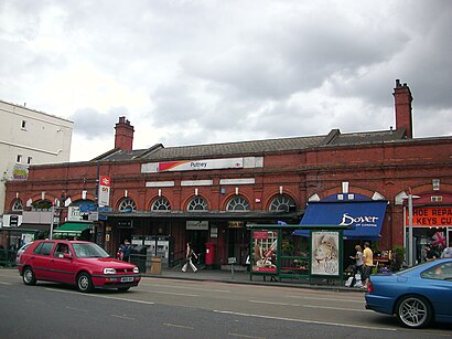
See Putney on the map
Directions to Putney with public transportation
The following transport lines have routes that pass near Putney
 Bus:
Bus: - Train:
- Tube:
- River Bus:
How to get to Putney by bus?
Click on the bus route to see step by step directions with maps, line arrival times and updated time schedules.
How to get to Putney by train?
Click on the train route to see step by step directions with maps, line arrival times and updated time schedules.
How to get to Putney by Tube?
Click on the Tube route to see step by step directions with maps, line arrival times and updated time schedules.
Bus stations near Putney
- Lytton Grove (PJ),2 min walk,
- Putney Heath / Green Man (L),7 min walk,
- Putney Station (G),8 min walk,
- Putney Arts Theatre (J),9 min walk,
Tube stations near Putney
- East Putney,4 min walk,
River Bus stations near Putney
- Putney Pier,30 min walk,
Bus routes to Putney
- 14,Russell Square - Putney Heath,
- 37,Peckham - Putney Heath,
- 39,Clapham Junction - Putney Bridge,
- 85,Kingston - Putney Bridge,
- 93,Putney Bridge - North Cheam,
- 424,Fulham, Craven Cottage - Putney Heath,
- 170,Victoria,
- 493,Tooting, St. George's Hospital,
- 639,St John Bosco College,
- 670,St John Bosco College,
- 337,Richmond,
- N74,Baker Street Station,
- 430,South Kensington,
What are the nearest stations to Putney?
The nearest stations to Putney are:
- Lytton Grove (PJ) is 92 meters away, 2 min walk.
- East Putney is 280 meters away, 4 min walk.
- Putney Heath / Green Man (L) is 499 meters away, 7 min walk.
- Putney Station (G) is 539 meters away, 8 min walk.
- Putney Arts Theatre (J) is 664 meters away, 9 min walk.
- Putney Pier is 2283 meters away, 30 min walk.
Which bus lines stop near Putney?
These bus lines stop near Putney: 14, 37, 39, 424, 85, 93.
Which train line stops near Putney?
SOUTH WESTERN RAILWAY
Which Tube line stops near Putney?
DISTRICT
What’s the nearest Tube station to Putney?
The nearest Tube station to Putney is East Putney. It’s a 4 min walk away.
What’s the nearest bus stop to Putney?
The nearest bus stop to Putney is Lytton Grove (PJ). It’s a 2 min walk away.
What’s the nearest River Bus station to Putney?
The nearest River Bus station to Putney is Putney Pier. It’s a 30 min walk away.
What time is the first Tube to Putney?
The DISTRICT is the first Tube that goes to Putney. It stops nearby at 05:00.
What time is the last Tube to Putney?
The DISTRICT is the last Tube that goes to Putney. It stops nearby at 01:02.
What time is the first bus to Putney?
The 93 is the first bus that goes to Putney. It stops nearby at 03:00.
What time is the last bus to Putney?
The 14 is the last bus that goes to Putney. It stops nearby at 03:49.
What time is the first River Bus to Putney?
The RB6 is the first River Bus that goes to Putney. It stops nearby at 06:30.
What time is the last River Bus to Putney?
The RB6 is the last River Bus that goes to Putney. It stops nearby at 21:33.
See Putney on the map
Public Transportation to Putney
Wondering how to get to Putney, United Kingdom? Moovit helps you find the best way to get to Putney with step-by-step directions from the nearest public transit station.
Moovit provides free maps and live directions to help you navigate through your city. View schedules, routes, timetables, and find out how long does it take to get to Putney in real time.
Looking for the nearest stop or station to Putney? Check out this list of stops closest to your destination: Lytton Grove (PJ); East Putney; Putney Heath / Green Man (L); Putney Station (G); Putney Arts Theatre (J); Putney Pier.
Bus:Train:Tube:River Bus:
Want to see if there’s another route that gets you there at an earlier time? Moovit helps you find alternative routes or times. Get directions from and directions to Putney easily from the Moovit App or Website.
We make riding to Putney easy, which is why over 1.5 million users, including users in Putney, trust Moovit as the best app for public transit. You don’t need to download an individual bus app or train app, Moovit is your all-in-one transit app that helps you find the best bus time or train time available.
For information on prices of bus, train and Tube, costs and ride fares to Putney, please check the Moovit app.
Use the app to navigate to popular places including to the airport, hospital, stadium, grocery store, mall, coffee shop, school, college, and university.
Putney Address: Chartfield Avenue Putney London SW15 6 street in Putney
Attractions near Putney
Hdspace Limited,KFH Estate Agents,Orison Tech Limited,Cardtronics,Sustainable Hospitality Alliance,Russell-Cooke Solicitors,Events Limited,Russell Cooke,Form New Co,Putney High School,Aux,Chocolate Films Workshops,Sandringham Court,Prospect House School,Langham Court Limited,Trampas Trading,BPR Architects,Ravenna Estate,Ofcc Limited,Fantastic RemovalsHow to get to popular attractions in Putney with public transportation
Heathrow Terminal 3, Heathrow,Acton, Acton,South Oxhey, South Oxhey,Virgin Active, Acton,Reading College, Reading,Stratford Station, Stratford,Victoria Bus Station, Westminster,Windsor Royal Shopping, Windsor,Cassiobury Park, Watford,Gatwick Airport, Crawley,Feltham, Feltham,Renaissance London Heathrow Hotel, Heathrow,King's Cross St Pancras Underground Station, Pentonville,Royal Observatory Greenwich, Greenwich,Folkestone Bus Station, Shepway,Bellerbys College, Brighton And Hove,The Whittington Hospital, Upper Holloway,Nuffield Health Newbury Fitness & Wellbeing Gym, Newbury (W Berks),Hampton Court Palace, Hampton Court,Chinatown, SohoGet around Putney by public transport!
Travelling around Putney has never been so easy. See step by step directions as you travel to any attraction, street or major public transport station. View bus and train timetables, arrival times, service alerts and detailed routes on a map, so you know exactly how to get to anywhere in Putney.
When travelling to any destination around Putney use Moovit's Live Directions with Get Off Notifications to know exactly where and how far to walk, how long to wait for your line , and how many stops are left. Moovit will alert you when it’s time to get off — no need to constantly re-check whether yours is the next stop.
Wondering how to use public transport in Putney or how to pay for public transport in Putney? Moovit public transport app can help you navigate your way with public transport easily, and at minimum cost. It includes public transport fees, ticket prices, and costs. Looking for a map of Putney public transport lines? Moovit public transport app shows all public transport maps in Putney with all bus, train or Tube routes and stops on an interactive map.
Putney has 3 transport type(s), including: bus, train or Tube, operated by several transport agencies, including London Underground, London Buses, Transport for London, London Tramlink, Transport for London, National Rail, Bluestar, Berry's Coaches, Oxford Bus Company, Stagecoach West, Community First Wessex, Cresta Coaches, D & P Boat Hire, First Portsmouth, Fareham & Gosport and FYTbus