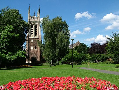
Get to Stapenhill by taxi
See Stapenhill, Burton Upon Trent, on the map
Directions to Stapenhill (Burton Upon Trent) with public transport
The following transport lines have routes that pass near Stapenhill
Bus:
Train:
How to get to Stapenhill by Bus?
Click on the Bus route to see step by step directions with maps, line arrival times and updated time schedules.
How to get to Stapenhill by Train?
Click on the Train route to see step by step directions with maps, line arrival times and updated time schedules.
Which Bus lines stop near Stapenhill?
These Bus lines stop near Stapenhill: 2, 21
Which Train lines stop near Stapenhill?
These Train lines stop near Stapenhill: CROSSCOUNTRY
See Stapenhill, Burton Upon Trent, on the map

Public Transit to Stapenhill in Burton Upon Trent
Wondering how to get to Stapenhill in Burton Upon Trent, United Kingdom? Moovit helps you find the best way to get to Stapenhill with step-by-step directions from the nearest public transit station.
Moovit provides free maps and live directions to help you navigate through your city. View schedules, routes, timetables, and find out how long does it take to get to Stapenhill in real time.
Bus:Train:
Want to see if there’s another route that gets you there at an earlier time? Moovit helps you find alternative routes or times. Get directions from and directions to Stapenhill easily from the Moovit App or Website.
We make riding to Stapenhill easy, which is why over 1.5 million users, including users in Burton Upon Trent, trust Moovit as the best app for public transit. You don’t need to download an individual bus app or train app, Moovit is your all-in-one transit app that helps you find the best bus time or train time available.
For information on prices of Bus and Train, costs and ride fares to Stapenhill, please check the Moovit app.
Use the app to navigate to popular places including to the airport, hospital, stadium, grocery store, mall, coffee shop, school, college, and university.
Location: Burton Upon Trent, West Midlands

Attractions near Stapenhill
- South Stapenhill Social Club
- Stonham Housing Association Ltd.
- Midway School Of Motoring
- Heath Road (heath rosliston)
- Heath Rosliston
- STEFAN SMITH & ASSOCIATES LTD
- Needham, P
- B G Baker
- 28 Rosliston Road
- 3 Hawthorn Crescent
- System for Business
- Ivy Lodge Close, Burton upon Trent
- David Preece
- Stapenhill Surgery
- Highland Veterinary Clinic
- Beaufort Dental Health Centre
- Firs Day Nursery
- Immanuel Church
- De15 9rd
- Pearlydean Marketing
How to get to popular attractions in Burton Upon Trent with public transportation
- Birmingham Snow Hill, Ladywood
- Coleshill, Coleshill South
- PSA Peugeot Citroen HQ, Lower Stoke
- Joseph Chamberlain 6th Form College, Sparkbrook & Balsall Heath East
- Aston University, Nechells
- The Square Peg, Ladywood
- Great Bridge, Great Bridge
- The Nec Birmingham, Bickenhill
- Selly Oak, Bournville & Cotteridge
- The Mailbox, Ladywood
- Kingstanding Circle, Oscott
- University College Birmingham, Soho & Jewellery Quarter
- Birmingham Coach Station, Bordesley & Highgate
- Queen Mary's Grammar School, Paddock
- Harborne, Harborne
- Rowley Regis Hospital, Blackheath
- Olton, Olton
- Bewdley Bridge, Bewdley & Rock
- Bartley Green, Bartley Green
- Hilton Birmingham Metropole, Bickenhill