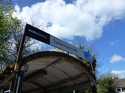
Directions to Sydenham Hill Station with public transportation
The following transport lines have routes that pass near Sydenham Hill Station
How to get to Sydenham Hill Station by bus?
Click on the bus route to see step by step directions with maps, line arrival times and updated time schedules.
How to get to Sydenham Hill Station by train?
Click on the train route to see step by step directions with maps, line arrival times and updated time schedules.
Bus stations near Sydenham Hill Station
- Sydenham Hill, 1 min walk,
- Kingswood Drive / College Road (D), 7 min walk,
- Wells Park Road (H), Dulwich, 7 min walk,
- Canbury Mews (D), 8 min walk,
- Dulwich Wood Park / College Road (R), 10 min walk,
Train stations near Sydenham Hill Station
- Crystal Palace, 8 min walk,
- Tulse Hill, 9 min walk,
Bus routes to Sydenham Hill Station
- SOUTHEASTERN, London Blackfriars,
- 450, West Croydon,
- N63, King's Cross,
- 202, Blackheath, Royal Standard,
- 363, Elephant & Castle,
- 356, Upper Sydenham,
- 3, Victoria,
- N3, Oxford Circus,
What are the nearest stations to Sydenham Hill Station?
The nearest stations to Sydenham Hill Station are:
- Sydenham Hill is 10 meters away, 1 min walk.
- Kingswood Drive / College Road (D) is 476 meters away, 7 min walk.
- Wells Park Road (H), Dulwich is 507 meters away, 7 min walk.
- Crystal Palace is 563 meters away, 8 min walk.
- Canbury Mews (D) is 596 meters away, 8 min walk.
- Tulse Hill is 693 meters away, 9 min walk.
- Dulwich Wood Park / College Road (R) is 738 meters away, 10 min walk.
Which bus lines stop near Sydenham Hill Station?
These bus lines stop near Sydenham Hill Station: 202, 3, 363.
Which train line stops near Sydenham Hill Station?
SOUTHEASTERN
What’s the nearest train station to Sydenham Hill Station?
The nearest train station to Sydenham Hill Station is Crystal Palace. It’s a 8 min walk away.
What’s the nearest bus stop to Sydenham Hill Station?
The nearest bus stop to Sydenham Hill Station is Sydenham Hill. It’s a 1 min walk away.
What time is the first train to Sydenham Hill Station?
The OVERGROUND is the first train that goes to Sydenham Hill Station. It stops nearby at 07:01.
What time is the last train to Sydenham Hill Station?
The SOUTHEASTERN is the last train that goes to Sydenham Hill Station. It stops nearby at 00:12.
What time is the first bus to Sydenham Hill Station?
The N63 is the first bus that goes to Sydenham Hill Station. It stops nearby at 03:02.
What time is the last bus to Sydenham Hill Station?
The N3 is the last bus that goes to Sydenham Hill Station. It stops nearby at 03:28.
See Sydenham Hill Station on the map
Public Transportation to Sydenham Hill Station
Wondering how to get to Sydenham Hill Station, United Kingdom? Moovit helps you find the best way to get to Sydenham Hill Station with step-by-step directions from the nearest public transit station.
Moovit provides free maps and live directions to help you navigate through your city. View schedules, routes, timetables, and find out how long does it take to get to Sydenham Hill Station in real time.
Looking for the nearest stop or station to Sydenham Hill Station? Check out this list of stops closest to your destination: Sydenham Hill; Kingswood Drive / College Road (D); Wells Park Road (H); Crystal Palace; Canbury Mews (D); Tulse Hill; Dulwich Wood Park / College Road (R).
Bus: 202, 3, 363, SOUTHEASTERN, 450, N63, 356.Train: SOUTHEASTERN, OVERGROUND, SOUTHERN, SOUTHERN, THAMESLINK.
Want to see if there’s another route that gets you there at an earlier time? Moovit helps you find alternative routes or times. Get directions from and directions to Sydenham Hill Station easily from the Moovit App or Website.
We make riding to Sydenham Hill Station easy, which is why over 1.5 million users, including users in Sydenham Hill, trust Moovit as the best app for public transit. You don’t need to download an individual bus app or train app, Moovit is your all-in-one transit app that helps you find the best bus time or train time available.
For information on prices of train, bus and Tube, costs and ride fares to Sydenham Hill Station, please check the Moovit app.
Use the app to navigate to popular places including to the airport, hospital, stadium, grocery store, mall, coffee shop, school, college, and university.
Sydenham Hill Station Address: College Road SE21 London SE21 7 street in Sydenham Hill
Attractions near Sydenham Hill Station
Sydenham Hill Train Station,Dulwich College College Road,Dulwich College,Sydenham Hill (Syh),Ducks,Peters Dance Club,St Stephens C of E Church,Seeley Drive Kingswood Estate,SE21 8NX,SE21 8QR,Crystal Palace,Bowen Drive,Lk Medical Services Limited,Huntley House,Mary Datchelor Playing Field,Kingswood Estate,Wood House Dulwich,Kingsdale Foundation School,SE26 6RS,Dulwich Prep LondonHow to get to popular attractions in Sydenham Hill with public transportation
Churchill Square, Brighton And Hove,Hammersmith Hospital, White City,Hillingdon Hospital, Hillingdon,Catford, Catford,Imperial War Museum, Elephant & Castle,Hammersmith, Hammersmith,Whetstone Audi, Whetstone,St Thomas' Hospital, Waterloo,Virgin Active, Wimbledon,Oxford Circus, Soho,Middlesex University, Hendon,Ealing Hospital, Hanwell,Dorking, Dorking,Bognor Regis, Bognor Regis,London Waterloo Station, Waterloo,Bluewater, Greenhithe,Uxbridge College, Uxbridge,Portobello Road Market, Notting Hill,The Spaniards Inn, Highgate,Churchill Square Shopping Centre, Brighton And HoveGet around London by public transport!
Travelling around London has never been so easy. See step by step directions as you travel to any attraction, street or major public transport station. View bus and train timetables, arrival times, service alerts and detailed routes on a map, so you know exactly how to get to anywhere in London.
When travelling to any destination around London use Moovit's Live Directions with Get Off Notifications to know exactly where and how far to walk, how long to wait for your line , and how many stops are left. Moovit will alert you when it’s time to get off — no need to constantly re-check whether yours is the next stop.
Wondering how to use public transport in London or how to pay for public transport in London? Moovit public transport app can help you navigate your way with public transport easily, and at minimum cost. It includes public transport fees, ticket prices, and costs. Looking for a map of London public transport lines? Moovit public transport app shows all public transport maps in London with all Bus, Train, Tube, Tramlink, River Bus and DLR routes and stops on an interactive map.
London has 6 transport type(s), including: Bus, Train, Tube, Tramlink, River Bus and DLR, operated by several transport agencies, including London Underground, London Buses, Transport for London, London Tramlink, National Rail, Bluestar, Berry's Coaches, Oxford Bus Company, Stagecoach West, Community First Wessex, Cresta Coaches, D & P Boat Hire, First Portsmouth, Fareham & Gosport, FYTbus, IFS Cloud Cable Car