Directions to Taringa station with public transport
The following transport lines have routes that pass near Taringa
How to get to Taringa station by bus?
Click on the bus route to see step by step directions with maps, line arrival times and updated time schedules.
How to get to Taringa station by train?
Click on the train route to see step by step directions with maps, line arrival times and updated time schedules.
Bus stops near Taringa
- Stanley Tce at Harrys Road, Stop 18, 3 min walk,
- Josling St at Perrin Park, Stop 18, 7 min walk,
- Moggill Rd at Bbc, Stop 16, 7 min walk,
- Oxford Tce Near Lucinda St, Stop 22/16, 8 min walk,
Train stations near Taringa
- Taringa Station, 9 min walk,
- Indooroopilly Station, 26 min walk,
Ferry station near Taringa
- Regatta Ferry Terminal, 16 min walk,
Bus lines to Taringa station
- 415, Spring Hill, Wickham Tce,
- 417, Long Pocket,
- 425, Chapel Hill - City Express,
- 430, Fig Tree Pocket - City Express,
- 433, Kenmore South - City,
- 435, Brookfield - City Express,
- 444, Moggill - City Express,
- 445, Fig Tree Pocket - City,
- N449, Valley - Riverhills Nightlink Via Indooroopilly,
- 450, Riverhills - City Express Via Mt Ommaney,
- 453, Mt Ommaney - City Express,
- 454, Riverhills - City Express,
- 460, Heathwood - City Express,
- 598, Great Circle Line Anti-clockwise,
- 414, Indooroopilly Interchange,
- 599, Toowong, High St,
What are the nearest stations to Taringa?
The nearest stations to Taringa are:
- Stanley Tce at Harrys Road, Stop 18 is 174 meters away, 3 min walk.
- Josling St at Perrin Park, Stop 18 is 470 meters away, 7 min walk.
- Moggill Rd at Bbc, Stop 16 is 512 meters away, 7 min walk.
- Oxford Tce Near Lucinda St, Stop 22/16 is 572 meters away, 8 min walk.
- Taringa Station is 620 meters away, 9 min walk.
- Regatta Ferry Terminal is 1165 meters away, 16 min walk.
- Indooroopilly Station is 1979 meters away, 26 min walk.
Which bus lines stop near Taringa?
These bus lines stop near Taringa: 415, 425, 430, 444, 445.
Which train lines stop near Taringa?
These train lines stop near Taringa: CAIP, CASP, NAIP.
What’s the nearest train station to Taringa?
The nearest train station to Taringa is Taringa Station. It’s a 9 min walk away.
What’s the nearest bus station to Taringa?
The nearest bus station to Taringa is Stanley Tce at Harrys Road, Stop 18. It’s a 3 min walk away.
What’s the nearest ferry station to Taringa?
The nearest ferry station to Taringa is Regatta Ferry Terminal. It’s a 16 min walk away.
What time is the first train to Taringa?
The RPSP is the first train that goes to Taringa. It stops nearby at 04:52.
What time is the last train to Taringa?
The IPBR is the last train that goes to Taringa. It stops nearby at 00:26.
What time is the first bus to Taringa?
The 453 is the first bus that goes to Taringa. It stops nearby at 05:33.
What time is the last bus to Taringa?
The 425 is the last bus that goes to Taringa. It stops nearby at 23:33.
What time is the first ferry to Taringa?
The CITYCAT NORTHSHORE HAMILTON - UQ ST LUCIA is the first ferry that goes to Taringa. It stops nearby at 05:38.
What time is the last ferry to Taringa?
The CITYCAT NORTHSHORE HAMILTON - UQ ST LUCIA is the last ferry that goes to Taringa. It stops nearby at 23:31.
See Taringa on the map
Public Transportation to Taringa
Wondering how to get to Taringa, Australia? Moovit helps you find the best way to get to Taringa with step-by-step directions from the nearest public transit station.
Moovit provides free maps and live directions to help you navigate through your city. View schedules, routes, timetables, and find out how long does it take to get to Taringa in real time.
Looking for the nearest stop or station to Taringa? Check out this list of stops closest to your destination: Stanley Tce at Harrys Road; Josling St at Perrin Park; Moggill Rd at Bbc; Oxford Tce Near Lucinda St; Taringa Station; Regatta Ferry Terminal; Indooroopilly Station.
Bus: 415, 425, 430, 444, 445, 417, 433, 435.Train: CAIP, CASP, NAIP, BRIP, BRSP, CARW, BRRW.Ferry: CITYCAT NORTHSHORE HAMILTON - UQ ST LUCIA, CITYCAT QUT GARDENS POINT - WEST END.
Want to see if there’s another route that gets you there at an earlier time? Moovit helps you find alternative routes or times. Get directions from and directions to Taringa easily from the Moovit App or Website.
We make riding to Taringa easy, which is why over 1.5 million users, including users in Brisbane, trust Moovit as the best app for public transit. You don’t need to download an individual bus app or train app, Moovit is your all-in-one transit app that helps you find the best bus time or train time available.
For information on prices of bus and train, costs and ride fares to Taringa, please check the Moovit app.
Use the app to navigate to popular places including to the airport, hospital, stadium, grocery store, mall, coffee shop, school, college, and university.
Location: Brisbane
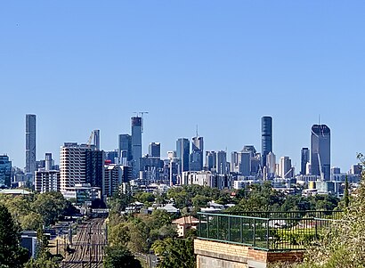
Taringa is a suburb in the City of Brisbane, Queensland, Australia. In the 2021 census, Taringa had a population of 8,732 people.Wiki
Popular routes to Taringa station
Popular routes from Taringa station
Places Near Taringa
How to get to popular places in Brisbane with public transport
Get around Brisbane by public transport!
Travelling around Brisbane has never been so easy. See step by step directions as you travel to any attraction, street or major public transport station. View bus and train timetables, arrival times, service alerts and detailed routes on a map, so you know exactly how to get to anywhere in Brisbane.
When travelling to any destination around Brisbane use Moovit's Live Directions with Get Off Notifications to know exactly where and how far to walk, how long to wait for your line , and how many stops are left. Moovit will alert you when it’s time to get off — no need to constantly re-check whether yours is the next stop.
Wondering how to use public transport in Brisbane or how to pay for public transport in Brisbane? Moovit public transport app can help you navigate your way with public transport easily, and at minimum cost. It includes public transport fees, ticket prices, and costs. Looking for a map of Brisbane public transport lines? Moovit public transport app shows all public transport maps in Brisbane with all Bus, Train, Light rail and Ferry routes and stops on an interactive map.
Brisbane has 4 transport type(s), including: Bus, Train, Light rail and Ferry, operated by several transport agencies, including TransLink, TransLink SEQ, Griffith Uni Intercampus bus, Christensens Bus and Coach and North Stradbroke Island Buses