Twickenham stop - Saturday schedule
| Line | Direction | Time |
|---|---|---|
| SOUTH WESTERN RAILWAY | Bus Replacement: Kingston | 04:30 |
| SOUTH WESTERN RAILWAY | Bus Replacement: Barnes | 04:39 |
| SOUTH WESTERN RAILWAY | Bus Replacement: Barnes | 04:46 |
| SOUTH WESTERN RAILWAY | Virginia Water | 05:03 |
| SOUTH WESTERN RAILWAY | Bus Replacement: Feltham | 05:09 |
| SOUTH WESTERN RAILWAY | London Waterloo | 05:13 |
| SOUTH WESTERN RAILWAY | Bus Replacement: Barnes | 05:20 |
| SOUTH WESTERN RAILWAY | Bus Replacement: Feltham | 05:25 |
| SOUTH WESTERN RAILWAY | Weybridge | 05:32 |
| SOUTH WESTERN RAILWAY | Bus Replacement: Twickenham | 05:36 |
| SOUTH WESTERN RAILWAY | Bus Replacement: Feltham | 05:37 |
| SOUTH WESTERN RAILWAY | London Waterloo | 05:39 |
| SOUTH WESTERN RAILWAY | Bus Replacement: Barnes | 05:40 |
| SOUTH WESTERN RAILWAY | London Waterloo | 05:43 |
| SOUTH WESTERN RAILWAY | Bus Replacement: Kingston | 05:44 |
| SOUTH WESTERN RAILWAY | Bus Replacement: Feltham | 05:47 |
| SOUTH WESTERN RAILWAY | Virginia Water | 05:48 |
| SOUTH WESTERN RAILWAY | Reading | 05:48 |
| SOUTH WESTERN RAILWAY | Bus Replacement: Barnes | 05:50 |
| SOUTH WESTERN RAILWAY | London Waterloo | 05:53 |
| SOUTH WESTERN RAILWAY | Bus Replacement: Twickenham | 05:59 |
| SOUTH WESTERN RAILWAY | Bus Replacement: Barnes | 06:00 |
| SOUTH WESTERN RAILWAY | Twickenham | 06:05 |
| SOUTH WESTERN RAILWAY | Bus Replacement: Feltham | 06:07 |
| SOUTH WESTERN RAILWAY | Virginia Water | 06:10 |
Directions to Twickenham stop with public transport
The following transport lines have routes that pass near Twickenham
How to get to Twickenham stop by bus?
Click on the bus route to see step by step directions with maps, line arrival times and updated time schedules.
How to get to Twickenham stop by train?
Click on the train route to see step by step directions with maps, line arrival times and updated time schedules.
How to get to Twickenham stop by Tube?
Click on the Tube route to see step by step directions with maps, line arrival times and updated time schedules.
Bus stops near Twickenham stop
- Twickenham Station (C), 1 min walk,
- Twickenham Station (B), 1 min walk,
- Arragon Road (D), 2 min walk,
- York Street / Twickenham (G), 6 min walk,
Tube stations near Twickenham station
- Hounslow East, 5 min walk,
Train stations near Twickenham station
- Richmond, 7 min walk,
Bus lines to Twickenham stop
- H22, West Middlesex Hospital,
- 267, Fulwell,
- 281, Hounslow, Bus Station,
- 681, Teddington School,
- 290, Staines,
- N22, Fulwell,
- 33, Castelnau, Lonsdale Road,
- N33, Hammersmith,
- R68, Kew, Retail Park,
- R70, Richmond, Manor Circus,
- 490, Richmond, Pools on the Park,
What are the nearest stations to Twickenham?
The nearest stations to Twickenham are:
- Twickenham Station (C) is 6 meters away, 1 min walk.
- Twickenham Station (B) is 15 meters away, 1 min walk.
- Arragon Road (D) is 132 meters away, 2 min walk.
- Hounslow East is 335 meters away, 5 min walk.
- York Street / Twickenham (G) is 396 meters away, 6 min walk.
- Richmond is 483 meters away, 7 min walk.
Which bus lines stop near Twickenham?
These bus lines stop near Twickenham: 267, 281, 490.
Which train lines stop near Twickenham?
These train lines stop near Twickenham: MILDMAY LINE, SOUTH WESTERN RAILWAY.
Which Tube line stops near Twickenham?
DISTRICT (Richmond)
What’s the nearest Tube station to Twickenham?
The nearest Tube station to Twickenham is Hounslow East. It’s a 5 min walk away.
What’s the nearest train station to Twickenham?
The nearest train station to Twickenham is Richmond. It’s a 7 min walk away.
What’s the nearest bus station to Twickenham?
The nearest bus stations to Twickenham are Twickenham Station (C) and Twickenham Station (B). The closest one is a 1 min walk away.
What time is the first Tube to Twickenham?
The PICCADILLY is the first Tube that goes to Twickenham. It stops nearby at 03:24.
What time is the last Tube to Twickenham?
The DISTRICT is the last Tube that goes to Twickenham. It stops nearby at 00:54.
What time is the first train to Twickenham?
The SOUTH WESTERN RAILWAY is the first train that goes to Twickenham. It stops nearby at 06:40.
What time is the last train to Twickenham?
The SOUTH WESTERN RAILWAY is the last train that goes to Twickenham. It stops nearby at 00:38.
What time is the first bus to Twickenham?
The N33 is the first bus that goes to Twickenham. It stops nearby at 03:08.
What time is the last bus to Twickenham?
The N22 is the last bus that goes to Twickenham. It stops nearby at 03:50.
See Twickenham stop on the map
Public transport to Twickenham stop
Looking for directions to Twickenham in Twickenham, United Kingdom?
Download the Moovit App to find the current schedule and step-by-step directions for Bus, Train or Tube routes that pass through Twickenham.
Looking for the nearest stops closest to Twickenham ? Check out this list of closest stops to your destination: Twickenham Station (C); Twickenham Station (B); Arragon Road (D); Hounslow East; York Street / Twickenham (G); Richmond.
Bus: 267, 281, 490, H22, 681, 290, N22, 33, N33, R68, R70.Train: MILDMAY LINE, SOUTH WESTERN RAILWAY, DISTRICT.Tube: DISTRICT, PICCADILLY.
We make riding on public transit to Twickenham easy, which is why over 1.5 million users, including users in Twickenham trust Moovit as the best app for public transit.
Use the app to navigate to popular places including to the airport, hospital, stadium, grocery store, mall, coffee shop, school, college, and university.
The stop has the following entrances: Car Park Entrance, London Road Entrance and London Road Entrance
The first line to this stop is SOUTH WESTERN RAILWAY, at 04:30, and the last line is SOUTH WESTERN RAILWAY at 02:39.
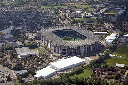
Mary's Terrace, London, England, United Kingdom
This stop serves National Rail and National Rail’s lines
Popular routes to Twickenham stop
Popular routes from Twickenham stop
Bus stops near Twickenham stop
Tube station near Twickenham station
Train station near Twickenham station
Popular public transport stations in Twickenham
Get around Twickenham by public transport!
Travelling around Twickenham has never been so easy. See step by step directions as you travel to any attraction, street or major public transport station. View bus and train timetables, arrival times, service alerts and detailed routes on a map, so you know exactly how to get to anywhere in Twickenham.
When travelling to any destination around Twickenham use Moovit's Live Directions with Get Off Notifications to know exactly where and how far to walk, how long to wait for your line , and how many stops are left. Moovit will alert you when it’s time to get off — no need to constantly re-check whether yours is the next stop.
Wondering how to use public transport in Twickenham or how to pay for public transport in Twickenham? Moovit public transport app can help you navigate your way with public transport easily, and at minimum cost. It includes public transport fees, ticket prices, and costs. Looking for a map of Twickenham public transport lines? Moovit public transport app shows all public transport maps in Twickenham with all Bus, Train, Tube, Tramlink, River Bus and DLR routes and stops on an interactive map.
London has 6 transport type(s), including: Bus, Train, Tube, Tramlink, River Bus and DLR, operated by several transport agencies, including London Buses, Transport for London, London Underground, London River Services, National Rail, Luton Airport Shuttle, Bayliss Executive Travel, Edward Thomas, Metrobus, Coggeshall Community Bus, Tendring Community Transport, Sullivan Buses, Z & S Transport, Central Connect and Compass Travel