Directions to West Hampstead Thameslink with public transportation
The following transport lines have routes that pass near West Hampstead Thameslink
How to get to West Hampstead Thameslink by bus?
Click on the bus route to see step by step directions with maps, line arrival times and updated time schedules.
How to get to West Hampstead Thameslink by train?
Click on the train route to see step by step directions with maps, line arrival times and updated time schedules.
How to get to West Hampstead Thameslink by Tube?
Click on the Tube route to see step by step directions with maps, line arrival times and updated time schedules.
Bus stations near West Hampstead Thameslink
- West Hampstead Thameslink, 2 min walk,
- West Hampstead Station (N), 3 min walk,
- West Hampstead, 4 min walk,
Tube stations near West Hampstead Thameslink
- West Hampstead, 4 min walk,
- Finchley Road, 15 min walk,
Bus routes to West Hampstead Thameslink
- THAMESLINK, Herne Hill,
- C11, Brent Cross, Shopping Centre,
- 139, Waterloo,
- 328, Chelsea, World's End,
- OVERGROUND, Bus Replacement: Willesden Junction,
- OVERGROUND, Stratford (London),
What are the nearest stations to West Hampstead Thameslink?
The nearest stations to West Hampstead Thameslink are:
- West Hampstead Thameslink is 128 meters away, 2 min walk.
- West Hampstead Station (N) is 145 meters away, 3 min walk.
- West Hampstead is 228 meters away, 4 min walk.
- Finchley Road is 1126 meters away, 15 min walk.
Which bus lines stop near West Hampstead Thameslink?
These bus lines stop near West Hampstead Thameslink: 139, 328.
Which train lines stop near West Hampstead Thameslink?
These train lines stop near West Hampstead Thameslink: OVERGROUND, THAMESLINK.
Which Tube line stops near West Hampstead Thameslink?
JUBILEE
What’s the nearest Tube station to West Hampstead Thameslink?
The nearest Tube station to West Hampstead Thameslink is West Hampstead. It’s a 4 min walk away.
What’s the nearest bus stop to West Hampstead Thameslink?
The nearest bus stop to West Hampstead Thameslink is West Hampstead Thameslink. It’s a 2 min walk away.
What time is the first Tube to West Hampstead Thameslink?
The METROPOLITAN is the first Tube that goes to West Hampstead Thameslink. It stops nearby at 05:07.
What time is the last Tube to West Hampstead Thameslink?
The METROPOLITAN is the last Tube that goes to West Hampstead Thameslink. It stops nearby at 00:54.
What time is the first bus to West Hampstead Thameslink?
The 139 is the first bus that goes to West Hampstead Thameslink. It stops nearby at 03:17.
What time is the last bus to West Hampstead Thameslink?
The 139 is the last bus that goes to West Hampstead Thameslink. It stops nearby at 03:24.
What time is the first train to West Hampstead Thameslink?
The THAMESLINK is the first train that goes to West Hampstead Thameslink. It stops nearby at 03:20.
What time is the last train to West Hampstead Thameslink?
The THAMESLINK is the last train that goes to West Hampstead Thameslink. It stops nearby at 03:52.
How much is the bus fare to West Hampstead Thameslink?
The bus fare to West Hampstead Thameslink costs about £1.65.
How much is the train fare to West Hampstead Thameslink?
The train fare to West Hampstead Thameslink costs about £1.60 - £17.00.
How much is the Tube fare to West Hampstead Thameslink?
The Tube fare to West Hampstead Thameslink costs about £1.60 - £5.50.
See West Hampstead Thameslink on the map
Public Transportation to West Hampstead Thameslink
Wondering how to get to West Hampstead Thameslink, United Kingdom? Moovit helps you find the best way to get to West Hampstead Thameslink with step-by-step directions from the nearest public transit station.
Moovit provides free maps and live directions to help you navigate through your city. View schedules, routes, timetables, and find out how long does it take to get to West Hampstead Thameslink in real time.
Looking for the nearest stop or station to West Hampstead Thameslink? Check out this list of stops closest to your destination: West Hampstead Thameslink; West Hampstead Station (N); West Hampstead; Finchley Road.
Bus: 139, 328, THAMESLINK, C11, OVERGROUND, OVERGROUND.Train: OVERGROUND, THAMESLINK.Tube: JUBILEE, METROPOLITAN.
Want to see if there’s another route that gets you there at an earlier time? Moovit helps you find alternative routes or times. Get directions from and directions to West Hampstead Thameslink easily from the Moovit App or Website.
We make riding to West Hampstead Thameslink easy, which is why over 1.5 million users, including users in West Hampstead, trust Moovit as the best app for public transit. You don’t need to download an individual bus app or train app, Moovit is your all-in-one transit app that helps you find the best bus time or train time available.
For information on prices of Tube, bus and train, costs and ride fares to West Hampstead Thameslink, please check the Moovit app.
Use the app to navigate to popular places including to the airport, hospital, stadium, grocery store, mall, coffee shop, school, college, and university.
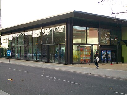
West Hampstead Thameslink Address: Iverson Road street in West Hampstead
Attractions near West Hampstead Thameslink
NWL Solicitors,Aspect,Udare,West Hampstead Thameslink Railway Station (WHP),Bicycle Parking,LOTUS Tantric Massage,Charlotte Guest House,West Hampstead Farmers' Market,195-197 Sumatra Road,Iverson Road,Hyjan Investments Holdings,Find Your Place,Karina Leapman & Co,A.S.B Architects,Carmel Olefins,Charlotte Guest House London,Sandwell Victoria Mansions,West Hampstead,Starbucks West Hampstead,Starbucks (Starbucks West Hampstead)How to get to popular attractions in West Hampstead with public transportation
Lewisham Shopping Centre, Lewisham,Marble Arch, Mayfair,Churchill Square Shopping Centre, Brighton And Hove,Terminal 4, Heathrow,Dorking, Dorking,Science Museum, Kensington,Whitgift Centre, Croydon,Nuffield Health, Hayes Town,Merton, Wimbledon,Crystal Palace, Crystal Palace,Ilford, Ilford,Ferney Road, East Barnet,Heathrow Terminal 4, Heathrow,Emirates Stadium, Highbury,Madame Tussauds, Marylebone,Bexleyheath, Bexleyheath,West Middlesex Hospital, Isleworth,Starbucks, Chiswick,Terminal 3, Heathrow,Waterloo Station, WaterlooGet around London by public transport!
Travelling around London has never been so easy. See step by step directions as you travel to any attraction, street or major public transport station. View bus and train timetables, arrival times, service alerts and detailed routes on a map, so you know exactly how to get to anywhere in London.
When travelling to any destination around London use Moovit's Live Directions with Get Off Notifications to know exactly where and how far to walk, how long to wait for your line , and how many stops are left. Moovit will alert you when it’s time to get off — no need to constantly re-check whether yours is the next stop.
Wondering how to use public transport in London or how to pay for public transport in London? Moovit public transport app can help you navigate your way with public transport easily, and at minimum cost. It includes public transport fees, ticket prices, and costs. Looking for a map of London public transport lines? Moovit public transport app shows all public transport maps in London with all Bus, Train, Tube, Tramlink, River Bus and DLR routes and stops on an interactive map.
London has 6 transport type(s), including: Bus, Train, Tube, Tramlink, River Bus and DLR, operated by several transport agencies, including London Underground, London Buses, Transport for London, London Tramlink, National Rail, Bluestar, Berry's Coaches, Oxford Bus Company, Stagecoach West, Community First Wessex, Cresta Coaches, D & P Boat Hire, First Portsmouth, Fareham & Gosport, FYTbus, IFS Cloud Cable Car