See Westminster Bridge on the map
Directions to Westminster Bridge with public transportation
The following transport lines have routes that pass near Westminster Bridge
 Bus:
Bus: - Train:
- Tube:
- River Bus:
How to get to Westminster Bridge by bus?
Click on the bus route to see step by step directions with maps, line arrival times and updated time schedules.
How to get to Westminster Bridge by train?
Click on the train route to see step by step directions with maps, line arrival times and updated time schedules.
How to get to Westminster Bridge by Tube?
Click on the Tube route to see step by step directions with maps, line arrival times and updated time schedules.
Tube stations near Westminster Bridge
- Westminster,1 min walk,
- Embankment,7 min walk,
Bus stations near Westminster Bridge
- Westminster Stn / Westminster Pier (H),1 min walk,
- Westminster Stn / Parliament Square (G),3 min walk,
- Westminster Stn / Parliament Square (A),3 min walk,
- London Eye, Waterloo,5 min walk,
- Banqueting House, Westminster,6 min walk,
- St Thomas' Hospital / A & E Department (C),8 min walk,
River Bus stations near Westminster Bridge
- Westminster Pier,2 min walk,
Bus routes to Westminster Bridge
- 11,Fulham Broadway,
- 148,White City,
- 12,Dulwich Library,
- N53,Plumstead Station,
- N109,Croydon Town Centre,
- N155,Aldwych,
- 159,Oxford Circus,
- N381,Whitehall, Horse Guards,
- 453,Deptford Bridge,
- N3,Bromley North - Oxford Circus,
- N11,Whitehall, Horse Guards - Ealing Broadway,
- 24,Hampstead Heath - Pimlico,
- 26,Victoria - Hackney Wick,
- N26,Chingford Station - Victoria,
- N44,Sutton Station - Aldwych,
- 87,Aldwych - Wandsworth,
- N87,Aldwych - Kingston,
- 88,Clapham Common - Parliament Hill Fields,
- N136,Chislehurst, War Memorial - Oxford Circus,
- 734,Waterloo,
What are the nearest stations to Westminster Bridge?
The nearest stations to Westminster Bridge are:
- Westminster is 37 meters away, 1 min walk.
- Westminster Stn / Westminster Pier (H) is 60 meters away, 1 min walk.
- Westminster Pier is 94 meters away, 2 min walk.
- Westminster Stn / Parliament Square (G) is 159 meters away, 3 min walk.
- Westminster Stn / Parliament Square (A) is 222 meters away, 3 min walk.
- London Eye, Waterloo is 347 meters away, 5 min walk.
- Banqueting House, Westminster is 414 meters away, 6 min walk.
- Embankment is 512 meters away, 7 min walk.
- St Thomas' Hospital / A & E Department (C) is 606 meters away, 8 min walk.
Which bus lines stop near Westminster Bridge?
These bus lines stop near Westminster Bridge: 11, 148, 24, 26.
Which train lines stop near Westminster Bridge?
These train lines stop near Westminster Bridge: ELIZABETH, SOUTH WESTERN RAILWAY, SOUTHEASTERN.
Which Tube lines stop near Westminster Bridge?
These Tube lines stop near Westminster Bridge: DISTRICT, JUBILEE.
What’s the nearest Tube station to Westminster Bridge?
The nearest Tube station to Westminster Bridge is Westminster. It’s a 1 min walk away.
What’s the nearest bus stop to Westminster Bridge?
The nearest bus stop to Westminster Bridge is Westminster Stn / Westminster Pier (H). It’s a 1 min walk away.
What’s the nearest River Bus station to Westminster Bridge?
The nearest River Bus station to Westminster Bridge is Westminster Pier. It’s a 2 min walk away.
What time is the first Tube to Westminster Bridge?
The DISTRICT is the first Tube that goes to Westminster Bridge. It stops nearby at 05:25.
What time is the last Tube to Westminster Bridge?
The JUBILEE is the last Tube that goes to Westminster Bridge. It stops nearby at 00:47.
What time is the first bus to Westminster Bridge?
The 88 is the first bus that goes to Westminster Bridge. It stops nearby at 03:00.
What time is the last bus to Westminster Bridge?
The N136 is the last bus that goes to Westminster Bridge. It stops nearby at 03:57.
What time is the first River Bus to Westminster Bridge?
The RB6 is the first River Bus that goes to Westminster Bridge. It stops nearby at 06:16.
What time is the last River Bus to Westminster Bridge?
The RB1 is the last River Bus that goes to Westminster Bridge. It stops nearby at 22:34.
See Westminster Bridge on the map
Public Transportation to Westminster Bridge
Wondering how to get to Westminster Bridge, United Kingdom? Moovit helps you find the best way to get to Westminster Bridge with step-by-step directions from the nearest public transit station.
Moovit provides free maps and live directions to help you navigate through your city. View schedules, routes, timetables, and find out how long does it take to get to Westminster Bridge in real time.
Looking for the nearest stop or station to Westminster Bridge? Check out this list of stops closest to your destination: Westminster; Westminster Stn / Westminster Pier (H); Westminster Pier; Westminster Stn / Parliament Square (G); Westminster Stn / Parliament Square (A); London Eye; Banqueting House; Embankment; St Thomas' Hospital / A & E Department (C).
Bus:Train:Tube:River Bus:
Want to see if there’s another route that gets you there at an earlier time? Moovit helps you find alternative routes or times. Get directions from and directions to Westminster Bridge easily from the Moovit App or Website.
We make riding to Westminster Bridge easy, which is why over 1.5 million users, including users in Westminster, trust Moovit as the best app for public transit. You don’t need to download an individual bus app or train app, Moovit is your all-in-one transit app that helps you find the best bus time or train time available.
For information on prices of bus, Tube and train, costs and ride fares to Westminster Bridge, please check the Moovit app.
Use the app to navigate to popular places including to the airport, hospital, stadium, grocery store, mall, coffee shop, school, college, and university.
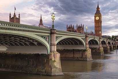
Westminster Bridge Address: Victoria Embankment SW1 London SW1A 2 street in Westminster
Attractions near Westminster Bridge
Westminster @ A3211,A302 Victoria,Victoria Embankment Bridge,Victoria A302,Bridge Street Victoria Embankment,Clock Tower,Boudica Statue,Thames River Party Boats,Chicken Cottage,Kempton Park,Lobby Portcullis House,Μπιγκ Μπεν (Big Ben),Office Of Stephen Twigg MP,Big Ben,Megabus from London to Gent,House of Commons Library,Big Ben (Elizabeth Tower),Bureau de Change,Top Private Tours,Portcullis HouseHow to get to popular attractions in Westminster with public transportation
Southall Police Station, Southall,Whitgift School, South Croydon,Hogwarts School, Abbots Langley,Nuffield Health Newbury Fitness & Wellbeing Gym, Newbury (W Berks),Costco Wholesale, South Croydon,Cassiobury Park, Watford,Windsor Castle, Windsor,Issigonis House, Acton,Hayes Railway Station, Hayes (Kent),Camden Market Hall, Camden Town,Westbourne Studios, Westbourne Park,Golders Green, Golders Green,Charing Cross Hospital, Hammersmith,Chase Farm Hospital, Enfield,Cineworld, Ashford,Clapton Pond, Clapton,Gatwick Airport, Crawley,The Whittington Hospital, Upper Holloway,Hampton Court Palace, Hampton Court,Morden, St HelierGet around Westminster by public transport!
Travelling around Westminster has never been so easy. See step by step directions as you travel to any attraction, street or major public transport station. View bus and train timetables, arrival times, service alerts and detailed routes on a map, so you know exactly how to get to anywhere in Westminster.
When travelling to any destination around Westminster use Moovit's Live Directions with Get Off Notifications to know exactly where and how far to walk, how long to wait for your line , and how many stops are left. Moovit will alert you when it’s time to get off — no need to constantly re-check whether yours is the next stop.
Wondering how to use public transport in Westminster or how to pay for public transport in Westminster? Moovit public transport app can help you navigate your way with public transport easily, and at minimum cost. It includes public transport fees, ticket prices, and costs. Looking for a map of Westminster public transport lines? Moovit public transport app shows all public transport maps in Westminster with all bus, Tube or train routes and stops on an interactive map.
Westminster has 3 transport type(s), including: bus, Tube or train, operated by several transport agencies, including London Underground, London Buses, Transport for London, London Tramlink, Transport for London, National Rail, Bluestar, Berry's Coaches, Oxford Bus Company, Stagecoach West, Community First Wessex, Cresta Coaches, D & P Boat Hire, First Portsmouth, Fareham & Gosport and FYTbus