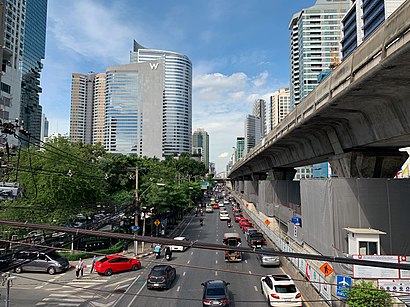
See ถนน สาทรใต้ on the map
Directions to ถนน สาทรใต้ with public transportation
The following transit lines have routes that pass near ถนน สาทรใต้
 Metro:
 - Bus:
- Ferry:
How to get to ถนน สาทรใต้ by bus?
Click on the bus route to see step by step directions with maps, line arrival times and updated time schedules.
How to get to ถนน สาทรใต้ by metro?
Click on the metro route to see step by step directions with maps, line arrival times and updated time schedules.
How to get to ถนน สาทรใต้ by ferry?
Click on the ferry route to see step by step directions with maps, line arrival times and updated time schedules.
Bus stations near ถนน สาทรใต้
- ซอยนราธิวาสราชนครินทร์ 7,ตรงข้ามตึกเอ็มไพน์,4 min walk,
- ศึกษาวิทยา Suksa Wittaya,7 min walk,
Bus lines to ถนน สาทรใต้
- 77,อู่หมอชิต 2 Mochit 2 Bus Depot,
- 77,นิคมรถไฟ กม.11 Nikhom Rotfai Km.11,
- 77 (ปอ.) (AC),อู่สาธุประดิษฐ์ Sathu Pradit Bus Depot,
- 17,แจงร้อน - อนุสาวรีย์ชัยสมรภูมิ Chaeng Ron - Victory Monument,
- 17 (ปอ.) (AC),แจงร้อน - อนุสาวรีย์ชัยสมรภูมิ Jang Ron - Victory Monument,
What are the closest stations to ถนน สาทรใต้?
The closest stations to ถนน สาทรใต้ are:
- ซอยนราธิวาสราชนครินทร์ 7,ตรงข้ามตึกเอ็มไพน์ is 237 meters away, 4 min walk.
- ศึกษาวิทยา Suksa Wittaya is 477 meters away, 7 min walk.
Which metro line stops near ถนน สาทรใต้?
สายสีลม SILOM LINE
Which bus lines stop near ถนน สาทรใต้?
These bus lines stop near ถนน สาทรใต้: 17, 17 (ปอ.) (AC), 77, BRT.
Which ferry line stops near ถนน สาทรใต้?
เรือด่วนธงเหลือง YELLOW FLAG
What’s the nearest bus stop to ถนน สาทรใต้?
The nearest bus stop to ถนน สาทรใต้ is ซอยนราธิวาสราชนครินทร์ 7,ตรงข้ามตึกเอ็มไพน์. It’s a 4 min walk away.
What time is the first metro to ถนน สาทรใต้?
The สายสีลม SILOM LINE is the first metro that goes to ถนน สาทรใต้. It stops nearby at 5:36 AM.
What time is the last metro to ถนน สาทรใต้?
The สายสีลม SILOM LINE is the last metro that goes to ถนน สาทรใต้. It stops nearby at 12:38 AM.
What time is the first bus to ถนน สาทรใต้?
The 77 is the first bus that goes to ถนน สาทรใต้. It stops nearby at 3:09 AM.
What time is the last bus to ถนน สาทรใต้?
The รถสองแถว 1256 is the last bus that goes to ถนน สาทรใต้. It stops nearby at 12:10 AM.
See ถนน สาทรใต้ on the map
Public Transportation to ถนน สาทรใต้
Wondering how to get to ถนน สาทรใต้, Thailand? Moovit helps you find the best way to get to ถนน สาทรใต้ with step-by-step directions from the nearest public transit station.
Moovit provides free maps and live directions to help you navigate through your city. View schedules, routes, timetables, and find out how long does it take to get to ถนน สาทรใต้ in real time.
Looking for the nearest stop or station to ถนน สาทรใต้? Check out this list of stops closest to your destination: ซอยนราธิวาสราชนครินทร์ 7,ตรงข้ามตึกเอ็มไพน์; ศึกษาวิทยา Suksa Wittaya.
Metro:Bus:Ferry:
Want to see if there’s another route that gets you there at an earlier time? Moovit helps you find alternative routes or times. Get directions from and directions to ถนน สาทรใต้ easily from the Moovit App or Website.
We make riding to ถนน สาทรใต้ easy, which is why over 1.5 million users, including users in สาทร, trust Moovit as the best app for public transit. You don’t need to download an individual bus app or train app, Moovit is your all-in-one transit app that helps you find the best bus time or train time available.
For information on prices of bus, metro and ferry, costs and ride fares to ถนน สาทรใต้, please check the Moovit app.
Use the app to navigate to popular places including to the airport, hospital, stadium, grocery store, mall, coffee shop, school, college, and university.
ถนน สาทรใต้ Address: ถนน สาทรใต้ เขต สาทร กรุงเทพมหานคร 10120 ประเทศไทย street in สาทร
Attractions near ถนน สาทรใต้
คาสเคด คลับ,Green Leaf Spa Ascott Sathorn (กรีน ลีฟ สปา),Eternal Resin Co.,ltd@Bangkok City Tower,Piriya Tower,มูลนิธิกองทุนนิยมไทย,13 / 3 โรงแรมสุโขทัย สาทรใต้ ถนนสาทรใต้,27/1 สาทรใต้ ถนนสาทรใต้,Ascott Sathorn Bangkok,อาคารสาธรธานี 2 ชั้น 7,Cat & Nat Publishing (Thailand) Ltd.,Aldo's Mediterranean Bistro & Wine Bar,Thailand Elite Head Office,ถนน สาทร ซอย 1 1,The M Pub Beers n' Beers,ถนน สาทรเหนือ,Chang Puak Camp,106 ซอยศึกษาวิทยา 1 (Soi Sueksa Witthaya 1),Cascade Sport Club,Executive Office @ Ascott Sathorn Bangkok,Ascott Sathorn Bangkok SHA Plus CertifiedHow to get to popular attractions in สาทร with public transit
ประตูน้ำ, ปทุมวัน,ร้านใส่นม, ปากเกร็ด,ท่ารถต่างจังหวัด ขาออก, ธัญบุรี,เยาวราช, สัมพันธวงศ์,The Platinum Fashion Mall, ปทุมวัน,วัดชมภูเวก, เมืองนนทบุรี,ศรแก้ว ต้มตำยำเผา, ทุ่งครุ,โตโยต้าเภตรา, เมืองปทุมธานี,วิทยาลัยวิทยาศาสตร์และเทคโนโลยีการกีฬา, พุทธมณฑล,ตลาดนัดกลางซอยวัจนะ จอมทอง19, จอมทอง,Popular Condominium T2 (Popular Condominium T2 (ป็อปปูล่าคอนโดมิเนี่ยม T2)), ปากเกร็ด,The Colour Living Hotel, เมืองสมุทรปราการ,บ้านสวนปาล์ม, คลองหลวง,เตียกุ่ยฮวด, บางพลี,หมู่บ้านทองพัฒนา, ภาษีเจริญ,ช่อผกา, ธัญบุรี,เอส.เอ มอเตอร์ไซค์, กระทุ่มแบน,วิทยาลัยการปกครอง,BMTA Bus Stop ท่าน้ำนนท์ (Thanam Nonthaburi), เมืองนนทบุรี,พรปิยะแมนชั่น, บางซื่อGet around สาทร by public transit!
Traveling around สาทร has never been so easy. See step by step directions as you travel to any attraction, street or major public transit station. View bus and train schedules, arrival times, service alerts and detailed routes on a map, so you know exactly how to get to anywhere in สาทร.
When traveling to any destination around สาทร use Moovit's Live Directions with Get Off Notifications to know exactly where and how far to walk, how long to wait for your line, and how many stops are left. Moovit will alert you when it's time to get off — no need to constantly re-check whether yours is the next stop.
Wondering how to use public transit in สาทร or how to pay for public transit in สาทร? Moovit public transit app can help you navigate your way with public transit easily, and at minimum cost. It includes public transit fees, ticket prices, and costs. Looking for a map of สาทร public transit lines? Moovit public transit app shows all public transit maps in สาทร with all bus, metro or ferry routes and stops on an interactive map.
สาทร has 3 transit type(s), including: bus, metro or ferry, operated by several transit agencies, including บีทีเอส BTS, MRT, บริษัท ไทย สมายล์ บัส จำกัด;thaismilebus company limited, ขสมก. BMTA, รถไฟฟ้ารฟท. SRTET, รถไฟฟ้ารฟท. SRTET, รถประจำทาง Transport Bus, บีอาร์ที BRT, เรือคลองโดยสาร Canal Ferry, เรือข้ามฟาก River Ferry, รถสองแถว Songthaew, จุฬาป๊อบบัส Chula Pop Bus, ขสมก BMTA, ขสมก. (BMTA) and รถมินิบัส Minibus