Directions to ป้อมปราบศัตรูพ่าย with public transportation
The following transit lines have routes that pass near ป้อมปราบศัตรูพ่าย
How to get to ป้อมปราบศัตรูพ่าย by bus?
Click on the bus route to see step by step directions with maps, line arrival times and updated time schedules.
How to get to ป้อมปราบศัตรูพ่าย by metro?
Click on the metro route to see step by step directions with maps, line arrival times and updated time schedules.
How to get to ป้อมปราบศัตรูพ่าย by ferry?
Click on the ferry route to see step by step directions with maps, line arrival times and updated time schedules.
Bus stations near ป้อมปราบศัตรูพ่าย
- การรถไฟแห่งประเทศไทย State Railway Of Thailand, 2 min walk,
- โรงเรียนเทพศิรินทร์ Thepsirin School, 2 min walk,
- แยกนพวงค์ Noppawong, 2 min walk,
- ท่าปล่อยรถ หัวลำโพง Hua Lamphong Bus Terminal, 3 min walk,
- ไมตรีจิตต์ Maitri Chit, 3 min walk,
- ตรงข้ามโรงเรียนเทพศิรินทร์ Watthepsirin School, 3 min walk,
- วงเวียน 22 กรกฎา Wongwian 22 Kadukhada, 4 min walk,
- โรงพยาบาลกว๋องสิวมูลนิธิ Kwongsiew Hospital, 6 min walk,
Bus lines to ป้อมปราบศัตรูพ่าย
- 7, ท่าปล่อยรถ คลองขวาง Klongkwang Bus Terminal,
- 49, สถานีรถไฟหัวลำโพง Hua Lamphong,
- 49 (ปอ.) (AC), อู่หมอชิต 2 Mochit 2 Bus Depot,
- 204, ท่าราชวงศ์ Tha Ratchawong,
- 53, [เปลี่ยนรถ] ท่าปล่อยรถ สนามหลวง,
- 29, อู่รังสิต Rangsit Bus Depot,
- 34, อู่รังสิต Rangsit Bus Depot,
- 4, ท่าปล่อยรถ ท่าเรือคลองเตย,
- 40 (ปอ.) (AC), Mrt หัวลำโพง(ทางออก 3) Mrt Hua Lamphong (Exit 3),
- 73 (ปอ.) (AC), โรงแรมดิเอมเมอรัล Rongraem Di Em Moe Ran,
- 73ก (ปอ.) (AC), อู่สวนสยาม Siam Park Bus Depot,
- 15, โรงละครแห่งชาติ National Theater,
- 47, สถานีตำรวจพระราชวัง Phrarachawang Police Station,
- 204 (ปอ.) (AC), ท่าราชวงศ์ Tha Ratchawong,
- 508 (ปอ.) (AC), ท่ารถสาย2(ปากคลองตลาด),
- 4 (ปอ.) (AC), ท่าปล่อยรถ ท่าเรือคลองเตย,
- 21, สภากาชาดไทย the Thai Red Cross Society,
- 21 (ปอ.) (AC), วัดคู่สร้าง(ถนนประชาอุทิศ) WAT Koosrang,
- 40, สามย่าน Sam Yan Intersection,
- 1, โรงพยาบาลเจริญกรุง(ตรงข้ามซอยเจริญกรุง 86),
What are the closest stations to ป้อมปราบศัตรูพ่าย?
The closest stations to ป้อมปราบศัตรูพ่าย are:
- การรถไฟแห่งประเทศไทย State Railway Of Thailand is 71 meters away, 2 min walk.
- โรงเรียนเทพศิรินทร์ Thepsirin School is 81 meters away, 2 min walk.
- แยกนพวงค์ Noppawong is 119 meters away, 2 min walk.
- ท่าปล่อยรถ หัวลำโพง Hua Lamphong Bus Terminal is 191 meters away, 3 min walk.
- ไมตรีจิตต์ Maitri Chit is 202 meters away, 3 min walk.
- ตรงข้ามโรงเรียนเทพศิรินทร์ Watthepsirin School is 215 meters away, 3 min walk.
- วงเวียน 22 กรกฎา Wongwian 22 Kadukhada is 268 meters away, 4 min walk.
- โรงพยาบาลกว๋องสิวมูลนิธิ Kwongsiew Hospital is 398 meters away, 6 min walk.
Which metro line stops near ป้อมปราบศัตรูพ่าย?
สายเฉลิมรัชมงคล MRT BLUE LINE
Which bus lines stop near ป้อมปราบศัตรูพ่าย?
These bus lines stop near ป้อมปราบศัตรูพ่าย: 29, 48, 49, 507 (ปอ.) (AC), 7 (ปอ.) (AC), 85.
Which ferry line stops near ป้อมปราบศัตรูพ่าย?
เรือด่วนธงส้ม ORANGE FLAG
What’s the nearest bus stop to ป้อมปราบศัตรูพ่าย?
The nearest bus stops to ป้อมปราบศัตรูพ่าย are การรถไฟแห่งประเทศไทย State Railway Of Thailand, โรงเรียนเทพศิรินทร์ Thepsirin School and แยกนพวงค์ Noppawong. The closest one is a 2 min walk away.
What time is the first metro to ป้อมปราบศัตรูพ่าย?
The สายเฉลิมรัชมงคล MRT BLUE LINE is the first metro that goes to ป้อมปราบศัตรูพ่าย. It stops nearby at 5:52 AM.
What time is the last metro to ป้อมปราบศัตรูพ่าย?
The สายเฉลิมรัชมงคล MRT BLUE LINE is the last metro that goes to ป้อมปราบศัตรูพ่าย. It stops nearby at 12:10 AM.
What time is the first bus to ป้อมปราบศัตรูพ่าย?
The 34 is the first bus that goes to ป้อมปราบศัตรูพ่าย. It stops nearby at 3:00 AM.
What time is the last bus to ป้อมปราบศัตรูพ่าย?
The 34 is the last bus that goes to ป้อมปราบศัตรูพ่าย. It stops nearby at 3:55 AM.
What time is the first ferry to ป้อมปราบศัตรูพ่าย?
The ท่าเรือสวัสดี - ท่าวัดทองธรรมชาติ is the first ferry that goes to ป้อมปราบศัตรูพ่าย. It stops nearby at 6:00 AM.
What time is the last ferry to ป้อมปราบศัตรูพ่าย?
The ท่าเรือสวัสดี - ท่าวัดทองธรรมชาติ is the last ferry that goes to ป้อมปราบศัตรูพ่าย. It stops nearby at 8:03 PM.
See ป้อมปราบศัตรูพ่าย on the map
Public Transportation to ป้อมปราบศัตรูพ่าย
Wondering how to get to ป้อมปราบศัตรูพ่าย, Thailand? Moovit helps you find the best way to get to ป้อมปราบศัตรูพ่าย with step-by-step directions from the nearest public transit station.
Moovit provides free maps and live directions to help you navigate through your city. View schedules, routes, timetables, and find out how long does it take to get to ป้อมปราบศัตรูพ่าย in real time.
Looking for the nearest stop or station to ป้อมปราบศัตรูพ่าย? Check out this list of stops closest to your destination: การรถไฟแห่งประเทศไทย State Railway Of Thailand; โรงเรียนเทพศิรินทร์ Thepsirin School; แยกนพวงค์ Noppawong; ท่าปล่อยรถ หัวลำโพง Hua Lamphong Bus Terminal; ไมตรีจิตต์ Maitri Chit; ตรงข้ามโรงเรียนเทพศิรินทร์ Watthepsirin School; วงเวียน 22 กรกฎา Wongwian 22 Kadukhada; โรงพยาบาลกว๋องสิวมูลนิธิ Kwongsiew Hospital.
Metro: สายเฉลิมรัชมงคล MRT BLUE LINE.Bus: 29, 48, 49, 507 (ปอ.) (AC), 7 (ปอ.) (AC), 85, 204, 7, 49 (ปอ.) (AC), 53, 34, 4, 40 (ปอ.) (AC), 73 (ปอ.) (AC), 73ก (ปอ.) (AC), 15, 47, 204 (ปอ.) (AC), 508 (ปอ.) (AC).Ferry: เรือด่วนธงส้ม ORANGE FLAG.
Want to see if there’s another route that gets you there at an earlier time? Moovit helps you find alternative routes or times. Get directions from and directions to ป้อมปราบศัตรูพ่าย easily from the Moovit App or Website.
We make riding to ป้อมปราบศัตรูพ่าย easy, which is why over 1.5 million users, including users in ป้อมปราบศัตรูพ่าย, trust Moovit as the best app for public transit. You don’t need to download an individual bus app or train app, Moovit is your all-in-one transit app that helps you find the best bus time or train time available.
For information on prices of bus, metro and ferry, costs and ride fares to ป้อมปราบศัตรูพ่าย, please check the Moovit app.
Use the app to navigate to popular places including to the airport, hospital, stadium, grocery store, mall, coffee shop, school, college, and university.
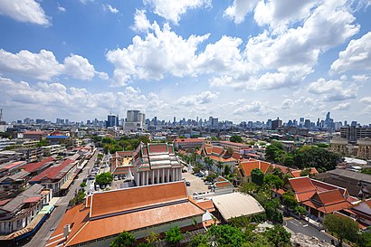
ป้อมปราบศัตรูพ่าย Address: ถนนมิตรพันธ์ street in ป้อมปราบศัตรูพ่าย
Attractions near ป้อมปราบศัตรูพ่าย
พรชัยพนัสขนส่ง,ร้านกุ่ยช่าย เจ๊เกียว ตลาดน้อย,ลิ้มเจ็งไถ่,ลิ้มเจ็งไถ่ (Lim Cheng Thai),ต. ไทยเจริญยางยนต์,บางกอกแอร์คราฟท์เอ็นจิเนียริ่ง,Pro Bigscooter Shop,ทีเอชดีออโต้พาร์ท,จินตพาณิชย์ (จินตพานิช),KASIKORNBANK (ธนาคารกสิกรไทย),โรงเรียนสายปัญญา ในพระบรมราชินูปถัมภ์,บริษัท นำชัยเจริญยนต์ จำกัด,ตึกพระองค์เจ้าสายสนิทวงศ์@saipanya,กรุงเทพค้ากระดาษ แอนด์เทรดดิ้ง,ร้านลุงหม่อม เทพศิรินทร์,Bangkok Bank (ธนาคารกรุงเทพ),เหรียญทอง 1993,ห้างหุ้นส่วนจำกัด กรุงเทพค้ากระดาษ,โรงเรียนสายปัญญา,ห้องสมุดโรงเรียนสายปัญญา l Library Of Saipanya SchoolHow to get to popular attractions in ป้อมปราบศัตรูพ่าย with public transit
Swissotel Bangkok Ratchada SHA Certified, ห้วยขวาง,ซอยมิสทีน, สะพานสูง,ตลาดไท, ธัญบุรี,เดอะ พาซิโอ พาร์ค กาญจนาภิเษก (The Paseo Park Kanchanaphisek), ตลิ่งชัน,รถตู้อ้อมใหญ่-หมอชิต,ซอยวัดกู้, ปากเกร็ด,สถานีเดินรถนครชัยแอร์ กรุงเทพฯ, จตุจักร,วัดเสมียนนารี, จตุจักร,วัดหูช้าง, บางกรวย,BTS กรมทหารราบที่ 11 (N16), บางเขน,วัดชนะสงครามฯ, พระนคร,Seacon Bangkae (ซีคอน บางแค), ภาษีเจริญ,ซอย วัดสัมพันธวงศ์, สัมพันธวงศ์,ศาลหลักเมืองกรุงเทพมหานคร, พระนคร,วัดราชโอรส, จอมทอง,สมาคมประกันชีวิตไทย, สาทร,เคหะบางพลี, บางเสาธง,คิวรถตู้โชคชัย กทม-304 ศรีมหาโพธิ, ราชเทวี,ถนน เจริญกรุง ซอย 30, บางรัก,วินรถตู้ ต.120 ปากน้ำ - หมอชิต, เมืองสมุทรปราการGet around Bangkok by public transit!
Traveling around Bangkok has never been so easy. See step by step directions as you travel to any attraction, street or major public transit station. View bus and train schedules, arrival times, service alerts and detailed routes on a map, so you know exactly how to get to anywhere in Bangkok.
When traveling to any destination around Bangkok use Moovit's Live Directions with Get Off Notifications to know exactly where and how far to walk, how long to wait for your line, and how many stops are left. Moovit will alert you when it's time to get off — no need to constantly re-check whether yours is the next stop.
Wondering how to use public transit in Bangkok or how to pay for public transit in Bangkok? Moovit public transit app can help you navigate your way with public transit easily, and at minimum cost. It includes public transit fees, ticket prices, and costs. Looking for a map of Bangkok public transit lines? Moovit public transit app shows all public transit maps in Bangkok with all Bus, Train, Metro, SkyTrain and Ferry routes and stops on an interactive map.
Bangkok has 5 transit type(s), including: Bus, Train, Metro, SkyTrain and Ferry, operated by several transit agencies, including บีทีเอส BTS, MRT, บริษัท ไทย สมายล์ บัส จำกัด;thaismilebus company limited, ขสมก. BMTA, รถไฟฟ้ารฟท. SRTET, รถประจำทาง Transport Bus, บีอาร์ที BRT, เรือคลองโดยสาร Canal Ferry, เรือข้ามฟาก River Ferry, รถสองแถว Songthaew, จุฬาป๊อบบัส Chula Pop Bus, ขสมก BMTA, ขสมก. (BMTA), รถมินิบัส Minibus, รฟท. SRT