Directions to สะพานพระราม 4 (ปากเกร็ด) with public transportation
The following transit lines have routes that pass near สะพานพระราม 4
How to get to สะพานพระราม 4 by bus?
Click on the bus route to see step by step directions with maps, line arrival times and updated time schedules.
How to get to สะพานพระราม 4 by metro?
Click on the metro route to see step by step directions with maps, line arrival times and updated time schedules.
Ferry stations near สะพานพระราม 4 in ปากเกร็ด
- ท่าปากเกร็ด (ข้ามฟาก);Pakkret Pier (Ferry), 2 min walk,
- ท่าเรือปากเกร็ด;Pakkret Pier, 2 min walk,
Bus stops near สะพานพระราม 4 in ปากเกร็ด
- จุดขึ้นลง;Visual Stop, 2 min walk,
- วัดบ่อ,ท่าน้ำปากเกร็ด,ซอยวัดสนามเหนือ, 4 min walk,
- ท่าเรือปากเกร็ด;Pakkret Pier, 4 min walk,
- สะพานพระราม 4;Rama 4 Bridge, 20 min walk,
- สะพานพระราม 4 Rama IV Bridge, 20 min walk,
Bus lines to สะพานพระราม 4 in ปากเกร็ด
- 1025, ปากเกร็ด;Pak Kret,
- 1029, ถนนศรีสมาน;Srisaman Road,
- 1029, โรงเรียนวัดโพธิ์ทองบน;Pho Thong Bon School,
- 1029, ซอยพระแม่การุณย์;Soi Phra Mae Karun,
- ต.64, อนุสาวรีย์ชัยสมรภูมิ;Victory Monument,
- ต.22, มีนบุรี;Min Buri,
- ต.11, ปากเกร็ด;Pak Kret,
- ต.102, ท่าน้ำปากเกร็ด;Pak Kret Pier,
- 6029, บางใหญ่;Bang Yai,
- 32, วัดบ่อ,ท่าน้ำปากเกร็ด,ซอยวัดสนามเหนือ,
- 166 (ปอ.) (AC), อนุสาวรีย์ชัยสมรภูมิ (เกาะพหลโยธิน),
- ต.10, สถานีขนส่งผู้โดยสารสายเหนือ (หมอชิต 2) - ปากเกร็ด;Bangkok Bus Terminal (Mo Chit 2) - Pak Kret,
- 2-2, ท่าเรือปากเกร็ด - ท่าเรือสี่พระยา; Pak Kret Pier - Si Phraya Pier,
- 2-2, ท่าเรือปากเกร็ด - ท่าเรือสี่พระยา;Pak Kret Pier - Si Phraya Pier,
- ต.22, มีนบุรี - ปากเกร็ด;Min Buri - Pak Kret,
- 52, ท่าเรือปากเกร็ด - หมอชิต 2;Pakkred - Mochit 2,
- ต.64, อนุสาวรีย์ชัยสมรภูมิ - ปากเกร็ด (ทางด่วน);Victory Monument - Pak Kret (Highway),
- ต.97, มหาวิทยาลัยรามคำแหง - ปากเกร็ด;Ramkhamhaeng University - Pak Kret,
- 104, ปากเกร็ด - หมอชิต 2;Pakkred - Mochit 2,
- 166, [ท] เมืองทองธานี - อนุสาวรีย์ชัยสมรภูมิ;[E] Muangthong Thani - Victory Monument,
What are the closest stations to สะพานพระราม 4?
The closest stations to สะพานพระราม 4 are:
- ท่าปากเกร็ด (ข้ามฟาก);Pakkret Pier (Ferry) is 83 meters away, 2 min walk.
- ท่าเรือปากเกร็ด;Pakkret Pier is 83 meters away, 2 min walk.
- จุดขึ้นลง;Visual Stop is 118 meters away, 2 min walk.
- วัดบ่อ,ท่าน้ำปากเกร็ด,ซอยวัดสนามเหนือ is 268 meters away, 4 min walk.
- สะพานพระราม 4;Rama 4 Bridge is 1512 meters away, 20 min walk.
- สะพานพระราม 4 Rama IV Bridge is 1512 meters away, 20 min walk.
Which metro line stops near สะพานพระราม 4?
PINK
Which bus lines stop near สะพานพระราม 4?
These bus lines stop near สะพานพระราม 4: 1025, 6029.
What’s the nearest bus stop to สะพานพระราม 4 in ปากเกร็ด?
The nearest bus stop to สะพานพระราม 4 in ปากเกร็ด is จุดขึ้นลง;Visual Stop. It’s a 2 min walk away.
What’s the nearest ferry station to สะพานพระราม 4 in ปากเกร็ด?
The nearest ferry stations to สะพานพระราม 4 in ปากเกร็ด are ท่าปากเกร็ด (ข้ามฟาก);Pakkret Pier (Ferry) and ท่าเรือปากเกร็ด;Pakkret Pier. The closest one is a 2 min walk away.
What time is the first bus to สะพานพระราม 4 in ปากเกร็ด?
The 166 (ปอ.) (AC) is the first bus that goes to สะพานพระราม 4 in ปากเกร็ด. It stops nearby at 4:33 AM.
What time is the last bus to สะพานพระราม 4 in ปากเกร็ด?
The 2-5 (32) is the last bus that goes to สะพานพระราม 4 in ปากเกร็ด. It stops nearby at 11:40 PM.
What time is the first ferry to สะพานพระราม 4 in ปากเกร็ด?
The เรือข้ามฟาก is the first ferry that goes to สะพานพระราม 4 in ปากเกร็ด. It stops nearby at 5:00 AM.
What time is the last ferry to สะพานพระราม 4 in ปากเกร็ด?
The เรือข้ามฟาก is the last ferry that goes to สะพานพระราม 4 in ปากเกร็ด. It stops nearby at 7:35 PM.
See สะพานพระราม 4, ปากเกร็ด, on the map
Public Transit to สะพานพระราม 4 in ปากเกร็ด
Wondering how to get to สะพานพระราม 4 in ปากเกร็ด, Thailand? Moovit helps you find the best way to get to สะพานพระราม 4 with step-by-step directions from the nearest public transit station.
Moovit provides free maps and live directions to help you navigate through your city. View schedules, routes, timetables, and find out how long does it take to get to สะพานพระราม 4 in real time.
Looking for the nearest stop or station to สะพานพระราม 4? Check out this list of stops closest to your destination: ท่าปากเกร็ด (ข้ามฟาก);Pakkret Pier (Ferry); ท่าเรือปากเกร็ด;Pakkret Pier; จุดขึ้นลง;Visual Stop; วัดบ่อ,ท่าน้ำปากเกร็ด,ซอยวัดสนามเหนือ; สะพานพระราม 4;Rama 4 Bridge; สะพานพระราม 4 Rama IV Bridge.
Metro: PINK.Bus: 1025, 6029, 1029, 1029, 1029, ต.64, ต.22, ต.11, ต.102.Ferry: เรือข้ามฟาก, เรือข้ามฟาก.
Want to see if there’s another route that gets you there at an earlier time? Moovit helps you find alternative routes or times. Get directions from and directions to สะพานพระราม 4 easily from the Moovit App or Website.
We make riding to สะพานพระราม 4 easy, which is why over 1.5 million users, including users in ปากเกร็ด, trust Moovit as the best app for public transit. You don’t need to download an individual bus app or train app, Moovit is your all-in-one transit app that helps you find the best bus time or train time available.
For information on prices of bus and metro, costs and ride fares to สะพานพระราม 4, please check the Moovit app.
Use the app to navigate to popular places including to the airport, hospital, stadium, grocery store, mall, coffee shop, school, college, and university.
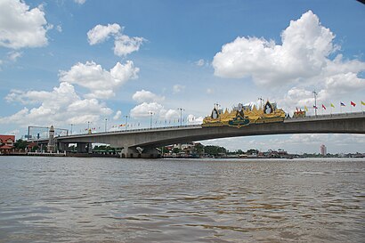
สะพานพระราม 4 Address: ถ.ชัยพฤกษ์ street in ปากเกร็ด
Attractions near สะพานพระราม 4
Rama IV Bridge (สะพานพระราม 4),บริษัท ศรีท่าอ่างอินดัสทรี จำกัด,บริษัท เจ แอล ฟอร์คลิฟท์ แอนด์ พาร์ท จำกัด,แดง ธนาภรณ์ หินอ่อน-แกรนิต จก บริษัท,บริษัท แพน เอเซีย เคเบิ้ล จำกัด,ท่าเรือวัชรีวงศ์,ท่าเรือปากเกร็ด,ท่าเรือปากเกร็ด (Pak Kret Pier) N33,ครัวริมน้ำปากเกร็ด,ปากเกร็ด - วัดเตย,สภาท่าน้ำ,ป้าย รถเมล์หัวถนนปากเกร็ด,ท่าเรือข้ามฟากวัดเตย,ร้านปากเกร็ดแก๊ส สาขาหัวถนนปากเกร็ด,ร้านข้าวมันไก่-ปากเกร็ด,ก๋วยจั๊บป้าจี่,เกียรติธนาขนส่ง,ห้างทองแต้มั่งเชียง,7-11 ท่าเรือฟาร์มอ่างทอง,ป้ายรถเมล์ หัวถนน วัดบ่อ ปากเกร็ดHow to get to popular attractions in ปากเกร็ด with public transit
โรงพยาบาลพระนั่งเกล้า, เมืองนนทบุรี,ท่ารถตู้ บีทีเอสหมอชิต - ฟิวเจอร์รังสิต, จตุจักร,วัดสวนแก้ว, บางใหญ่,สุกี้ตี๋น้อย, จตุจักร,สำนักงานขนส่งกรุงเทพมหานครพื้นที่ 2, ตลิ่งชัน,บิ๊กซี่พระราม4, คลองเตย,Rangsit University (มหาวิทยาลัยรังสิต), เมืองปทุมธานี,หน้าสนามกีฬา กกท., บางกะปิ,แยกเทพารักษ์-สําโรง, เมืองสมุทรปราการ,สายใต้ เซ็นเตอร์ สายใต้ใหม่, ตลิ่งชัน,MRT Sam Yot (BL30 / PP23) (MRT สามยอด), สัมพันธวงศ์,ป้ายรถเมล์เดอะมอลบางกะปิ, บางกะปิ,นั่งเล่น พระราม5, เมืองนนทบุรี,วัดชนะสงครามฯ, พระนคร,เซ็นทรัลพระราม 3, ยานนาวา,พระจอมเกล้าพระนครเหนือ, บางซื่อ,ปัญญาภิวัฒน์ 2, เมืองนนทบุรี,โรงพยาบาลเจริญกรุงประชารักษ์, บางคอแหลม,รัฐสภา เกียกกาย, บางพลัด,Gaysorn Tower (เกษร ทาวเวอร์), ปทุมวันGet around Bangkok by public transit!
Traveling around Bangkok has never been so easy. See step by step directions as you travel to any attraction, street or major public transit station. View bus and train schedules, arrival times, service alerts and detailed routes on a map, so you know exactly how to get to anywhere in Bangkok.
When traveling to any destination around Bangkok use Moovit's Live Directions with Get Off Notifications to know exactly where and how far to walk, how long to wait for your line, and how many stops are left. Moovit will alert you when it's time to get off — no need to constantly re-check whether yours is the next stop.
Wondering how to use public transit in Bangkok or how to pay for public transit in Bangkok? Moovit public transit app can help you navigate your way with public transit easily, and at minimum cost. It includes public transit fees, ticket prices, and costs. Looking for a map of Bangkok public transit lines? Moovit public transit app shows all public transit maps in Bangkok with all Bus, Train, Metro, SkyTrain and Ferry routes and stops on an interactive map.
Bangkok has 5 transit type(s), including: Bus, Train, Metro, SkyTrain and Ferry, operated by several transit agencies, including บีทีเอส BTS, MRT, บริษัท ไทย สมายล์ บัส จำกัด;thaismilebus company limited, ขสมก. BMTA, รถไฟฟ้ารฟท. SRTET, รถประจำทาง Transport Bus, บีอาร์ที BRT, เรือคลองโดยสาร Canal Ferry, เรือข้ามฟาก River Ferry, รถสองแถว Songthaew, จุฬาป๊อบบัส Chula Pop Bus, ขสมก BMTA, ขสมก. (BMTA), รถมินิบัส Minibus, รฟท. SRT