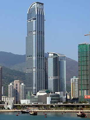
Directions to 如心廣場 (33847) with public transportation
The following transit lines have routes that pass near 如心廣場
How to get to 如心廣場 by bus?
Click on the bus route to see step by step directions with maps, line arrival times and updated time schedules.
How to get to 如心廣場 by subway?
Click on the subway route to see step by step directions with maps, line arrival times and updated time schedules.
Bus stations near 如心廣場 in 33847
- 如心廣場 Nina Tower, 3 min walk,
- 荃新天地 Citywalk, 4 min walk,
- 荃灣大會堂 Tsuen Wan Town Hall, 6 min walk,
- 荃灣體育館 Tsuen Wan Sports Centre, 6 min walk,
Ferry stations near 如心廣場 in 33847
- 荃灣 Tsuen Wan, 5 min walk,
Subway stations near 如心廣場 in 33847
- 荃灣西 Tsuen Wan West, 7 min walk,
- 青衣 Tsing Yi, 28 min walk,
- 葵芳 Kwai Fong, 36 min walk,
Bus lines to 如心廣場 in 33847
- NR331S, 荃灣(如心廣場) Tsuen Wan (Nina Tower),
- 上環(修打蘭街) — 荃灣(荃灣街市街), 荃灣街市街(不停美孚) Tsuen Wan Market St (Omit Mei Foo),
- NR92, 錦綉花園巴士總站 Fairview Park Bus Terminal,
- 38A, 美孚 Mei Foo,
- 38B, 碩門邨 Shek Mun Estate,
- 238M, 荃灣站 Tsuen Wan Station,
What are the closest stations to 如心廣場?
The closest stations to 如心廣場 are:
- 如心廣場 Nina Tower is 162 meters away, 3 min walk.
- 荃新天地 Citywalk is 257 meters away, 4 min walk.
- 荃灣 Tsuen Wan is 345 meters away, 5 min walk.
- 荃灣大會堂 Tsuen Wan Town Hall is 384 meters away, 6 min walk.
- 荃灣體育館 Tsuen Wan Sports Centre is 399 meters away, 6 min walk.
- 荃灣西 Tsuen Wan West is 441 meters away, 7 min walk.
- 青衣 Tsing Yi is 2139 meters away, 28 min walk.
- 葵芳 Kwai Fong is 2755 meters away, 36 min walk.
Which bus lines stop near 如心廣場?
These bus lines stop near 如心廣場: 234X, 30X, 33A, 49X, 86, 930.
Which subway line stops near 如心廣場?
西鐵綫 WEST RAIL LINE
What’s the nearest subway station to 如心廣場 in 33847?
The nearest subway station to 如心廣場 in 33847 is 荃灣西 Tsuen Wan West. It’s a 7 min walk away.
What’s the nearest bus stop to 如心廣場 in 33847?
The nearest bus stop to 如心廣場 in 33847 is 如心廣場 Nina Tower. It’s a 3 min walk away.
What’s the nearest ferry station to 如心廣場 in 33847?
The nearest ferry station to 如心廣場 in 33847 is 荃灣 Tsuen Wan. It’s a 5 min walk away.
See 如心廣場, 33847, on the map
Public Transit to 如心廣場 in 33847
Wondering how to get to 如心廣場 in 33847, Hong Kong? Moovit helps you find the best way to get to 如心廣場 with step-by-step directions from the nearest public transit station.
Moovit provides free maps and live directions to help you navigate through your city. View schedules, routes, timetables, and find out how long does it take to get to 如心廣場 in real time.
Looking for the nearest stop or station to 如心廣場? Check out this list of stops closest to your destination: 如心廣場 Nina Tower; 荃新天地 Citywalk; 荃灣 Tsuen Wan; 荃灣大會堂 Tsuen Wan Town Hall; 荃灣體育館 Tsuen Wan Sports Centre; 荃灣西 Tsuen Wan West; 青衣 Tsing Yi; 葵芳 Kwai Fong.
Bus: 234X, 30X, 33A, 49X, 86, 930, NR331S, 上環(修打蘭街) — 荃灣(荃灣街市街).Subway: 西鐵綫 WEST RAIL LINE, 屯馬綫 TUEN MA LINE, 東涌綫 TUNG CHUNG LINE, 機場快綫 AIRPORT EXPRESS, 荃灣綫 TSUEN WAN LINE.Ferry: 珀麗灣 - 荃灣.
Want to see if there’s another route that gets you there at an earlier time? Moovit helps you find alternative routes or times. Get directions from and directions to 如心廣場 easily from the Moovit App or Website.
We make riding to 如心廣場 easy, which is why over 1.5 million users, including users in 33847, trust Moovit as the best app for public transit. You don’t need to download an individual bus app or train app, Moovit is your all-in-one transit app that helps you find the best bus time or train time available.
For information on prices of subway and bus, costs and ride fares to 如心廣場, please check the Moovit app.
Use the app to navigate to popular places including to the airport, hospital, stadium, grocery store, mall, coffee shop, school, college, and university.
如心廣場 Address: 楊屋道 street in 33847
Attractions near 如心廣場
Nina Tower,L'Hotel Nina Et Convention Centre,如心海景酒店暨會議中心,Ru Chinese Restaurant 如粵滬中菜廳,L'hotel Nina et Convention Centre ,Nina Mall I 如心廣埸I,Nina Tower Tsuen Wan,荃灣 如心廣場,Sportful Garden Restaurant 陶源酒家,陶源酒家,759 Store 759 阿信屋,壹號食堂,8 Yeung Uk Road,Nina Fossil Garden 如心化石公園,如心广场巴士总站,L'hotel Nina et Convention Centre 如心海景酒店暨會議中心,Nina Tower 如心廣場,Trader's Lobby Lounge (商大堂酒吧),JPone,Tsuen Wan Nina Tower Bus Terminus 荃灣(如心廣場)巴士總站How to get to popular attractions in 33847 with public transit
香港中文大學, 沙田 Sha Tin,荃灣大會堂, 荃灣 Tsuen Wan,中華基金中學 the Chinese Foundation Secondary School, 東區 Eastern,Tai Lam Chung BBQ 大欖涌燒烤樂園, 屯門 Tuen Mun,大埔東昌街康體大樓 Tai Po Tung Cheong Street Leisure Building, 大埔 Tai Po,東華三院黃大仙醫院 Twghs Wong Tai Sin Hospital, 黃大仙 Wong Tai Sin,Oma Oma, 屯門 Tuen Mun,Victoria Harbour,深水灣泳灘, 南區 Southern,8度海逸酒店, 九龍 Kowloon City,九龍醫院康復大樓, 九龍 Kowloon City,海逸皇宮大酒樓, 九龍 Kowloon City,迪欣湖,屯門裁判法院 Tuen Mun Magistrates' Courts, 屯門 Tuen Mun,香港仔華人永遠墳場, 南區 Southern,香港教育大學, 大埔 Tai Po,聖德勒叁醫院(法國醫院), 九龍 Kowloon City,石硤尾公園體育館 Shek Kip Mei Park Sports Centre, 深水埗 Sham Shui Po,橫頭磡賽馬會診所 Wang Tau Hom Jockey Club Clinic, 九龍 Kowloon City,千禧新世界香港酒店 New World Millennium Hong Kong Hotel, 油尖旺 Yau Tsim MongGet around Hong Kong by public transit!
Traveling around Hong Kong has never been so easy. See step by step directions as you travel to any attraction, street or major public transit station. View bus and train schedules, arrival times, service alerts and detailed routes on a map, so you know exactly how to get to anywhere in Hong Kong.
When traveling to any destination around Hong Kong use Moovit's Live Directions with Get Off Notifications to know exactly where and how far to walk, how long to wait for your line, and how many stops are left. Moovit will alert you when it's time to get off — no need to constantly re-check whether yours is the next stop.
Wondering how to use public transit in Hong Kong or how to pay for public transit in Hong Kong? Moovit public transit app can help you navigate your way with public transit easily, and at minimum cost. It includes public transit fees, ticket prices, and costs. Looking for a map of Hong Kong public transit lines? Moovit public transit app shows all public transit maps in Hong Kong with all Bus, Subway, Light Rail, Ferry, Cable Car and Funicular routes and stops on an interactive map.
Hong Kong has 6 transit type(s), including: Bus, Subway, Light Rail, Ferry, Cable Car and Funicular, operated by several transit agencies, including 港鐵 MTR, 天星小輪 Star Ferry, 九巴 KMB, 城巴 Citybus, 城巴機場快線 Cityflyer, 龍運巴士 LWB, 九巴 KMB / 城巴 CTB, 龍運巴士 LWB / 城巴 CTB, 新大嶼山巴士 NLB, 愉景灣巴士 DB, 香港電車 Hong Kong Tramways, 香港中文大學 The Chinese University of Hong Kong, 港島區專線小巴 GMB HK Island, 九龍區專線小巴 GMB Kowloon, 新界區專線小巴 GMB New Territories